"How shall I tell you of the freedom of the Downs—
You who love the dusty life and durance of great towns,
And think the only flowers that please embroider ladies' gowns—
How shall I tell you ..."
Edward Wyndham Tempest.
Every writer on Sussex must be indebted more or less to the researches and to the archaeological knowledge of the first serious historian of the county, M.A. Lower. I tender to his memory and also to his successors, who have been at one time or another the good companions of the way, my grateful thanks for what they have taught me of things beautiful and precious in Seaward Sussex.
E.H.
CHAPTER
APPENDIX—
THE SUSSEX DOWNS FROM END TO END.
LONDON TO THE SOUTH DOWNS. THE WEALD.
The traveller through Sussex, as through every other English shire, will find many reminders of the Great War in church, churchyard or village green. Some are imposing or beautiful, some, alas, are neither, or are out of keeping with the quiet peace of their surroundings. To mention any, however striking in themselves or interesting in their connexion, would be invidious as, at the time of writing, lack of labour or material has prevented the completion of a great number of them.
The local historian of the future will bring a woeful number of his family records to a final close with the brief but glorious inscription on the common tablet where plough-boy and earl's son are commemorated side by side.
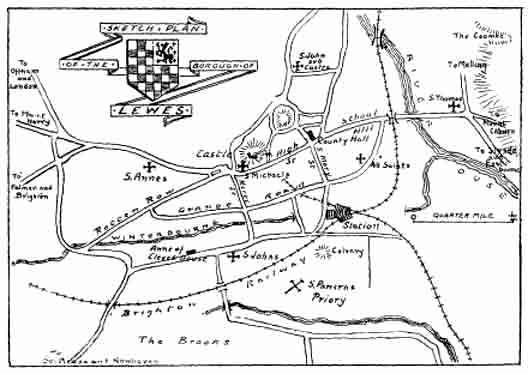
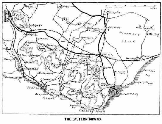
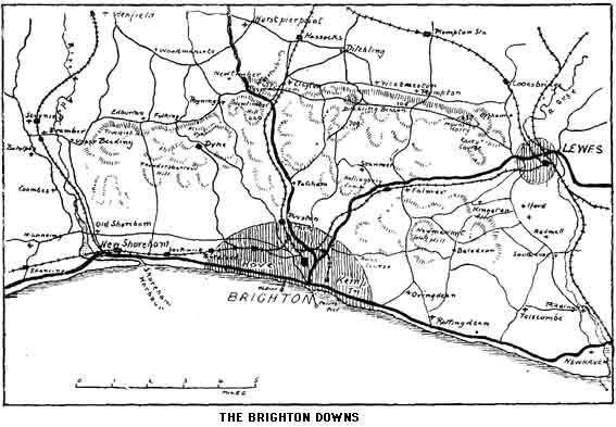
The sketch maps accompanying this book are simply for convenience in identifying the route followed therein. Wanderers upon the Downs and in the highways and byways at their feet will find Bartholomew's "half-inch" map, sheet 32, the most useful. This scale is much to be preferred to the "one inch" parent which lacks the contour colouring.
PLANS.
ARCHITECTURAL TERMS
The following brief notes will assist the traveller who is not an expert, in arriving at the approximate date of ecclesiastical buildings.
SAXON 600-1066. Simple and heavy structure. Very small wall openings. Narrow bands of stone in exterior walls.
NORMAN 1066-1150. Round arches. Heavy round or square pillars. Cushion capitals. Elaborate recessed doorways. Zig-zag ornament.
TRANSITION 1150-1200. Round arched windows combined with pointed structural arch. Round pillars sometimes with slender columns attached. Foliage ornament on capitals.
EARLY ENGLISH 1200-1280 (including Geometrical). Pointed arches. Pillars with detached shafts. Moulded or carved capitals. Narrow and high pointed windows. Later period—Geometrical trefoil and circular tracery in windows.
DECORATED 1280-1380. High and graceful arches. Deep moulding to pillars. Convex moulding to capitals with natural foliage. "Ball flower" ornament. Elaborate and flamboyant window tracery.
PERPENDICULAR 1380-1550. Arches lower and flattened. Clustered pillars. Windows and doors square-headed with perpendicular lines. Grotesque ornament. (The last fifty years of the sixteenth century were characterized by a debased Gothic style with Italian details in the churches and a beauty and magnificence in domestic architecture which has never since been surpassed.)
JACOBEAN and GEORGIAN 1600-1800 are adaptations of the classical style. The "Gothic Revival" dates from 1835.
"Then I saw in my Dream, that on the morrow he got up to go forwards, but they desired him to stay till the next day also, and then said they, we will (if the day be clear) show you the delectable Mountains, which they said, would yet further add to his comfort, because they were nearer the desired Haven than the place where at present he was. So he consented and staid. When the Morning was up they had him to the top of the House, and bid him look South, so he did; and behold at a great distance he saw a most pleasant Mountainous Country, beautified with Woods, Vineyards, Fruits of all sorts; Flowers also, with Springs and Fountains, very delectable to behold."
Every one who has followed the fortunes of Christian in the stately diction of the Pilgrim's Progress must wish to know from whence came those wonderful word pictures with which the dreamer of Bedford Jail gems his masterpiece. That phrase "delectable mountains" conjures up in each individual reader's mind those particular hills wherever they may be, which are his own peculiar delight, and for which, exiled, his spirit so ardently longs.
It is not presuming too much to suppose that the scene in Bunyan's mind was that long range of undulating downs sometimes rising into bold and arresting shape, and always with their finest aspect toward the Bedford plains and him who cast longing eyes toward them. From almost any slight eminence on the south of Bedford town on a clear day the Dunstable and Ivinghoe hills are to be seen in distant beauty, and there is the strongest similarity between them and those glorious summits which every man of Sussex knows and loves so well.
The Chiltern Hills and the South Downs are built up of the same material, have had their peculiarities of shape and form carved by the same artificers—rain and frost, sun and wind; their flowers are the same, and to outward seeming their sons and daughters are the same in the way that all hill folk are alike and yet all differ in some subtle way from the dweller in the plains.
Be this so or not our Downs are to us delectable mountains, and let the reader who scoffs at the noun remember that size is no criterion of either beauty or sublimity. That Sussex lover and greatest of literary naturalists, Gilbert White, in perhaps his most frequently quoted passage so characterizes the "majestic chain"; to his contemporaries such a description was not out of place; our great grandfathers were appalled when brought from the calm tranquillity of the southern slopes to the stern dark melancholy of the mountains of Cumberland and Westmoreland. The diary descriptions of those timid travellers of the late eighteenth and early nineteenth centuries are full of such adjectives as "terrible," "frightful," "awful." One unlucky individual's nerves caused him to stigmatize as "ghastly and disgusting" one of the finest scenes in the Lake District, probably unsurpassed in Europe for its perfectly balanced beauty of form and splendour of colouring. To the general reader of those times the descriptive poems of Wordsworth were probably unmeaning rhapsodies. Our ancestors, however, were very fond of "prospects." An old atlas of the counties of England, published about 1800, came into the writer's hands recently. The whole of the gentler hills, including every possible vantage point in the Downs, had been most carefully and neatly marked with the panorama visible from the summit; but even Kinder Scout and the Malverns came in for the same fate as the Welsh and Cumberland mountains, all of which had been left severely alone, though the intrepid traveller had braved the terrors of the Wrekin, while such heights as Barton Hill in Leicestershire and Leith Hill in Surrey were heavily scored with names of places seen, the latter including that oft-told tale—a legend, so far as the present writer is aware—of St. Paul's dome and the sea being visible with a turn of the head. Though our idea of proportion in relation to scenery has suffered a change, Gilbert White's phrase must not be sneered at; and most comparisons are stupidly unfair. The outline of Mount Caburn is a rounded edition of the most perfect of all forms. The rolling undulations of the tamest portions of the range are broken by combes whose sides are steep enough to give a spice of adventure to their descent. The "prospects," as such, are immeasurably superior to those obtainable from most of the mountains of the north and west, where a distant view is rare by reason of the surrounding chain of heights, and where the chance of any view at all to reward the climber is remote unless he chooses that fortnight in early June or late September when the peaks are usually unshrouded. Really bad weather, long continued, is uncommon in the Down country. A dull or wet spell is soon over. The writer has set out from Worthing in a thin drizzle of the soaking variety, descending from a sky of lead stretching from horizon to horizon, which in the north would be accepted as an institution of forty-eight hours at least, and on arriving at the summit of Chanctonbury has been rewarded by a glorious green and gold expanse glittering under a dome of intense blue.
From the wooded heights of the Hampshire border to that grand headland where the hills find their march arrested by the sea, the escarpment of the Downs is sixty miles long and every mile is beautiful. It would be an ideal holiday, a series of holy days, to follow the edge all the way, meeting with only three valley breaks of any importance; but the charm of the hill villages nestling in their tree embowered and secluded combes would be too much for any ordinary human, especially if he were thirsty, so in this book the traveller is taken up and down without any regard for his consequent fatigue, when it is assured that his rest will be sweet, even though it may be only under a hawthorn bush!
"No breeze so fresh and invigorating as that of the Sussex Downs; no turf so springy to the feet as their soft greensward. A flight of larks flies past us, and a cloud of mingled rooks and starlings wheel overhead.... The fairies still haunt this spot, and hold their midnight revels upon it, as yon dark rings testify. The common folk hereabouts term the good people 'Pharisees' and style these emerald circles 'Hagtracks.' Why, we care not to enquire. Enough for us, the fairies are not altogether gone. A smooth soft carpet is here spread out for Oberon and Titania and their attendant elves, to dance upon by moonlight...." (Ainsworth: Ovingdean Grange.)
"He described the Downs fronting the paleness of the earliest dawn and then their arch and curve and dip against the pearly grey of the half-glow; and then among their hollows, lo, the illumination of the east all around, and up and away, and a gallop for miles along the turfy, thymy, rolling billows, land to left, sea to light below you.... Compare you the Alps with them? If you could jump on the back of an eagle, you might. The Alps have height. But the Downs have swiftness. Those long stretching lines of the Downs are greyhounds in full career. To look at them is to set the blood racing! Speed is on the Downs, glorious motion, odorous air of sea and herb, exquisite as the Isles of Greece." (Geo. Meredith: Beauchamp's Career.)

The most delightful close springy turf covers the Downs with a velvet mantle, forming the most exhilarating of all earthly surfaces upon which to walk and the most restful on which to stretch the wearied body. Most delightful also are the miniature flowers which gem and embroider the velvet; gold of potentilla, blue of gentian, pink and white of milkwort, purple of the scabious and clustered bell-flower; the whole robe scented with the fragrance of sweet thyme. Several unfamiliar species of orchis may be found and also the rare and beautiful rampion, "The Pride of Sussex." The hills are a paradise for birds; the practice of snaring the wheatear for market has lately fallen into desuetude and the "Sussex ortolan" is becoming more numerous than it was a dozen years ago. Every epicure should be interested in the numerous "fairy rings," sufficient evidence of the abundance of mushrooms which will spring up in the night after a moist day. One of the most comfortable traits of our chalk hills however is the marvellous quickness with which the turf dries after rain. Those who have experienced the discomfort of walking the fells of Cumberland and Westmoreland, which at most seasons of the year resemble an enormous wet sponge, often combined with the real danger of bog and morass, will appreciate the better conditions met with in Sussex hill rambling. Where the chalk is uncovered it becomes exceedingly slippery after a shower, but there is rarely a necessity to walk thereon.
The pedestrian on the Downs should use caution after dusk; chalk pits are not seen, under certain conditions, until the wayfarer is on the verge. Holes in the turf are of frequent occurrence and may be the cause of a twisted ankle, or worse, when far from help.
The "dene holes" are of human origin. Once thought to be primitive dwelling places, they are now supposed to have been merely excavations for the sake of the chalk or the flints contained therein, and possibly adapted for the storage of grain. Of equal interest are the so-called "dew ponds," of which a number are scattered here and there close to the edge of the northern escarpment. Undoubtedly of prehistoric origin, the art of making the pond has become traditional and some have been built by shepherds still living. These pools of clear cool water high up on the crest of a hill gain a mysterious air by their position, but their existence is capable of a scientific explanation. Built in the first place to be as nearly as possible non-conducting, with an impervious "puddled" bottom, the pond is renewed every night to a certain extent by the dew which trickles down each grass and reed stem into the reservoir beneath, and to a much greater extent by the mists which drift over the edge to descend in rain on the Weald. The pools might well be called "cloud ponds."
The most lovely scenes, the best view points, are described in their proper place. The question as to which is the finest section of the Downs must be left to the individual explorer. To some natures the free bare wind-swept expanse at the back of Brighton will appeal the most. By others the secret woods which climb from hidden combe and dry gully, mostly terminating in a bare top, and which are all west of the Arun, will be considered incomparably the best. To every man of Lewes the isolated mass of hills which rise on the east of the town are the Downs. But all must be seen to be truly appreciated and loved as they will be loved.
Hotels will not be found in the Downs; the tourist who cannot live without them will find his wants supplied within but a few miles at any of the numerous Londons by the Sea; but that will not be Sussex pure and undefiled, and if simplicity and cleanliness, enough to eat and drink, and a genuine welcome are all that is required, he will find these in our Downland inns.
It is in the more remote of these hostelries that the inquisitive stranger will hear the South Saxon dialect in its purity and the slow wit of the Sussex peasant at its best. The old Downland shepherd with embroidered smock and Pyecombe crook is vanishing fast, and with him will disappear a good deal of the character which made the Sussex native essentially different from his cousins of Essex and Wessex.
One of the most delightful records of rustic life ever printed is that study in the "Wealden Formation of Human Nature" by the former rector of Burwash, John Cocker Egerton, entitled Sussex Folk and Sussex Ways. True, the book is mainly about Wealden men and we are more concerned with the hill tribes, but the shrewd wit and quaint conceits of the South Saxon portrayed therein will be readily recognized by the leisurely traveller who has the gift of making himself at home with strangers. It is to be hoped that in the great and epoch-making changes that are upon us in this twentieth century some at least of the individual characteristics of the English peasantry will remain. It is the divergent and opposite traits of the tribes which make up the English folk that have helped to make us great. May we long be preserved from a Wellsian uniformity!
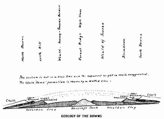
A brief description of the geological history of the range may not be amiss here. It will be noted by the traveller from the north that the opposing line of heights in Surrey have their steepest face (or "escarpment") on the south side, while the Sussex Downs have theirs on the north. A further peculiarity lies in the fact that the river valleys which cut across each range from north to south are opposite each other, thus pointing to the probability that the fracture which caused the clefts was formerly continuous for fifty miles through the great dome of chalk which extended over what is now the Weald. The elevation of this "dome," caused by the shrinking and crumpling of the earth's crust and consequent rise of the lower strata, was never an actual smooth rise and fall from the sea to the Thames valley; through the ages during which this thrust from below was in progress the crown of the dome would be in a state of comparatively rapid disintegration, and it is because of this that we have no isolated masses of chalk remaining between the two lines of hills. The highlands called by geologists the "Forest Ridge" are in the centre and are the lowest strata of the upheaval; they are the so-called Hastings sands which enter the sea at that town half-way between Beachy Head and Dover cliffs. North and south of this ridge is the lower greensand, forming in Sussex the low hills near Heathfield, Cuckfield and Petworth, and which reaches the sea south and north of Hastings. It was at one time supposed that the face of the Downs originally formed a white sea cliff and that an arm of the sea stretched across what we know as the Weald, but the simpler explanation is undoubtedly the correct one.
The Downs themselves are composed of various qualities of chalk; some of such a hard, smooth and workable material that, as will be seen presently, the columns in some of the Downland churches are made from this native "rock." While the upper strata is soft and contains great quantities of flints, the middle layers are brittle and yield plenty of fossils, lower still is the marl, a greyish chalk of great value in the fertilization of the gault. This latter forms an enormous moist ditch or gutter at the foot of the escarpment, and from the farmer's point of view is essentially bad land, requiring many tons of marl to be mixed with it before this most difficult of all clays becomes fertile. Between the chalk and the gault clay is a very narrow band of upper greensand, only occasionally noticeable in the southern range, but strongly marked in the North Downs.
"The chalk is our landscape and our proper habitation. The chalk gave us our first refuge in war by permitting those vast encampments on the summits. The chalk filtered our drink for us and built up our strong bones; it was the height from the slopes of which our villages, standing in a clear air, could watch the sea or the plain; we carved it—when it was hard enough; it holds our first ornaments; our clear streams run over it; the shapes and curves it takes and the kind of close rough grass it bears (an especial grass for sheep) are the cloak of our counties; its lonely breadths delight us when the white clouds and the necks move over them together; where the waves break it into cliffs, they are characteristic of our shores, and through its thin coat of whitish mould go the thirsty roots of our three trees—the beech, the holly, and the yew. For the clay and the sand might be deserted or flooded and the South Country would still remain, but if the Chalk Hills were taken away we might as well be in the Midlands."
(Hilaire Belloc: The Old Road.)
A description of these hills, however short, would be incomplete without some reference to the sheep, great companies of which roam the sunlit expanse with their attendant guardians—man and dog (who deserve a chapter to themselves). Southdown mutton has a fame that is extra-territorial; it has been said that the flavour is due to the small land snail of which the sheep must devour millions in the course of their short lives. But the explanation is more probably to be found in the careful breeding of the local farmers of a century or so ago. Gilbert White refers to two distinct breeds—"To the west of the Adur ... all had horns, smooth white faces and white legs, but east of that river all flocks were poll sheep (hornless) ... black faces with a white tuft of wool." Since that day, however, east has been west and west east and the twain have met.
The traveller may be fortunate enough to come across a team of oxen ploughing. The phenomenon is yearly becoming more rare; but within sight and sound of the Eastbourne expresses between Plumpton and Cooksbridge this archaic survival from a remote past is more likely to be seen than elsewhere.
The oxen are usually black and are the remnants of a particular breed, the outcome of a long and slow experiment in getting the right sort of draught animal. The ploughs themselves, as Jefferies says, "must have been put together bit by bit in the slow years—slower than the ox.... How many thousand, thousand clods must have been turned in the furrows before ... the curve to be given to this or that part grew upon the mind, as the branch grows upon the tree!"
But the Downs are not scarred to any great extent by cultivation. The sheep and the birds are mostly in sole possession and are almost the only living moving things on the hills. The fox, though at one time common, is now very rarely seen, for game, with the disappearance of gorse and bramble, has almost vanished, and other beasts of prey, weasel and stoat, shun the open uplands where the only enemy of field mouse and vole is the eagle of the south country, the peregrine falcon.
"Lewes is the most romantic situation I ever saw"; thus Defoe, and the capital of Sussex shares with Rye and Arundel the distinction of having a continental picturesqueness more in keeping with old France than with one of the home counties of England. This, however, is only the impression made by the town when viewed as a whole; its individual houses, its churches and castle, and above all, its encircling hills are England, and England at her best and dearest to those who call Sussex home. The beauty of the surroundings when viewed from almost any of its old world streets and the charm of the streets themselves make the old town an ever fresh and welcome resort for the tired Londoner who appreciates a quiet holiday. As a centre for the exploration of East Sussex Lewes has no equal; days may be spent before the interest of the immediate neighbourhood is exhausted; for those who are vigorous enough for hill rambling the paths over the Downs are dry and passable in all weathers, and the Downs themselves, even apart from the added interest of ancient church or picturesque farm and manor, are ample recompense for the small toil involved in their exploration.
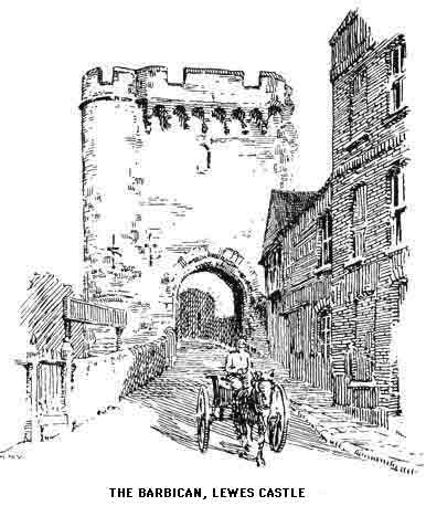
The origin of Lewes goes back to unknown times, the very meaning of the name is lost, its situation in a pass and on the banks of the only navigable river in East Sussex inevitably made it a place of some importance. It is known that Athelstan had two mints here and that the Norman Castle was only a rebuilding by William de Warenne on the site of a far older stronghold. To this de Warenne, the Conqueror, with his usual liberality, presented the town, and it is from the ruins of his castle that we should commence our exploration.
Of de Warenne's building only the inner gateway remains. The outer gate and the keep date from the reign of the first Edward; the site of a second keep is shown in private grounds not far off, a feature very rare in this country if not unique.
The summit of the tower is laid out as an old world garden; and here is also the interesting museum of the Sussex Archaeological Society, but the visitor will be best repaid by the magnificent view of the surrounding country spread out before him. To the north-west rises Mount Harry, and to the right of this stretches the wide expanse of the Weald bounded by the sombre ridges of Ashdown Forest, dominated by Crowborough Beacon slightly east of due north.
The quarries and combe of Cliffe Hill stand up with fine effect immediately east of the town, which sinks from where we stand to the Ouse at the bottom of the valley. More to the south-east is Mount Caburn above the bare and melancholy flats through which the Ouse finds its way to the sea; due south-west the long range of Newmarket Hill stretches away to the outskirts of Brighton, and the Race Course Hill brings us back to our starting point. Beautiful as is the distant prospect the greatest charm of this unique view is in the huddle of picturesque red-tiled roofs and greenery beneath us.
Of the history of the Castle there are but scanty records; its part in the making of East Sussex seems to have been fairly quiescent, and in the great struggle of May 1264 between the forces of the Barons and Henry III, for which Lewes will always be famous, the fortress took no actual part and merely surrendered at discretion.
"The battle was fought on the hill where the races are held. Simon de Montfort, Earl of Leicester, headed the Baronial army. The Royal forces were divided into three bodies; the right entrusted to Prince Edward; the left to Richard, Earl of Cornwall, King of the Romans; and the centre to Henry himself. Prince Edward attacked the Londoners under Nicholas Seagrave with such impetuosity that they immediately fled and were pursued with great slaughter. Montfort taking advantage of this separation, vigorously charged the remaining division of the Royalists, which he put to rout. The King and the Earl of Cornwall hastened to the town, where they took refuge in the Priory. Prince Edward, returning in triumph from the pursuit of the Londoners, learned with amazement the fate of his father and uncle. He resolved to make an effort to set them at liberty, but his followers were too timid to second his ardour, and he was finally compelled to submit to the conditions subscribed by his father, who agreed that the Prince and his cousin Henry, son of the Earl of Cornwall, should remain as hostages in the hands of the Barons till their differences were adjusted by Parliament. In this contest 5,000 men were slain. The King, who had his horse slain under him, performed prodigies of valour. Richard, Earl of Cornwall, was taken prisoner."
By all accounts it was a good fight, and the best men won. A touch of humour is added to one record wherein it is related that Richard, King of the Romans, took refuge in a windmill, wherein he was afterwards captured amid shouts of "Come out, thou bad miller." This mill stood near the old Black Horse Inn, but has long since been burnt down.
Accounts vary exceedingly as to the number of the slain, some authorities giving as many as 20,000, others no more than 2,700.
"Many faire ladie lose hir lord that day,
And many gode bodie slayn at Leans lay.
The nombre none wrote, for tell them might no man.
But He that alle wote, and alle thing ses and can."
(Robert Brune.)
There are certain times, especially in the early hours of a fine autumn day, when the mass of old grey stone is seen rising above its vassal town through golden river mists which veil the modernities of the railway and its appurtenancies, and one feels that the battle might have taken place yesterday. Strange that this town is an important and busy railway junction and yet so little has the old-world appearance of the place suffered in consequence; here are no ugly rows of railwaymen's cottages in stark evidence on the hillsides; in actual fact the coming of the railway has added to the antiquarian and historical interest of the town, as will be seen presently.
A short distance along High Street stands St. Michael's Church, which has one of the three curious round towers for which the valley of the Ouse is famous. The style of the tower is Norman, but the body of the church is of later dates. Here are some fine brasses; one is supposed to commemorate a de Warenne who died about 1380; another is to John Bradford, rector, dated 1457. The monument to Sir Nicholas Pelham (1559) has an oft-quoted punning verse—
"What time the French sought to have sacked Sea-Foord
This Pelham did repel-em back aboord."
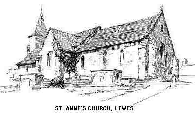
St. Anne's Church is nearly a quarter of a mile farther on. The style is Transitional. There are several interesting items, including a very fine and ancient font of a "basket" pattern. Note the uncommon appearance of the capitals on the south side pillars, an ancient tomb in the chancel wall, and, not least, the doorway with Norman moulding. There is in this church a window in memory of Lower, a fitting tribute to the historian of Sussex, but his best memorial will always be that work that is still the basis of most writings on the past of the county.
The road continues to the Battlefield and Mount Harry, but to explore the lower portion of the town a return must be made to High Street. At the corner of Bull Lane, marked by a memorial tablet and with a queer carved demon upon its front is Tom Paine's house. Note the unusual milestone on a house front opposite Keere Street, down which turning is presently passed (on the left) Southover House (1572), a good example of Elizabethan architecture. Keere Street has another remnant of the past in its centre gutter, the usual method of draining the street in medieval times, but now very seldom seen except in the City of London.
At the foot of the street is the (probably dry) bed of the Winterbourne, so called because, like other streams of the chalk country, it flows at intermittent times. A short distance farther, to the right, and just past St. John's Church, will be found the entrance to the space once occupied by the first Priory of the Cluniacs in England.
Founded in 1078 by William de Warenne and his wife Gundrada and dedicated to St. Pancras, the Priory was always closely allied with the parent house on the continent. At the Dissolution more than the usual vandalism seems to have been observed and Cromwell's creatures must have vented some personal spite against the monks in their wholesale demolition of the buildings. A mound to the north-east is supposed to be the site of a calvary, and until quite recently a "colombarium" or dovecote was allowed to stand which contained homes for over three thousand birds.
"The Priory building was probably irregular, varying in its form as the increase of inmates demanded additional room. But though irregular, it was certainly a noble edifice, faced with Caen stone, and richly adorned by the chisel of the sculptor. Its walls embraced an area of 32 acres, 2 rods, 11 perches, and it was not less remarkable for its magnificence than extent. The length of the church was 150 feet, having an altitude of 60 feet. It was supported by thirty-two pillars, eight of which were very lofty, being 42 feet high, 18 feet thick, and 45 feet in circumference; the remaining twenty-four were 10 feet thick, 25 feet in circumference, and 18 feet in height. [1] The belfry was placed over the centre of the church, at an elevation of 105 feet, and was supported by the eight lofty pillars above mentioned. The roof over the high altar was 93 feet high. Its walls were 10 feet thick. On the right side of the high altar was a vault supported by four pillars, and from this recess branched out five chapels that were bounded by a wall 70 yards long. A higher vault supported by four massive pillars, 14 feet in diameter, and 45 feet in circumference, was probably on the left side of the high altar, and corresponded with the one just mentioned, from which branched out other chapels or cells of the monks. How many chapels there were cannot be ascertained; the names of only three are known, the Virgin Mary, St. Thomas the Martyr, and St. Martin. The chapter-house and church were by far the most splendid apartments of this stately pile; the latter was richly adorned by the painter and the sculptor."
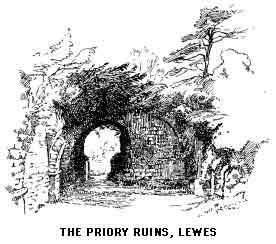
The wooden chapel of St. Pancras which existed here in Saxon times probably stood where later the high altar of the great Norman church was reared, and across this site the Eastbourne trains now run. The station itself is supposed to be on the site of the convent kitchens and consequently the present ruins are very scanty. Though the foundations laid bare at the cutting of the railway in 1845 show the great extent of the buildings, the battered walls which now remain give but little indication of the imposing dimensions quoted above, and the visitor will have to depend on sentiment and the imagination rather than on actual sightseeing. The excavators in 1845 had a gruesome experience, for they discovered a charnel pit containing thirteen cart loads of bones of the fallen warriors at the battle of Lewes. Although nearly six centuries had elapsed the stench was dreadful.
That the archaeological interest of Lewes owes much to the making of the railway will now be seen.
The following account appeared in the Gentleman's Magazine, 1845:—
"On the morning of Tuesday, October 28, a most interesting discovery was made by the workmen employed in forming a cutting for the Lewes and Brighton Railway, through the ground formerly occupied by the great Cluniac Priory of St. Pancras, at Lewes. It is well-known that the original founders, in 1078, were William de Warenne, Earl of Surrey, of a great Norman family, and his wife Gundred, the daughter of William the Conqueror and his Queen Matilda; that they pulled down an old wooden church to replace it by a stone one, and that after their deaths in 1085 and 1088, they were buried in the chapter-house of their Priory. So effectual, however, was the destruction of the buildings in 1537 by the Ecclesiastical Commissioners of Henry VIII that the very site of the church has been uncertain, and there has long been nothing visible of the ruins but a confused mass of broken walls and arches half buried under the soil. The bold intrusion of a railway into these hallowed precincts has thrown light upon this obscurity, and in the course of their excavations the workmen have found, covered by some slabs of Caen stone, two leaden chests containing the bones of the founders, and inscribed with their names. They are not coffins, but cists or chests, and are both of similar form and dimensions, ornamented externally by a large net-work of interlaced cords moulded in the lead. The cist of William de Warenne measures 2 feet 11 inches long, by 12½ inches broad, and is 8 inches deep, all the angles being squared, and the flat loose cover lapping an inch over. On the upper surface at one end is inscribed in very legible characters 'WillelMus.' The cist of the princess his wife is 2 inches shorter and 1 inch deeper, and the word 'Gvndrada' is very distinctly inscribed on the cover. It is worth remarking that her father, the Conqueror, in his charter, calls for Gundfreda, and her husband, who survived her, calls her Gundreda in his charter.
"It is obvious, from the length of these receptacles, that their bones have been transferred to them from some previous tombs, and it is not difficult to suppose that, the chapter-house not being built at the time of their deaths, the founders were buried elsewhere until its completion, and that the bodies were then found so decayed that their bones only remained for removal to a more distinguished situation, and were, on that occasion, placed in these very leaden chests. A rebuilding of the Priory Church was begun on the anniversary of William the founder's death in 1243, and from the antique form of the letters G and M the inscriptions cannot be fixed at a later period. The characters, indeed, more resemble the form used in the twelfth century. Of the genuine antiquity of these relics there cannot be the slightest doubt. It is locally notorious that the black marble slab which formerly covered the remains of Gundrada, beautifully carved and bordered with nine Latin verses in her honour cut in the rim and down the middle, was discovered in 1775 in Isfield Church, misappropriated as a tombstone over one of the Shirley family, and by the care of Sir William Burrel removed to the church of Southover, immediately adjoining the ruins of the Priory. It is very singular that now, after an interval of eight years, her very bones should be brought to the same church (under the superintendence of the Rev. Mr. Scobell) there to undergo a third burial under Gundrada's marble slab.
"The tombstone of Gundred Countess of Warren was discovered about the year 1775, by Dr. Clarke, rector of Buxted, in the Shirley chancel of Isfield Church, forming the table part of a mural monument of Edward Shirley, Esq., by whose father probably it was preserved at the demolition of the Priory, and conveyed to Isfield, his manorial estate. At the expense of Dr., afterwards Sir William, Burrell, it was removed from its obscure station, and placed upon a suitable shrine, in the vestry-pew of Southover Church, that being the nearest convenient spot to its original station. The stone is of black marble, sculptured in very high relief. The lower end had been broken off before its discovery at Isfield. Around the rim, and along the middle, is the following inscription:
Stirps Gundrada ducum, decus evi, nobile germen,
Intulit ecclesiis Anglorum balsama morum,
Martir (is hanc aedem struxit Pancrati in honorem)
Martha fuit miseris, fuit ex pietate Maria;
Pars obiit Marthe, superest pars magna Marie.
O pie Pancrati, testis pietatis et equi,
Te facit heredem, tu clemens suscipe matrem.
Sexta kalendarum junii lux obvia carnis
Fregit alabastrum (superest pars optima coelo).
(Conjectured words in parenthesis.)
"Another leaden coffin, full of bones, but without any inscription, has also been found, longer than those of the founder's, having a semicircular top, and six large rings of 3¼ inches diameter attached to the outsides. At a little distance from the two small chests, there was also found the remains of an ecclesiastic, buried without any coffin, but lying upon a bed of coarse gravel within a hollow space formed by large flat stones. His hands were in a position indicating that they had been joined together in the attitude of prayer over his breast, as usual. Not only his bones, but much of his thick woollen gown, his under-garment of linen, and his leather shoes have been preserved. These, too, have been carefully transferred to Southover Church. It has been conjectured with much probability that these remains were those of Peter, the son of John, Earl de Warren, the patron of the monastery, who was appointed prior contrary to the nomination of the Pope in favour of the suggestion that the reinterment of the remains of the founders took place about the beginning of the thirteenth century."
A chapel specially designed to receive the leaden caskets was erected in excellent taste at St. John's, Southover, in 1847. The names are plainly decipherable. The tombstone on the floor is that of Gundrada, brought here from Isfield. The effigy in the wall of the chapel is conjectured to be that of John de Braose, who died in 1232.
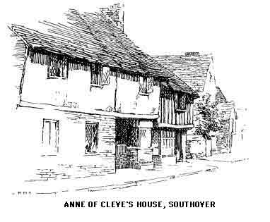
The picturesque old house on the north side of the street is called Anne of Cleve's House, but this title appears to be contradicted by the date 1599 on the front of the building; there is a possibility that this date was added when certain alterations took place; it is certain, however, that when Thomas Cromwell's time was past the property was made over to the King, of whom a very startling legend is told locally to the effect that he murdered one of his wives on a stairway in the Priory!
The rebuilt church of St. John-sub-castre has its ugliness redeemed in the antiquary's eye by the round Saxon arch retained in the outside wall and by the "Magnus Memorial" as certain stones, bearing a Latin inscription in Anglo-Saxon characters, are called. Here is also a fourteenth century tomb and an old font. The churchyard forms the site of a Roman camp, the vallum of which may still be seen.
St. Thomas-at-Cliffe has several interesting details including an uncommon and elaborate "squint" with two pillars; a modern painting of St. Thomas of Canterbury, patron saint of the church, and an old Dutch representation of the Ascension.
Among the many famous men of Lewes must be mentioned Tom Paine who came here in 1768, marrying in 1771 a daughter of the town named Elizabeth Ollive and in due time succeeding to her father's business of tobacconist. The house has already been noticed, it bears a memorial tablet and also a very quaint carved demon. It is just off the High Street and near St. Michael's Church. Lewes cannot claim the honour of seeing the birth of The Rights of Man (a rather dubious honour in those days); the book was written while Paine stayed with his biographer, Thomas Rickman the bookseller, in London.
Another famous resident of Lewes was John Evelyn, who spent a great part of his schooldays in the Grammer School at Southover. Here also was educated John Pell, the famous mathematician.
A house at the end of the town on the Newhaven road belonged to the Shelleys, and Dr. Johnson once stayed here on his way to the Thrales in Brighton.
The old "Star" Inn has been converted into municipal offices, but the fine front still remains and most of the old work in the interior. In the tower close by, in the Market-place, is "Great Gabriel," a bell dating, it is said, from the time of Henry III. Lower has the following lines on the bells of Lewes:—
"Oh, happy Lewes, waking or asleep,
With faithful
hands
your time
archangels
keep!
St.
Michael's
voice the fleeting hour records,
And
Gabriel
loud repeats his brother's words;
While humble
Cliffites, ruled by meaner power,
By Tom the
Archbishop
regulate their hour."
It was hereabouts that a great burning of heretics took place in 1557. Among the honoured names recorded upon the Martyr's Memorial is that of Richard Woodman, ironmaster, of Warbleton, whose protests against his pastor's weathercock attitude during the Marian persecutions resulted in the stake. The memorial perpetuates the names of sixteen persons who suffered the fiery death at this time. The consequence is that the zeal of the townsmen on the 5th of November is Orange in its fervour, and the streets are given up to various "fireworks" clubs whose members have been subscribing their spare shillings for months past. Crowds ascend Saxon Down and the surrounding hills to see the display from a distance; still greater crowds throng the streets to watch the destruction in effigy of some unpopular local or national celebrity. Of the Down land walks we have mentioned the most interesting, by reason of its fine views of the town, is to Cliffe Hill. An extension may be made to Saxon Down, a glorious expanse of wind-swept hill; and farther on to the conical Mount Caburn, with magnificent marine views; from this point a descent may be made to Glynde, which will be described presently.
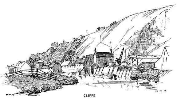
The long street of Cliffe leads northwards to South Malling; here is a conventicle named "Jireh" erected by J. Jenkyns, W.A. These cryptic initials mean "Welsh ambassador." In the cemetery behind is the tomb of William Huntingdon, the evangelist, whose epitaph is as follows:—
"Here lies the coalheaver, beloved of his God, but abhorred of men. The Omniscient Judge at the grand assize shall ratify and confirm this to the confusion of many thousands; for England and her metropolis shall know that there hath been a prophet among them.
"W.H., S.S." (Sinner Saved.)
The evangelist was wont to say "As I cannot get a D.D. for want of cash, neither can I get a M.A. for want of learning, therefore I am compelled to fly for refuge to S.S."
Malling Church is of no interest except perhaps for the fact that John Evelyn laid the foundation stone. At Old Malling once stood a Saxon collegiate church founded by Caedwalla in 688 and therefore one of the first Christian churches erected in Sussex. The Archbishops of Canterbury had a residence near, and in the Memorials of Canterbury Dean Stanley tells how Becket's murderers entered the house and threw their arms on the dining-table, which immediately threw them off; replaced, they were again thrown farther off with a louder crash. One of the knights then suggested that the table refused to bear its sacrilegious burden. This is still a popular local legend.
Ringmer, about two miles to the north-east, is closely connected with Gilbert White; the oft-quoted letter in which he says "I have now travelled the Downs upwards of 30 years, yet I still investigate that chain of majestic mountains with fresh admiration year by year" was written from here. There are several interesting monuments and brasses in the church, especially those to the Springett family.
Two miles distant from Lewes on the Eastbourne road is Beddingham, whose church shows a medley of styles from Norman to Decorated. About one hundred years ago a discovery was made near the village of a quantity of human remains together with weapons and accoutrements, pointing to the probability of a forgotten battle having taken place in the pass between the hills. A religious house dedicated to St. Andrew is conjectured to have existed at one time in or near the village. Monkish records relate that a ship hailing from Dunkirk and having on board a monk named Balger was driven into Seaford by a storm. This Balger was of an enterprising turn; making his way inland he helped himself to the relics of St. Lewinna, a British convert, which reposed in St. Andrew's Monastery. The adventures that overtook the relics and their illegal guardian during the journey back to Flanders make up a medieval romance of much interest and throw a curious light on the mental attitude of the religious, as regards the rights of property, during the Dark Ages.
A mile farther along the high road is the turning which leads to Glynde station and village, for which the most pleasant route is over the hills. The name is possibly a Celtic survival and describes the situation between opposing heights. "Glyn" is common throughout the whole of Wales. The church is in a style quite alien to its surroundings and might well belong to Clapham or Bloomsbury. It is a Grecian temple built about 1765 by the then Bishop of Durham, Dr. Trevor, and here the Bishop was buried. There are few more charming groups of cottages in Sussex than this beautiful village. Glynde Place, the seat of a former Speaker of the House of Commons, boasts the largest dairy in Sussex if not in England; between 700 and 800 pounds of butter are made here daily. John Ellman, the famous breeder of Southdown sheep lived here for nearly fifty years (1780-1829.)
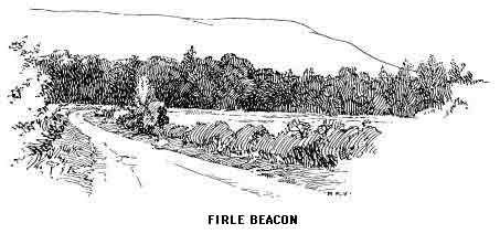
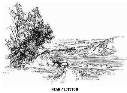
A short way farther, on the main road, is a turning to West Firle, on the east of which is the fine Firle Park belonging to the Gage's, a very ancient local family whose tombs and brasses may be seen in the church. The pedestrian is advised to press on to Firle Beacon from which a descent may be made to Alciston (pronounced "Aston") on the high road. The heap of flints on the summit of the Beacon is 718 feet above the sea, and therefore the hill is not so high as it looks, nor is it, as was formerly supposed to be the case, the second highest summit of the Downs. The view is superb both northwards to the Weald and southwards over the Channel. Alciston calls for little comment, the charm of the place consists in its air of remoteness and peace. The small church is partly Norman, and in the walls of Court House Farm are the remains of a religious house. Note the ancient barn and dovecote. A mile to the north is another little hamlet called "Simson," and spelt Selmeston. The curious wooden pillars in the church were fortunately untouched when the building was restored. The old altar slab has five crosses, and there are one or two interesting brasses.
Berwick is a scattered village on the western slopes of the Cuckmere valley; the Early English church is embowered in trees on a spur of the Downs; there is a fine canopied tomb in the chancel, an old screen and an uncommon type of font built in the wall. Note the eloquent epitaph to a former rector.
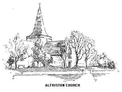
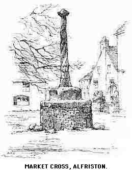
Half a mile farther is a turning on the right that passes Winton Street, where, a few years ago, there was a rich find of Anglo-Saxon antiquities. In two miles this byway reaches Alfriston. ("All-friston.") The church has a very common legend associated with it; the foundations are said to have been again and again removed by supernatural agency from another site to the spot where the solemn and stately old building now stands. It is a Perpendicular cruciform church and has an Easter sepulchre and three sedilia. The register is said to be the oldest in England, its first entry bearing the date of 1512. "A few years since as many as seventy 'virgins' garlands' hung in Alfriston Church at once" (Hare). Close by is a delightful pre-Reformation clergy house. Antiquaries are perhaps as concerned with the "Star" Inn, one of the most interesting in the south of England and dating from about 1490. The front of the house is covered with quaint carvings including St. George and the Dragon, a bear and ragged staff and what appears to be a lion. On each side of the doorway arc mitred saints conjectured to represent St. Julian and St. Giles. The inn is reputed to have been a place of sanctuary under Battle Abbey; it stands within the abbot's manor of Alciston and was undoubtedly the recognized hostel for pilgrims and mendicant friars. Another old inn, once a noted house of call for smugglers, is Market Cross House, opposite all that remains of the Cross, a mutilated and battered stump, and the only example, except that at Chichester, in the county.
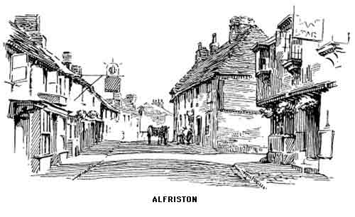
Alfriston once had a race week, the course being on the side of Firle Beacon; in those days the resident population was probably greater than it is now. Not only were more souls crowded into the old houses still standing in the village street but tradition tells that the place was larger and more suited to its spacious old church which is now barely half filled on an ordinary Sunday.
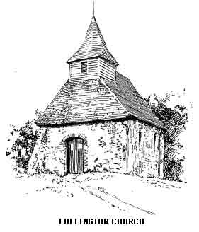
A footpath may be taken over the Cuckmere and up the hill beyond to the little dependency of Lullington. The church calls itself the smallest in Sussex but this depends upon what constitutes a church. The existing building is actually the chancel of a former church, perhaps another proof of a dwindling population.
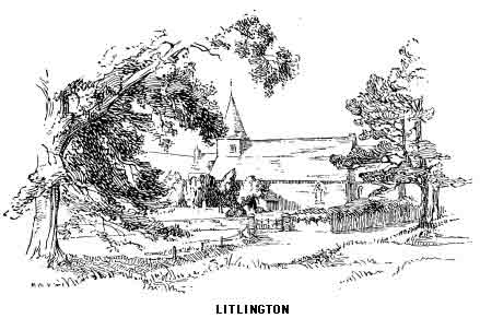
The winding lane on the eastern bank of the Cuckmere is thick with a glaring white dust on the dry days of summer, but there is no other practicable route to Litlington; where is a quaint and interesting old church with arches formed of the native chalk. This village is growing rather than decaying, and appears to be, in a small way, an asylum for those who have grown weary of the broader highways. It is in a most delightful situation and is even within reach of a morning dip in the sea for those vigorous enough to undertake a three mile walk each way. "Tea" placards nestling among the roses and ivy on the cottage walls also testify its attractions to holiday wayfarers, though the way to Litlington, even for the motor-cyclist, is too strenuous for the village to become overcrowded or vulgar.
The Cuckmere now begins to widen its banks and the theory that the waters once extended from side to side of the valley seems tenable as we view the wide expanse of sedgy swamp through which the present channel has been artificially cut. Cuckmere Haven is the name given to the bay between the last of the "Seven Sisters" and the eastern slopes of Seaford Head which should be ascended for the sake of the lovely view up the valley, seen at its best from this end.
"The only light that suits the tranquillity and tender pathos of the region is that which fills the dimples of the Downs with inexpressibly soft and dreamy expressions, and quickens the plain by revealing the individuality of every blade of grass and plough-turned clod by its own shadow."
(Coventry Patmore.)
Nearly all the villages of the Cuckmere are in sight and make together perhaps the most likely to be remembered of Sussex pictures. It is surprising how little this tranquil vale is known except to the chance visitor from Seaford. When one remembers the much exploited and spoilt beauty spots of Dorset and Devon one feels nervous for the future of these lesser known but equally charming sea-combes of Sussex.
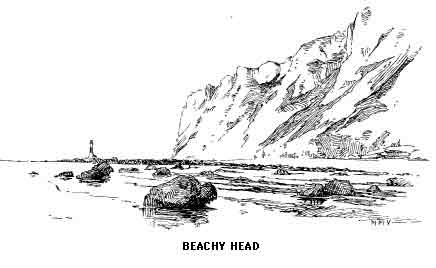
A short distance from the haven a steep gulley leads to the beach with a convenient chain and rope to prevent too sudden a descent. It has been suggested that through this gap the Romans passed from their moored fleets to the fortified settlements above. It was at one time possible to descend by another opening higher up the cliff to a ledge called "Puck Church Parlour." This is now inaccessible except to seabirds. The well-known view of the "Seven Sisters" is taken hereabouts and the disused "Belle Tout" lighthouse stands up well on the western slopes of Beachy Head, looking no distance across the Cuckmere bay.
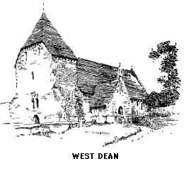
On the way from Litlington a slight divergence of half a mile or so might have been made to West Dean; this is a most sequestered little hamlet, famous only as the meeting place between the great Alfred and Asser, though some authorities claim the West Dean between Midhurst and Chichester as the authentic spot. There is a Norman arch in the tower of the church and also several canopied tombs and some good stained glass. Here is another priest's house even older than the one we have seen at Alfriston. George Gissing well describes the village and the surrounding country in his novel Thyrza.
A Downland road can be taken from here to Friston, Eastdean and Eastbourne, saving some miles of up and down walking, but the most enjoyable though more strenuous route is by the cliff path from Cuckmere Haven over the "Seven Sisters" cliffs to Beachy Head; a glorious six miles with the sea on one side and the Downs on the other, culminating in the finest headland on the south coast, 575 feet high, the magnificent end of the Downs in the sea. All these cliffs provide nesting-places for wild birds.
"I was much struck by the watchful jealousy with which the peregrines seemed to guard the particular cliff—more than 500 feet from the sea—on a lofty ledge of which their nest was situated, and which, indeed, they evidently considered their especial property; with the exception of a few jackdaws who bustled out of the crevices below, all the other birds which had now assembled on this part of the coast for the breeding season—it being about the middle of May—seemed to respect the territory of their warlike neighbours. The adjoining precipice, farther westward, was occupied by guillemots and razorbills, who had deposited their eggs, the former on the naked ledge, the latter in the crevices in the face of the cliff Here the jackdaws appeared quite at their ease, their loud, merry note being heard above every other sound, as they flew in and out of the fissures in the white rock or sate perched on a pinnacle near the summit, and leisurely surveyed the busy crowd below."
(A.E. Knox.)
At Birling Gap, just short of the Head, is a coast-guard station and the point of departure for the cable to France where we may descend to the coast by an opening which was once fortified. In history Beachy Head (possibly "Beau Chef") is chiefly remembered for the battle between the combined English and Dutch fleets and the French, in which the English admiral did not show to the best advantage.
Before the erection of the Belle Tout Light wrecks off the Head were of frequent occurrence and many are the tales of gallant fight and hopeless loss told by the coast dwellers here. "Parson Darby's Hole" under the Belle Tout is said to have been made by the vicar of East Dean (1680) as a refuge for castaways. We can but hope that his parishioners were as humane, but the probability is that the parson's efforts were looked on askance by his flock, who gained a prosperous livelihood by the spoils of the shore; and perhaps this feeling gave rise to the unkind fable that the cave was made as a refuge from Mrs. Darby's tongue.
"Sussex men that dwell upon the shore
Look out when storms arise and billows roar;
Devoutly praying with uplifted hands
That some well-laden ship may strike the sands.
To whose rich cargo they may make pretence."
(Congreve.)
The fine carriage-road which leaves Beachy Head leads directly into Eastbourne and is called the Duke's Drive. It was owing to the initiative of the grandfather of the present Duke of Devonshire, whose local seat is at Compton Place on the west of the town that the little hamlet of Sea Houses became the present beautiful and fashionable resort, with a sea-front of nearly three miles of gardens backed by hotels, boarding-houses and schools. As at Folkestone, education is here a strong feature, and a few years ago demure files of young ladies with attendant dragon taking the air between breakfast and study might have been seen. The epoch-ending events of the last few years, however, appear to have killed the "caterpillar."
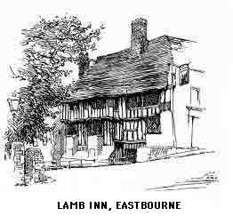
Eastbourne seems to have carefully pushed its workers, together with the gasworks, market gardens, and other utilitarian features round the screen of Splash Point. The boulevards going west and north are full of fine houses and brilliant shops and are lined with well grown trees. The continuation of Terminus Road will take us in a little over a mile to the old town; here is the parish church, mostly Transitional, and with many interesting features which should on no account be missed. Note the oak screen in the chancel; sedilia and piscina; also an Easter sepulchre. There is some old Flemish glass in the east window of the nave aisle; that of the chancel is modern but good. Near the church is a farmhouse, once a priory of Black Friars. The ancient "Lamb Inn" has an Early English crypt which may be seen on application.
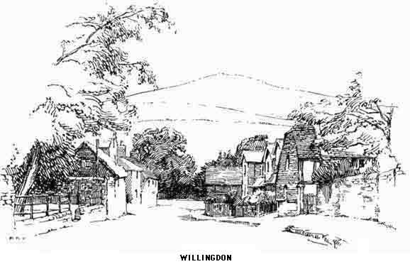
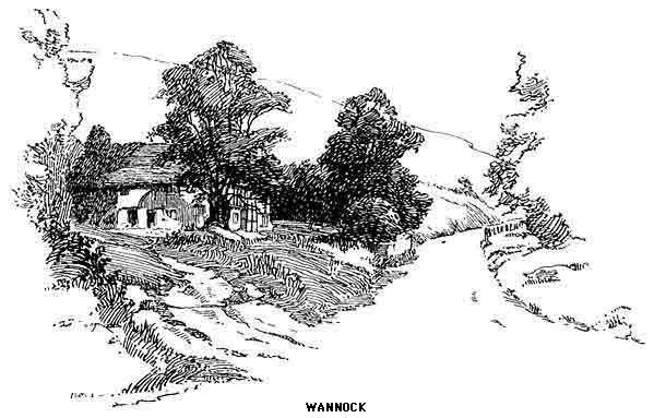
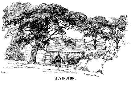
The most popular excursion from Eastbourne after "The Head" is to Willingdon, near which is Hampden Park and Wannock Glen, and, farther afield, Jevington. Willingdon has an interesting old church and is pleasantly situated, but the village is too obviously the "place to spend a happy day" to call for further comment. On the other hand, Jevington with its ancient but over-restored church, is quite unspoilt and, lying in one of the most beautiful of the Down combes, should certainly be visited.
We are now at the end of the Downs and the scenery eastwards takes on an entirely different character:—
"The great and fertile plain stretching along the Sussex coast from the eastward of Beachy Head in the direction of Hastings, and inland towards Wartling, Hurstmonceux and Hailsham, now studded with fat beeves, was at some remote era, covered by the sea, and what are known as 'eyes,' or elevations above the surrounding level—such as Chilleye, Northeye, Horseye, Richeye, &c.—must have been islands, forming a miniature archipelago. As all these are of Saxon meaning, it may be presumed that, at the time of the Saxon colonization, they were frequently or constantly insulated."
(Lower.)
Five miles from Eastbourne across the dreary flats of Pevensey Level lies all that remains of the city of Anderida, the headquarters of the Roman "Count of the Saxon Shore" and one of the last strongholds of Rome in Britain. The melancholy tale of the overthrow of ancient civilization in this corner of England by the barbarous Saxon invaders is summed up in the terse words of their own chronicle—"They slew all that dwelt therein, nor was there henceforth one Briton left." The name "Andredes Weald" is derived from the British—An tred—"No houses," and it correctly described the surrounding country at the time of the Roman occupation. The great Weald or forest actually extended from the coast to the Thames valley, broken only by the "Old Road" along the side of the North Downs, traversed by far-off ancestors of ours whose feelings as they gazed fearfully down into the depths of the primeval wood must have been on a plane with those of the earliest African explorers in the land of Pygmies. Here were the very real beginnings of those countless tales of Gnome and Fairy—ferocious tribe and gentle tribe—with which our folk-lore abounds.
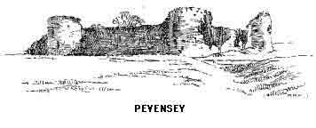
As to the existence of a British town here before the coming of the Romans nothing is known, but that Pevensey Bay witnessed the landing of Julius Caesar is tolerably certain, and here the custodians of Britain erected a great stronghold of whose walls we shall see the remnants as we first enter the castle. In 490 Ella besieged the city and, as quoted above, put it to fire and sword in effectual fashion; from this period therefore must be dated the foundations of the South Saxon kingdom. After upwards of five hundred years another conqueror appeared on the old Roman wall. On the twenty-eighth September 1066 William I landed, stumbled and fell, and "clutched England with both hands." Pevensey (Peofn's Island) was given to Robert of Mortain, and he it was who built the massive castle of the "Eagle" which we see rising inside the Roman wall. This name arose from the title "Honour of the Eagle" which was given to de Aquila, holder of the fortress under Henry I. After many changes of owners who included Edward I, Edward III and John of Gaunt, and after being besieged by Stephen against Matilda, by the Barons against Henry III, and by Richard II against Bolingbroke it fell on evil times and was actually sold for forty pounds by the Parliamentary commissioners as building material. The keep is in ruins and the chapel can only be traced in the grassy floor; here may still be seen the old font covered by an iron frame, and the opening of the castle well, in which, as related by Hare, skulls of the wolves which once roamed the great forest have been found.
In connexion with the Norman occupation of Sussex the curious and arbitrary system of "Rapes" by which the county is divided should be noticed. These six blocks of land have no apparent relation to the natural features of the country; each contains a powerful castle to overawe the division to which it belongs. The whole plan is eloquent of the method by which the Norman ruled the conquered race and kept them in subjection.
Pevensey shore is very trying for the pedestrian. The great expanse of shingle is of that drifting variety which makes walking almost an impossibility.
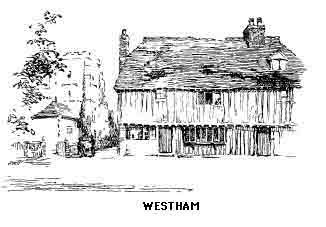
Pevensey church is to the east of the castle; the interior is graceful and it has some interesting details. Note the case of local curiosities, title deeds, etc. Westham, that part of the village nearest the station, was the overflow settlement from the walled town; this has a much finer church with Norman remains dating from the Conqueror's time, and the tower is noble in its massive proportions. Visitors should purchase the interesting little booklet shown on the table within the porch. The church has a fine oak screen in the south chancel and a stone altar with five crosses in the north aisle. Not far away is a large farmhouse known as "Priest-house"; this was once a monastic establishment.
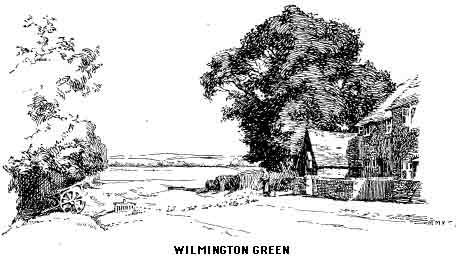
Close to Westham is Pevensey Station, from which the traveller can proceed to Hastings, Rye and Winchelsea; this beautiful and interesting district of Sussex is dealt with in Mr. Bradley's An Old Gate of England, and we must regretfully turn westwards. The return journey to Lewes may be made by the railway, though the Downs, for the unfatigued traveller, should prove the most alluring route. After passing Polegate a good view may be had on the left of the "Long Man of Wilmington" a figure 230 feet in length with a staff in each hand cut in the escarpment of Windover Hill; this is the only prehistoric figure on the Sussex Downs. Its origin has never been satisfactorily explained. Lower has suggested that it was the work of an idle monk of Wilmington. This is most unlikely. The theory has lately been put forward that the "staff" which the figure appears to be holding in each hand is really the outline of a door and that the effigy is that of Balder pushing back the gates of night. Wilmington village has an interesting Norman Church with a very fine yew in the churchyard. Built into the walls of a farmhouse close by are some remains of a Benedictine priory. Beautiful walks into the nearer woodlands of the Weald are easily taken from this pleasant village and the hill rambles toward Jevington are delightful.
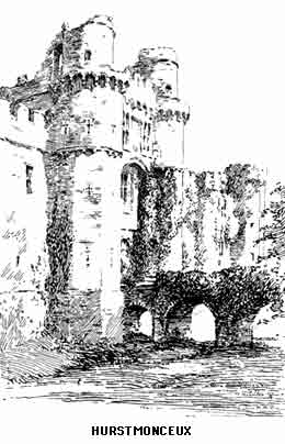
Before leaving this district mention must be made of Hurstmonceux. The nearest station is Pevensey, from which there is a rather dull walk of four miles across the Pevensey Levels. The more picturesque route is from Hailsham, though this is longer and belongs more to a tour of the Weald. The only village passed on the way from Pevensey is Wartling, beyond which a footpath can be taken across the meadows with a fine view of the ruins ahead. The present castle was built by Sir Roger de Fiennes in the reign of Henry VI. The name is taken from the first Lord of the Manor, Waleran de Monceux.
The outer shell is all that remains of what was once one of the grandest fortified mansions in England; it is now but a subject for artists and photographers, though at one time, since its dismantling, it made a good secret wine and spirit vaults. The colour of the walls is a surprise until it is realized that the building is of brick. The southern entrance, by which we approach, is the most imposing part of the ruin. We enter by a wooden bridge across the moat; this replaces the drawbridge. In the recessed chamber behind the central arch a ghostly drum was sometimes heard, and the supernatural drummer was supposed to guard hidden treasure. This legend was made good use of by the smuggling fraternity, the thumping of an empty keg being sufficient to scare away inconvenient visitors. Within the walls we are in a wilderness of broken brickwork covered with an enormous growth of ivy. Notice the great oven, and the ruins of the private chapel on the north side. The circuit of the walls should be made as far as is practicable; the magnificent row of Spanish chestnuts is much admired.
The story of the demolition of Hurstmonceux is unhappy reading; the act of vandalism for which the architect Wyatt was officially responsible seems to have been prompted by family spite.
The church is of great interest. The Dacre chantry and the splendid tomb of Thomas Fiennes, Lord Dacre, must be noticed; also a brass of Sir William Fiennes, 1405. The association of the place with the Hares, who are buried under the yew in the churchyard, although of recent date is nevertheless of much interest. The property and the living, which passed in 1855, came to the family through George Naylor of Lincoln's Inn, who bought them in 1708.
Near the church stands a fine fourteenth-century barn. The village is remarkable for a local industry—the making of "trug" baskets for the carriage of fruit.
The direct route to Brighton for pedestrians is by a footpath which leaves Lewes at the west end of Southover Street; this leads to the summit of Newmarket Hill and thence to the Racecourse and Kemp Town. No villages are passed and but few houses, and the six miles of Down, although so near a great town, are as lonely as any other six in Sussex. The high road leaves the town by the Battlefield road past St. Anne's church and follows the railway closely until the tram lines on the outskirts of Brighton are reached; this route passes Falmer, north-west of which lies the beautiful Stanmer Park, seat of the Earl of Chichester.
It will be best, however, to take the Newhaven road from Southover which hugs the foot of the Downs and in a short two miles reaches Iford. About half-way a turning to the right leads to the snug little village of Kingston with the hills rising closely all round. This place was once the property of Sir Philip Sidney. The remains of an ancient house belonging to the Priory at Lewes are to be seen in the old farmhouse named Swanborough which lies between Kingston and Iford. The architecture is Perpendicular, and Early English; permission should be obtained to examine the interesting details which, include a venerable oak table in the kitchen. Iford Church is a Norman building with a central tower and an Early English font.
A little over a mile farther is Rodmell with very fine Norman details in the church, which has the rare feature of a baptistery. The early Decorated screen is good; note also the squint with a shaft in the centre. Here is a brass dated 1433 in memory of Agatha Broke, on the back of which is another inscription to some one else of the seventeenth century. The church is surrounded by magnificent trees, and of especial note is the huge holm oak which overshadows the rest. The village inn has on its walls a quaint and amusing collection of precepts for its habitués which might well be duplicated elsewhere. Southease, the next village, has another of the three round towers of Sussex, and Piddinghoe, two miles farther, the third. These towers are a matter of puzzled conjecture to archaeologists; all three, Lewes, Southease and Piddinghoe are on the western bank of the Ouse. The suggestion that they were originally beacon towers is not very convincing, though the Ouse at the time they were built was a wider and deeper stream, forming in fact an estuary haven. The more prosaic explanation is that lack of stone for the quoins, which every square flint tower must have, led the builders to adopt this form. In any case, a beacon fire from a square tower is as effectual as from a round one. Piddinghoe has many associations with the smuggling days which have given birth to some quaint sayings, as "Pidd'nhoo they dig for moonshine,"—"At Pidd'nhoo they dig for smoke," etc., but we fail to see the point in "Magpies are shod at Pidd'nhoo."
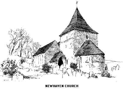
Seven miles from Lewes stands the rather mean port of Newhaven. After many years of neglect and decay this Elizabethan sea-gate is once more of great importance in continental traffic. Much money and skill were expended during the latter half of the nineteenth century in improving the harbour and building a breakwater and new quays. Louis Philippe landed here in 1848, having left Havre in his flight from France in the steamer "Express"; he was received by William Catt, who at one time owned the tide mills at Bishopstone; this worthy was a well known Sussex character and is immortalized by Lower. Newhaven has little to show the visitor beyond the small Norman church which has a chancel apse at the east of the tower. This portion is interesting but the nave has suffered from ignorant tinkering under the alias of "restoration." In the churchyard is a monument to those who perished in the wreck of the "Brazen" sloop of war in 1800 off the harbour, and another to a local brewer of the one-time famous "Tipper" ale, made from brackish water. The town was once called Meeching; this name is perpetuated in "Meeching Place" where a descendant of William Catt still lives.
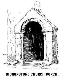
On the east of the Ouse is a much more interesting halt for the tourist in the small village of Bishopstone. The small remains of the tide mills just referred to are near the station. The very fine Norman church is about a mile away on the road to the Downs. The four storied tower is almost unique. Each stage diminishes in size, thus dispensing with buttresses; in this respect it is similar to Newhaven. Notice under the short spire a quaint corbel table. The south porch is extremely interesting as Saxon work though the mouldings are probably later enrichments by Norman workmen. Over the door is a stone dial with a cross and the name EADRIC. The interior is a good example of the change from round to pointed, the pure Norman of the east end gradually changing to Early English at the west. The combination of Norman ornament with the later style is almost unique in Sussex. In the vestry an interesting stone slab is shown; this was discovered during the restoration. It bears the carved presentment of a lamb, a cross, and two doves drinking. At this time a stone coffin lid, and a hidden fourteenth-century niche in the porch were also discovered. In the chancel is a memorial to James Hurdis, formerly Vicar of the parish, the author of The Village Curate, which has been likened to Cowper's Task; the verses are full of shrewd wit and local colour.
One mile south-east is the village of East Blatchington, now a suburb of Seaford; the restored church is Norman and Early English. In the south wall is a curious recess in Decorated style, the real use of which has not yet been discovered. Notice the sedilia and projecting piscina, and the tablet to the memory of the famous aeronaut, Coxwell, who died here in 1900.
Seaford was once an ancient port at the mouth of the Ouse before that river forsook its old channel for the outlet where is now the "New Haven." An important satellite of Hastings and ranking as one of the lesser Cinque ports, the old town saw much history-making during the French wars and suffered accordingly. Its actual foundation dates at least from Roman times as is proved by the fragments of sculpture, coins, etc., dug up at different times during the last two hundred years. At the rear of the East Cliff, near a footpath leading to Chyngton, are traces of a Roman cemetery with possible evidence of earlier British burials.
In the town itself are some interesting though scanty remains of mediaeval times. In the garden of a house named "The Folly" is a vaulted room the origin of which has never been satisfactorily explained. It is possibly part of the Ancient Hospital of St. Leonard. The open space at the higher end of the town is called "The Crouch" a name that is a corruption of "The Crux." The fine old Hardwicke House in Broad Street is dated 1603. At one time it was a lodging-house, but its fortunes have lately risen. Seaford House was once the temporary residence of Tennyson.
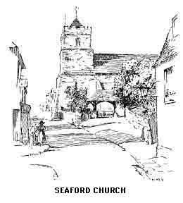
Seaford church is dedicated to St. Leonard and is Norman as far as the tower is concerned, of which the embattlement is modern; note the crosses in black flints on three of the sides. The base of the walls of the church date from this period, rising through Transitional to Perpendicular. The detail has been largely spoilt through restoration. Note the capitals of the pillars which are most elaborately worked, that near the south door having a representation of the Crucifixion carved upon it.
Millburgh House was once the property of a noted smuggler named Whitfield, whose immunity from punishment was obtained by judicious presents of choice wines in high quarters. Tales of the old smuggling days would fill many pages, and undoubtedly the profession formed the major commercial asset not only of Seaford but of more important Sussex towns both on the coast and on the roads leading to the capital.
Lower has recorded many interesting facts about the long war between the revenue officers and the natives, relieved at all times by the unfailing humour of the law-breakers, who took a keen delight in fooling the exciseman. It was but infrequently that real tragedy took place; considering the times, and the manner of those times, the records of Sussex are fairly clean. Such brutal murders as that of Chater in 1748, which crime was expiated at Chichester, were rare. The professionals were nearly all men of substance and standing in the land. The marine smuggler was of course a separate breed whose adventures and danger were of a different sort and, despite the glamour of the sea, of much less interest and excitement; on the other hand most of the inhabitants of such places as Alfriston had one or more of the male members of the family engaged in the trade, and many are the houses which still have secret vaults and chambers for the reception of the goods, chiefly wine, brandy, silk and tea. Most of the churches between Seaford and Lewes have at one time or another proved convenient temporary storage places, and on more than one occasion Sunday service has had to be suspended, on one excuse or another, until the building could be cleared of its congregation of tubs. Lower records that at Selmeston the smugglers actually used an altar tomb as a store for spirits, always leaving a tub for the parson.
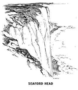
Seaford in its new rôle as a holiday resort has a serious obstacle to surmount; the only sea "front" possible is a wide shingle beach separated from the old town by a nondescript stretch of sandy desert; when and if this is filled in or converted into a garden the town should prosper exceedingly, for it has great natural attractions in Seaford Head which rises to the east and in the glorious Down walks within easy distance. In actual distance by rail it is, next to Brighton, the nearest South Coast resort to London and without doubt has a successful future before it. It is but little over two miles to the Cuckmere valley past the Roman camp and over the Head. The views of the "Seven Sisters" and on to Beachy Head from this point are very fine, and the great cliff itself, though much lower, is almost as interesting as the Eastbourne height. For one thing the wild life of the precipice is more easily studied, the crowds which on most summer days throng the more popular Head are not met with here. The writer has spent a June morning quite alone but for the myriad birds wheeling around and scolding at his presumption in being there at all.
The route now follows the coast road from Newhaven westwards. From the Portobello coastguard station, four miles from Newhaven Bridge, a road runs across the downs to the beautiful little village of Telscombe, nestling in a secluded combe in the heart of the hills; by-roads and footpaths also lead here by delightful ways from Southease and Piddinghoe. The church is old and interesting, quite unspoilt by any attempt at restoration; note the beautiful font on a marble platform.
Both here and at Rottingdean the artificial height of the churchyard above the surrounding land will be noticed. Cobbett's explanation for this is the obvious but rather gruesome one that dust added to dust has more than doubled the contents of the consecrated ground. From the comparative heights of the enclosure the author of Rural Rides reckoned the age of the building, a method which made a greater appeal to him than the rule of Norman round or English point.
Rottingdean has lately made a name for itself by reason of its modern literary associations. Its connexion with William Black and Rudyard Kipling is well known. Cardinal Manning and Bulwer Lytton both attended a once celebrated school kept here by Dr. Hooker. Edward Burne-Jones has left a lasting memorial of his association with the place in the beautiful east window of the church which was designed and presented by the artist. Certain columns in the walls point to the existence of a Saxon building of which these are the remains. Notice the effect of the tower in its unusual position between chancel and nave.
The village has a deserved place in the national history, as the following account will show:—
"In 1377 Hastings was burnt by the French, who also attempted to burn Winchelsea, but were foiled. They also attacked Rye, where they landed from five vessels. After plundering and setting it on fire they went away, leaving the town desolate. They landed at Rottingdean, advanced over the Downs with the design of laying waste Lewes, but in this were disappointed by the valour of John de Cariloce, Prior of Lewes, Sir Thomas Cheney, Constable of Dover Castle, Sir John Falsley, and others, who upon apprisal of it, hastened their vassals, and were joined by a number of peasantry, who boldly ascended the Downs, resolved to repel the invaders. They were insufficient both in number and skill to cope with the well-trained troops of France. The brave peasantry were totally routed, but not till one hundred of their party had sacrificed their lives, and the Prior and the two knights had been made prisoners. The loss which the French had sustained prevented further encroachments, and they returned to their ships with their prisoners, who were conducted to France."
That Rottingdean was known and appreciated over one hundred years ago will come as a surprise to many. The following account appeared in the Gentleman's Magazine, 1801:—
"The pleasant and delightful village of Rottingdean is situated on the Newhaven Road, at the distance of nearly four miles from Brighthelmstone, a popular watering place. This place is no otherwise remarkable than for its wells, which are nearly empty at high water, but which rise as the tide declines. This little village has of late been the resort of a considerable number of genteel company, for which bathing-machines and every accommodation have been provided. Here are a variety of lodging houses, a good inn, with convenient stables, coach-houses, etc. It is most frequented by such families as prefer a little retirement to the bustle and gaiety of Brighthelmstone, and who occasionally may wish to mix with the company there, for which its situation renders it at any time perfectly convenient. The road from Rottingdean to Brighthelmstone is delightfully pleasant in the summer season. On one side you have an extensive view of the sea, and on the other the Downs, covered with innumerable flocks of sheep, so justly held in estimation for their delicious flavour."
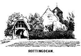
About two and a half miles from Rottingdean in a lonely dene surrounded by the Downs is the little hamlet of Balsdean; there is nothing to see here but a building locally called "The Chapel" (the architecture is Decorated, with an ancient thatched roof) but the walk will give the stranger to the district a good idea of the solitude and unique characteristics of the chalk hills. The curious T-shaped cuttings still to be seen in the sides of the Downs may be remarked; these are where the traps set to catch wheatears were set. A great trade was once done by the Downland peasantry in these "Sussex Ortolans," as they were called, but of late years the demand has dwindled to vanishing point.
The lover of the picturesque will feel grateful to the powers who refuse to destroy the deserted windmills which stud the Downs and of which there is one good example near here. One cannot suppose however that the object of letting them stand is other than utilitarian; after a long life of service in their original capacity these daylight beacons perform the duty of landmarks for seamen in the Channel.
A footpath from Rottingdean just a mile long crosses the Downs to Ovingdean, another lonely hamlet without inn or shop. An ancient church, possibly Saxon in part, and a few houses hidden by trees make a goal of a favourite walk from Brighton. Harrison Ainsworth has made the little place famous in "Ovingdean Grange," in which romance the novelist makes it one of the scenes in the flight of Charles II; this however is incorrect, as it is certain that Brighton was the limit of the royal fugitive's journey eastwards. The large building on the hill above Ovingdean is Roedean College for girls; its fine situation and imposing size make it a landmark, and the seascape from its windows must be unrivalled.
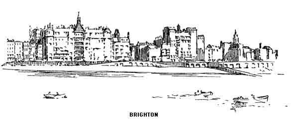
"Kind, cheerful, merry Dr. Brighton." Thackeray's testimonial is as apt to-day as when it was written, but the doctor is not one of the traditional type. Here is no bedside manner and no misplaced sympathy, in fact he is rather a hardhearted old gentleman to those patients who are really ill in mind or body and his remedies are of the "hair of the dog that bit you" type.
Londoners take Brighton as a matter of course and—as Londoners—are rarely enthusiastic. It takes a Frenchman to give the splendid line of buildings which forms the finest front in the world the admiration that is certainly its due. When one has had time to dissect the great town, appreciation is keener; there are several Brightons; there is a town built on a cliff, another with spacious lawns on the sea level, and a third, the old Brighton, bounded by the limits of the original fishing village, and, with all its brilliance, having a distinctly briny smell as of fish markets and tarred rope and sun-baked seaweed when you are near the shingle. This last is nearly an ever-present scent, for the sun is seldom absent summer or winter; in fact it is when the days are shortest that Brighton is at its best; The clear brilliance of the air when the Capital is full of fog and even the Weald between is covered with a cold pall of mist, makes the south side of the Downs another climate. Richard Jeffries, almost as great a town hater as Cobbet, has a good word for Brighton. "Let nothing cloud the descent of those glorious beams of sunlight which fall at Brighton" (referring to its treelessness). "Watch the pebbles on the beach; the foam runs up and wets them, almost before it can slip back the sunshine has dried them again. So they are alternately wetted and dried. Bitter sea and glowing light, dry as dry—that describes the place. Spain is the country of sunlight, burning sunlight, Brighton is a Spanish town in England, a Seville."
The history of Brighton is the history of Piccadilly, but although the Prince Regent is usually credited with the discovery of the town, this title to fame must be given to a doctor of Lewes named Russel, who wrote a book on the virtues of sea water as applied to the person. This was published in 1750, and from that time must be dated the rise of England's first sea resort, for almost immediately patients eager for the new cure came thronging from London by post-chaise and family coach, and the doctor soon removed from his native town to attend them. The "cure" became the mode, and in 1783, when the Prince made his first visit, the fortune of the town was assured.
After a hundred years that ended with the Mid-Victorians the exclusiveness of Brighton gave way to the excursion train, and though still a fashionable place, it is now more than ever London-by-the-sea and caters with true courtliness for coster and duke.
Brighton was never a "steps to the sea" for anywhere but London, and its beginnings as a small but independent fishing settlement are very remote; according to some seventeenth century writers it once boasted walls and upwards of two thousand inhabitants, but through the depredations of the sea, it had dwindled to a mere hamlet, and cut off by the Downs and away from all the usual channels of communication, the self-sufficiency of the place must have received a rude shock when the first visitors arrived, but natives of the coast are notoriously adaptable and know a "sure thing." The following account written in 1766 shows how quickly the town was preparing for its great future.
"Brighthelmstone, in the County of Sussex, is distant from London 57 miles, is a small, ill-built town, situate on the sea coast, at present greatly resorted to in the summer time by persons labouring under various disorders for the benefit of bathing and drinking sea water, and by the gay and polite on account of the company which frequent it at that season. Until within a few years it was no better than a mere fishing town, inhabited by fishermen and sailors, but through the recommendation of Dr. Russel, and by the means of his writing in favour of sea water, it is become one of the principal places in the kingdom for the resort of the idle and dissipated, as well as the diseased and infirm."
"It contains six principal streets, five (East Street, Black Lion Street, Ship Street, Middle Street, West Street) lie parallel with each other, and are terminated by the sea. The sixth, North Street, running along the ends of the other five, from the assembly house almost to the church. The church, which is a very ancient structure, is situate at a small distance from the town, upon an eminence, from which there is an exceedingly fine view of the sea, and in the churchyard is a monument erected to the memory of Captain Nicholas Tattersell, who assisted King Charles II in his escape after the Battle of Worcester.
"The house in which the King was concealed is kept by a publican who has hung the King's head for his sign. The church is a rectory, and the Rev. Mr. Mitchell is the present incumbent; besides the church there are three other places of worship, one for Presbyterians, another for Quakers, and a third for Methodists, which last is lately erected at the expense of the Countess of Huntingdon adjoining her house, through which there is a communication. There are two assembly rooms, which are opened on different nights, one kept by Mr. Shergold, and the other by Mr. Hicks, who also keeps the coffee-house. The place on which the company usually walk in the evening is a large field near the sea, called the Stean, which is kept in proper order for that purpose, and whereon several shops with piazzas and benches therein are erected, as is also a building to perform in when the weather will permit. There is also a small battery towards the sea. At a little distance from the town is a mineral spring which is said to be a very fine one though little used. Upon the hills near the church the Isle of Wight is frequently seen on a clear day. About the town are very pleasant Downs for the company to ride on, the air of which is accounted extremely wholesome, and about eight miles from Brighthelmstone on the Downs is one of the finest prospects in the world called Devil's Dyke."
The literary associations of Brighton are many and various. Charles Lamb lived for some years is Sussex House, Ship Street. Paston House was the home of William Black before he removed to Rottingdean. Ainsworth produced a goodly portion of his historical novels at No. 5, Arundel Terrace, and at 4 Percival Terrace, Herbert Spencer spent the last years of his life and here died. The name of Holyoake, the social reformer, is connected with Eastern Lodge, Camelford Street. A list of such names might be extended indefinitely, and if the celebrities who have been regular visitors were mentioned the record would be endless, though it is said that Robert Browning never entered the town. Dr. Johnson stayed in West Street, when the Thrales lived there; he bathed with the rest and, unlike the rest, abused the surroundings in his usual manner, declaring that a man would soon be so overcome by the dismalness of the Downs that he would hang himself if he could but find a tree strong enough to bear his weight!
Every Dickensian would like to identify the house which the creator of Paul Dombey had in mind when he painted the inimitable portrait of Mrs. Pipchin, "ogress and child queller," whose castle "was in a steep bye street.... where the small front gardens had the property of producing nothing but marigolds, whatever was sown in them; and where snails were constantly discovered holding on to the street doors.... In the winter time the air couldn't be got out of the Castle, and in the summer time it couldn't be got in.... It was not naturally a fresh smelling house; and in the window of the front parlour, which was never opened, Mrs. Pipchin kept a collection of plants in pots, which imparted an earthy flavour of their own to the establishment."
Little Paul afterwards went to Dr. Blimber's, which "was a mighty fine house fronting the sea"; this has been identified as being on or near the site now occupied by the Metropole. Thackeray, whose verdict on the town is quoted at the head of this chapter, laid several scenes among these squares and crescents and gave to one of his greatest characters the town's best known feature as a title.
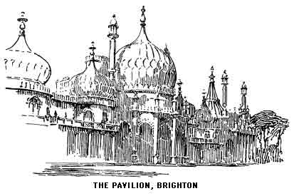
The extraordinary and incongruous building in the Steyne known as the Pavilion was built by Nash at the instigation of George IV. The architect cannot be entirely blamed for the monstrosity, the general idea and "style" was no doubt conceived by his patron. This is how the Pavilion impressed Cobbett: "Take a square box the sides of which are three feet and a half and the height a foot and a half. Take a large Norfolk turnip, cut of the green of the leaves, leave the stalk nine inches long, tie these round with a string three inches from the top, and put the turnip on the middle of the top of the box. Then take four turnips of half the size, treat them in the same way, and put them on the corners of the box. Then take a considerable number of bulbs, of the Crown-Imperial, the narcissus, the hyacinth, the tulip, the crocus and others; let the leaves of each have sprouted to about an inch more or less according to the size of the bulb; put all these pretty promiscuously but pretty thickly on top of the box. Then stand off and look at your architecture."
The building now belongs to the town, and the stables (The "Dome") form a very fine concert hall. The adjacent buildings, all part of the Pavilion, are used as Museum, Library and Picture Gallery. The residence of Mrs. Fitzherbert still overlooks the Steyne, up the steps of this house Barrymore drove his carriage and pair to the great detriment of both house and equipage. The Y.M.C.A. now occupy the premises. One of the best descriptions of the Regent's Brighton is in "Rodney Stone."
It was about 1826 that the greatest growth in building took place; from about this period date those magnificent squares, Regency and Brunswick in Hove, and Sussex Square in Kemp Town.
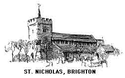
The Steyne is now a pleasant public garden; it was originally the "Stane" or rock upon which fishing nets were dried. St. Peter's Church at the north end was built in 1824 by Barry, and for its period is not unpleasing. In Church Street is the only ancient church in Brighton; it is dedicated to St. Nicholas; and was to a great extent rebuilt in 1853. Note its fine gilt screen and the Norman font with a representation of the Lord's Supper and certain scenes connected with the sea, but too archaic to be actually identified. In a chantry chapel is the Wellington memorial, an ornate cross eighteen feet high. The Duke was a worshipper here while a pupil of the then vicar, and the restoration of the church was a part of the memorial scheme. Captain Tattersell, who was instrumental in the escape of Charles II, is buried in the churchyard and a monument sets forth—
"When Charles ye great was nothing but a breath,
This valiant soul stept between him and death."
Here is also a memorial to Phoebe Hessel, who fought as a private in the fifth regiment of foot at the Battle of Fontenoy and died here aged 108.
There are several fine churches which have been built during recent years, including St. Paul's in West Street; every excursionist knows this, and to thousands it is the only church in Brighton, being on the direct route from the station to the sea. St. Martin's and St. Bartholomew's are open all day and are well worth a visit. Trinity Chapel was the scene for six years of the incumbency of F.W. Robertson, and another preacher of more recent fame, R.J. Campbell, was for a time the Minister of Union Street Congregational Church.
The old Chain Pier was, next to the Pavilion, the most distinctive feature of the town; built in 1823 and paved with stone, it was historic as the first pleasure pier. Swept away by a storm on the night of December 4, 1896, old Brightonians must have felt that something had gone from their lives when they looked from their windows next morning.
One of the "institutions" of Brighton is the Aquarium; it contains a very good collection of Marine exhibits, not as much appreciated as they should be. Of late years extra attractions have had to be added and concerts and other entertainments help to keep the glass tanks and their occupants popular.
Kemp Town, named after its speculative builder, has been but briefly alluded to; it is to many the most attractive part of the great town, rising at the east end to a respectable height above the sea and with fine views of the Channel. Unlike its parent it has no "history" whatever. King Edward, during the last years of his life, took a liking to this part of Brighton, and in his honour the district was officially renamed "King's Cliff," but the new style does not seem to have become popular. On the other hand Hove, with its "Lawns" and imposing squares, has a past; the following note appears in the Gentleman's Magazine dated 1792: "Hoove, by some spelled Hove or Hova, lies on the road between Brighthelmstone and New Shoreham, about two miles from the former and four from the latter. It was one of the many lordships in the county of Sussex which the Conqueror's survey records to have been the estate of Godwin Earl of Kent, in Edward the Confessor's time, and which after his death passed to his eldest son Harold, who being afterwards King, was slain by the Norman Duke, who seized his lands and gave them to his followers. Long after this time, this place was as large and as considerable a village as the county could boast; but it is reduced, by the encroachment of the sea at different times, to about a dozen dwellings. This place gives title to a prebend in the cathedral of Chichester; and the living, which is a vicarage united to Preston, is in the gift of the prebendary. Divine service is only performed in the church once in six weeks, and, by appearance of the ruinous state in which it at present is, that will be soon entirely neglected." This church, dedicated to St. Andrew, has been practically rebuilt, though some of the ancient features have been retained. Near the chancel door is the grave of Charlotte Elliot, the hymn writer. Admiral Westphal, one of the officers of Nelson's "Victory," is also interred here. The new parish church—All Saints—is of great magnificence and has cost about £50,000.
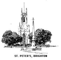
The western end of Hove, if we may believe some experts, has claims to a higher antiquity than any other locality between Pevensey and Bosham. Aldrington, as this district is called, is conjectured to have been the Roman "Portus Adurni," of which Shoreham would then be the lineal descendant. On the other hand the identification of this mysterious place with any part of Sussex has been seriously challenged. The estuary of the Adur then extended to Bramber. A glance at the two-inch Ordnance map of the district will make the old course of the river quite clear. In Hove Park is the famous "grey wether," called the "Goldstone." This used to lay in Goldstone Bottom between the railway and the Downs. Inspecting antiquaries proved such a nuisance that the farmer on whose land it lay determined to bury it out of sight; this almost superhuman task was performed in 1833 and the stone remained in the ground until 1902 when it was exhumed.
Preston, the northern extension of Brighton, originally a small place on the London road, has a pleasant park from which the suburb takes its name. The one object of interest to the tourist is the Early English church which has some remarkable frescoes; these represent the murder of St. Thomas of Canterbury, with Our Lord revealing himself to the martyr; on the opposite side St. Michael is shown weighing a soul. In the nave is another picture of the nativity. A destructive fire, a few years ago, greatly damaged these and also the fabric of the church. Careful repair, however, has to a great extent restored the building to its original condition The altar consists of a seventeenth century tomb. The old font was taken away to St. Saviour's Church, but has been very properly replaced.
Brighton is not the best centre for the exploration of the central Down country. If a coast town is chosen Worthing is much better; from there the real country is quickly reached, although the hills themselves are farther away. But there are one or two excursions which obviously belong to Brighton, the most important being that to the Devil's Dyke and Poynings. A rather dull walk of over five miles from the Steyne, retrieved during the last two by fine views on the left hand, will bring us to the old stone posts labelled "The Dyke." This road passes an interesting Museum of Ornithology collected by the late E.T. Booth. Here are to be seen cases of wild birds in their natural surroundings planned with greatest care by Mr. Booth, who gave a lifelong study to the habits and environment of British birds. On the occasions on which the writer has visited the collection no other persons were present, and few residents seem to have heard of it.
Trains run at frequent intervals from Brighton Central to the Dyke and public conveyances from the Aquarium. The excursion should not be missed, though the visitor who is a stranger must be prepared for a regrettable amount of waste paper and broken bottles left about to mar what would otherwise be one of the finest scenes in the Downs. Refreshment stalls and tea gardens help to vulgarize the surroundings, though the added desecration of aerial railway across the Dyke has been removed.
The local legend is almost too well known to bear repetition. The Sussex native has a dislike, probably derived from his remote ancestors, to refer directly to the Devil, so the story has it that the "Poor Man," becoming enraged at the number of churches built in the Weald, conceived the idea of drowning them by letting in the sea; he had half finished the great trench, being forced (like his remote prototype) to work at night, when an old lady, hearing the noise of digging, put her candle in a sieve and looked out of the window. The Devil took it for sunrise and disappeared, a very simple fiend indeed!
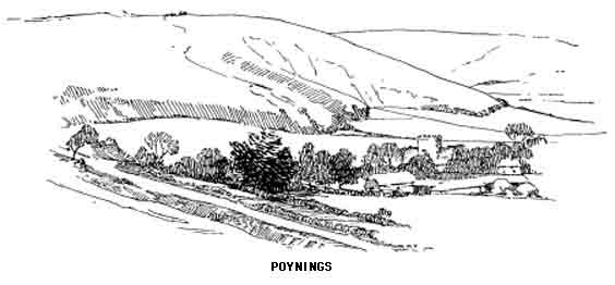
The view from the edge of the escarpment with Poynings just below to the right is very beautiful; away to the south-west is an eminence called "Thunder's Barrow," probably Thor's Barrow; at the lower end of the Dyke is the Devil's Punch Bowl, here are two more barrows "The Devil's Grave" and "The Devil's Wife's Grave."
A visit to Poynings (locally "Punnings") should be combined with this excursion; this is a really pleasant and, as yet, unspoilt village. One feels nervous for its future, but the good taste of the inhabitants, combined with the formidable barrier of the hills, will, it is hoped, prevent it ever becoming a mere congeries of tea gardens and like amenities. The fine cruciform church has a central tower and is Early Perpendicular; built by Baron de Poynings in the late fourteenth century it has many interesting details. Note the old thurible used as an alms box. The great south window was brought here from Chichester Cathedral. There is some good carved wood in the pulpit and rails. The ruins of Poynings Place, the one-time home of the Fitz-Rainalts, Barons of Poynings, may still be seen.
Newtimber Hill immediately east of the village is rarely visited and therefore is not rendered unsightly in the manner of the Dyke. The view is equally good and the Downs westward appear to even better advantage from this outlying point. A return could be made from Newtimber to Pycombe, once famous for its manufacture of shepherds crooks—"Pycoom Hooks." The village lies in the pass by which the London-Brighton road crosses the Downs. The old church has a twelfth century leaden font and a double piscina and is one of the highest in Sussex, being situated 400 feet above the sea. This walk could very well be extended to include Wolstonbury Hill and Hurstpierpoint.
The road running west from Poynings at the foot of the Downs would bring us to Fulking where is a memorial fountain to John Ruskin erected by a brewer. Another two miles along it is Edburton, an unspoilt village under the shadow of Trueleigh Hill; the fine Early English church has a pulpit and altar rails presented by Archbishop Laud and a leaden font of the early twelfth century. Nine miles north of Brighton by road, and about half-way between the two London highways, either of which may be taken, lies the large village or small town locally called "Hurst" and by the world at large, more romantically, Hurstpierpoint. The situation, with its wide and beautiful views over the surrounding country from Leith Hill and Blackdown to the ever present line of the Downs on the south, make it one of the pleasantest places in Sussex for a prolonged stay. St. John's College is one of the Woodard schools in connexion with Lancing foundation (see page 103); it is a fine building with an imposing chapel. The church is modern and was designed by Sir Charles Barry. In the south transept is an effigy of an unknown crusader and another of a knight in the north aisle. A brass in the chapel commemorates the fact that the martyred Bishop Hannington was born and held a curacy here. There are a number of memorials to the Campions, local squires and present owners of Danny; one of them runs thus:—
"Reader, bewail thy country's loss in the death of Henry Campion. In his life admire a character most amiable and venerable, of the Friend and Gentleman, and Christian."
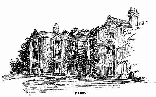
Danny is a beautiful specimen of the Elizabethan mansion at its best; it is built under the shadow of Wolstonbury Hill, one of the finest in shape of the outstanding bastions of the Downs, on the top of which is a circular camp with several pits within the vallum. The twin woods on the slope of the hill are locally known as "Campion's Eyebrows," they are well seen in the accompanying sketch.
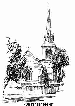
Hurstpierpoint may also be easily visited from Hassocks Station (2 miles), from which we may also start on the last stage of our return to Lewes. One mile east of the station is Keymer, a pleasant little place with an uninteresting church which has been practically rebuilt. Ditchling, a mile further, has a very fine Transitional and Early English church which will repay a visit. The nave is severely plain in the older style; the chancel shows some untouched and very beautiful workmanship. The east window is Geometrical, as are several in the nave, others are Decorated and, in the transept, Perpendicular. Note the old font which was evidently at one time coloured; also the aumbry, piscina and sedile. The chalk arches are finely worked. In the village are several old timber houses, including one said to have been inhabited by Anne of Cleves.
A walk of about two miles past Wick Farm or by Westmeston, over half a mile farther, brings the traveller to the summit of this section of the Downs—Ditchling Beacon (813 feet). Until more accurate surveys were made this was supposed to be the highest point of the whole range.
"This most commanding down is crowned with the grassy mound and trenches of an ancient earthwork, from whence there is a noble view of hill and plain. The inner slope of the green fosse is inclined at an angle pleasant to recline on, with the head just below the edge, in the summer sunshine. A faint sound as of a sea heard in a dream—a sibilant 'sish, sish'—passes along outside, dying away and coming again as a fresh wave of the wind rushes through the bennets and the dry grass." (Richard Jefferies.)
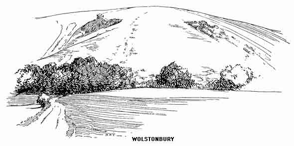
The views from Ditchling, though fine, are not nearly the best, for there is a tameness in the immediate country to the north. A glorious walk, however, can be taken by keeping along the edge past "Black Cap," the clump of trees about two miles east, and then either over or round Mount Harry to Lewes. Those who must see all the settlements of men should proceed downwards to Westmeston, a beautiful little place embowered in trees, some of which are magnificent in shape and size, particularly the great ash at the east of the church which is literally overshadowed by the Beacon. The building is uninteresting and the mural paintings dating from the twelfth century, which were discovered about fifty years ago, have not been preserved. It was near here that Baring Gould speaks of seeing the carcasses of two horses and three calves hanging in a elm; on inquiry he was informed that this was considered "lucky for cattle."
About a mile and a half north and two miles east of Ditchling village is the lonely hamlet of Street. The "Place" is a grand old house dating from the reign of the first James; behind the chimney of the hall was once a spacious hiding place and a story is told of a Royalist fugitive who rode into it on his horse and was never again seen. The restored church has a number of iron grave slabs and a monument to Martha Cogger, who was a "Pattern of Piety and Politeness."
Nearly two miles on the Lewes road is Plumpton, chiefly famed for its steeplechases which are held two miles away in the Weald and close to Plumpton station. The church is uninteresting. The "Place" is an old moated house, the property of Lord Chichester. The Leonard Mascall who lived here in the sixteenth century is said to have introduced the first carp from the Danube, the moat being used as their nursery. Notice the great V in firs on the face of the Downs; this is a memorial of the Victorian Jubliee; not particularly beautiful and leading one to speculate upon its permanence. A cutting in the chalk would probably recommend itself to the pious care of coming ages when the personage commemorated had either been entirely forgotten or had developed into a legendary heroine of fictitious character. That even cuttings are not always permanent is proved close by, for only occasionally can the cross cut to commemorate the great battle of Lewes be seen; the turf shows but a different shade of green at certain times and under certain atmospheric conditions.
The road to Lewes continues under the shadow of Mount Harry and eventually drops to the Lewes-London highway near Offham, remarkable as being the first place in the south where a line of rails was used for the passage of goods. A turn to the right and we soon reach Lewes near St. Anne's Church.
Public conveyances run from Brighton to Shoreham several times each day by Portslade and Southwick; the railway to Worthing also follows the road and little will be lost if the traveller goes direct to New Shoreham. Portslade and Southwick churches have some points of interest, the latter a one time church of the Knights Templar, but they are not sufficient compensation for the melancholy and depressing route. After passing Hove the road is cut off from the sea by the eastern arm of Shoreham Harbour, and there follows a line of gas works, coal sidings and similar eyesores, almost all the way to Shoreham town. However, the explorer will be amply recompensed when he arrives at the old port at the mouth of the Adur.
The original Saxon town had its beginnings at Old Shoreham, but, as the harbour silted up, the importance of the new settlement under Norman rule, exceeded all other havens between Portsmouth and Rye. The overlords were the powerful De Braose family, who have left their name and fame over a great extent of the Sussex seaboard.
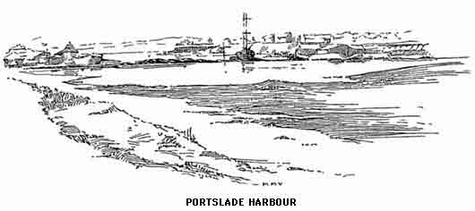
King John is known to have landed here after the death of Richard, and Charles II sailed from Shoreham after the Battle of Worcester. The fugitive came across country accompanied by Lord Wilmot, and at Brighton fell in with the Captain Tattersell, whose grave we have seen there. An arrangement was made by which he was to leave Shoreham in the captain's vessel; this was done the next morning and the King in due time reached Fecamp safely. At the restoration the gallant captain received an annual pension of one hundred pounds.
Shoreham is decidedly not the town to visit for an hour or two or for half a day. No one can possibly gain a correct impression of these smaller English towns by a casual call, as it were, between trains. A short stay, or two or three day visits (not on "early closing" day) is the least one can do before claiming to know the place.
New Shoreham is almost certain to disappoint on first acquaintance. In fact it may be described as mean and shabby! Other and competent judges have felt the charm of this old Seagate and one—Algernon Charles Swinburne—has immortalized it in his glowing lines "On the South Coast":—
"Shoreham, clad with the sunset glad and grave with glory that death reveres."
Shoreham church is second only to the Cathedral at Chichester and Boxgrove Priory in interest. As will be seen by the fragments in the churchyard a nave once made the building cruciform, and its proportions then would not have disgraced a small cathedral. A movement has been on foot for some time to rebuild the nave on the old site and an offertory box for this purpose will be seen within the church.
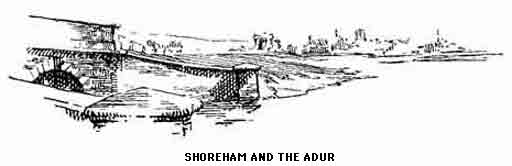
The prevailing effect of both exterior and interior is of solemn and stately age. The upper part of the tower is Transitional with certain later additions. The base of the tower, the choir transepts, and the fragment still remaining of the nave are Norman and Transitional of very noble and dignified proportions.
The vaulting will be noticed. This is Early English, also the beautiful ornament on the capitals and the interesting mason's marks on the pillars. The marble font is a very good specimen of the square type common in this locality. A brass in the nave of a merchant and his lady should be noticed, also a piscina with trefoil ornament and a modern window in the north transept to the infants who died between 1850 and 1875. There are a number of memorials to the Hooper family hereabouts. In this portion of the building the election of parliamentary candidates once took place.
The church owes nothing of its stateliness to a past connected with priory or monastery, it has always been a parish church and is of additional interest thereby. That it always will hold this rank is another matter; in these days of new sees one cannot tell that the parish church of to-day will not be the cathedral of to-morrow. Certainly Shoreham would wear the title with dignity.
There are many quaint corners left in the town (which since 1910 has been officially styled "Shoreham by Sea "), but the individuality of the place is best seen on the quay where a little shipbuilding is still carried on; in the reign of Edward III it supplied the Crown with a fleet of twenty-six sail. The figure-head sign of the "Royal George" Inn may be noticed; this was salvaged from the ill-fated ship of that name which sunk in Portsmouth Harbour.
The Norfolk Suspension Bridge, still retaining its old-fashioned toll, carries the Worthing road across the river, at high tide a fine estuary, but at low a feeble trickle lost in a waste of mud. The view of the town from the bridge is very charming, especially in the evening light.
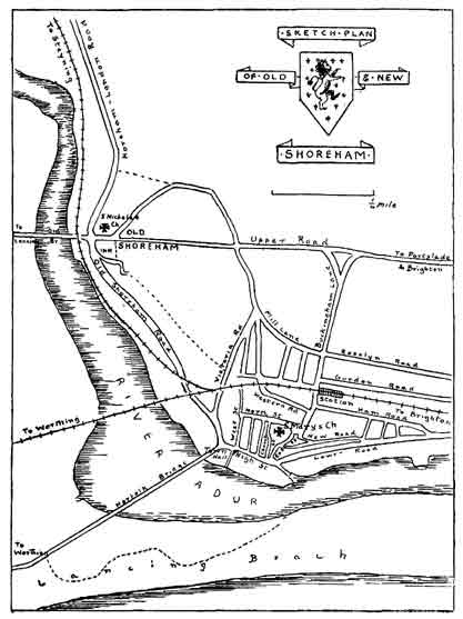
At Old Shoreham, a mile up stream, is another bridge which, with the church, is the most painted, sketched and photographed of all Sussex scenes; few years pass without it being represented on the walls of the Academy. This bridge is a very ancient wooden structure which has been patched and mended from time to time into a condition of extreme picturesqueness. The bridge leads to the "Sussex Pad," a noted smuggling hostelry in a situation ideal for the purpose, and then on to Lancing and Sompting.
The sturdy and grey old church which has seen so many centuries of change and decay in the life around it, which has even seen the very face of nature alter in the haven beneath, has not changed in any essential since the great De Braose of the eleventh century built it on the foundations of its Saxon predecessor, whose massive walls still support a goodly part of the Norman building. Almost the whole of the upper part of the church is Norman, though the chancel appears to have been restored at a later date. Note the fine pointed screen and the rich moulding of the arches and door, also the carved tye-beam above the great arch which leads to the crossing. The nave is curiously dark, through the absence of windows; here may be seen the remains of the Saxon wall projecting beyond the line of the newer work. A low side window near the southwest corner has been variously described as a confessional, a hagioscope, and a leper window.
The few small houses to the south of the church are all that now remain to show where the one time port stood; though none of the existing buildings are contemporary with that period.
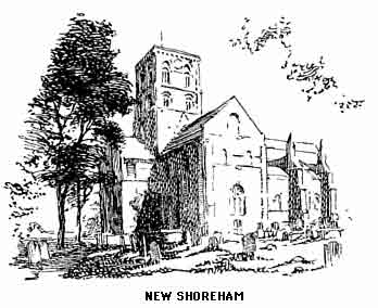
There is now a choice of ways. The direct route to Worthing goes across the Norfolk Bridge and then by South Lancing ("Bungalow Town ") and calls for no comment other than its fine marine views. The valley road to Bramber and Steyning we propose to travel presently, and we will now cross the old bridge by the "Sussex Pad," lately rebuilt. Half a mile from the inn the Down road to the right leads direct to the prominent group of buildings on a spur of the Downs which have been constantly in view during the walk from Shoreham. St. Nicholas', or Lancing, College was founded in 1849 by Nicholas Woodard, an Anglican priest. It is part of a larger scheme, other colleges in connexion being at Hurstpierpoint and Ardingly. The original school, established in 1848 at Shoreham, may still be seen at the corner of Church Street; it is now a laundry. The buildings are dominated most effectively by the great pile of the college chapel 97 feet from roof to floor. The general effect is most un-English and gives the west side of the Adur an air reminiscent of Normandy or Picardy.
Lancing is supposed to be derived from Wlencing, one of the sons of Ella. The church, originally Norman, has been much altered at various times and is mainly Early English. The remains of an Easter Sepulchre may be seen in the north wall of the chancel and at the door the mutilated fragment of a stoup.
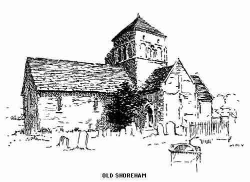
At the third mile from Shoreham is Sompting, famous for its church and well known to Worthing visitors, who have a pleasant walk of about two and a half miles by shady road and field path through Broadwater. The church stands in a group of elms on the slope to the north of the village. The tower and part of the chancel are undoubtedly Saxon, the remainder of the church having been rebuilt in Norman and Early English times. Notice the characteristic bands of stonework which run round the tower and the long capitals of the central ribs. The gabled spire is almost unique in this country and will awaken memories of Alsace for those who know that land. A similar spire may be seen in another Down country, at Sarratt in Hertfordshire, and a modern example at Southampton. Between the north side of the tower and the nave are the remains of a chapel erected by the Peverells. The interior of the church is equally uncommon and interesting, and the distressing newness which follows most restorations is not seen here, the work of the restorer, Mr. Carpenter, having been most careful and sympathetic. The outline of the original windows may be traced in the chancel which is now lit by Perpendicular openings. Over the altar is a tabernacle, not very well seen. Notice the piscina with triangular arch, and a tomb, it is supposed, of Richard Bury, dating from the time of Henry VII; also the curious corbel face in the east aisle of the vaulted north transept. The south transept is below the level of the nave; here are two mutilated pieces of sculpture, representing Our Lord with a book and a seated bishop with his crozier. The font is placed in a recess which formerly held an altar. The church became the property of the Knights Templar and a portion of the manor was held by the Abbey of Fécamp; the adjoining manor-house being still known as Sompting Abbotts; this house was for a short period the home of Queen Caroline.
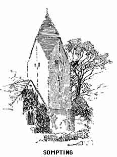
Enjoyable rambles may be taken by any of the numerous by-roads which lead northwards into the heart of the Downs by Roman Ditch, Beggar's Bush and Cissbury. It is proposed, however, to leave a more particular description of this country to that portion of our longer route to Worthing viâ Washington, for which we must return to Shoreham, and now to take the road which runs by the Adur to Upper Beeding. On the way will be noticed the little church at Coombe backed by the Downs; this has an unmistakable Saxon window in the nave, and a medieval crucifix discovered in 1877. Higher up the river is the little old church of Botolph's, which may be Saxon so far as the chancel arch is concerned, Both these churches are very old and quite untouched by the restorer. At Upper Beeding the Priory of Sele once stood where is now the vicarage; the Early English church is of small interest and need not detain us.
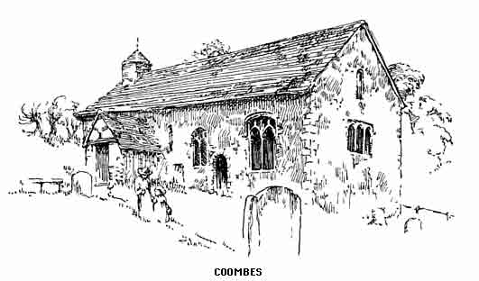
Bramber (Brymburgh) Castle holds the same position for the valley of the Adur that Lewes does for the Ouse and Arundel for the Arun. The stronghold antedates by many centuries the great Norman with whose name it is always coupled. Some authorities claim Bramber to have been the Portus Adurni that we have already connected with Aldrington; however that may be, Roman remains have been discovered here in the form of bridge foundations and it is more than possible that a British fort stood either on or near the hillock where William de Braose improved and rebuilt the then existing castle; this, with the barony, was granted to him by the Conqueror, and the family continued for many years to be the most powerful in Mid-Sussex. After the line failed, the property went to the Mowbrays and afterwards to the Howards, in whose hands it still remains. It was through this connexion that the title of Duke of Norfolk came to the holders of Arundel. Thomas Mowbray was made first Duke in 1388, and when the line ceased and the property changed hands the title went with it. It is possible that the army of the Parliament destroyed the castle in the Civil War, though no actual records prove this. A skirmish took place here between the Royalists and their opponents and is described in a letter addressed to a certain Samuel Jeake of Rye by one of the latter:—
"The enemy attempted Bramber Bridge, but our brave Carleton and Evernden with his Dragoons and our horse welcomed them with drakes and muskets, sending some eight or nine men to hell, I feare, and one trooper to Arundell prisoner, and one of Captain Evernden's Dragoons to heaven." It was the scene of a narrow escape for Charles II in his flight to Brighton. The poor remnants of the Castle are now an excuse for picnickers who are not always reverent, in point of tidiness, towards what was once a palace of the Saxon Kings.
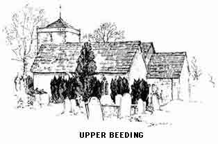
Bramber village is most picturesque and attractive; its size renders it difficult to believe that within living memory it returned two members to Parliament. Some amusing stories are told of the exciting elections in olden days, when as much as £1,000 were offered and refused for a single vote. This "borough" once returned Wilberforce the Abolitionist, of whom it is told that on passing through and being acquainted with the name of the village exclaimed "Bramber? why that's the place I'm member for."
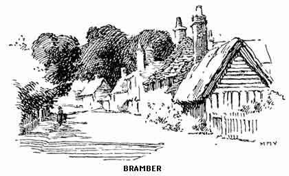
The church lies close under the south wall of the castle; only the nave and tower remain of the original cruciform building. Although the arches are Norman and show the original frescoes, a claim was made by Dr. Green, Rector in 1805, that "in rebuilding the church at his own expense about twenty years before, he had no assistance except that the Duke of Rutland and Lord Calthorpe, joint proprietors of the borough, each gave £25, Magdalen College £50 and Mr. Lidbetter, an opulent local farmer, £20; but the Duke of Norfolk, Lord of the Manor, nothing!" This "rebuilding" refers to the re-erection of the tower arches, the space between being converted into a chancel. New windows in Norman style were inserted in 1871 to bring the east end into harmony with the nave.
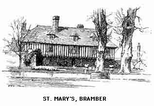
St. Mary's is the first house to be seen on approaching the village from the east. It is a beautiful specimen of a timber-built Sussex house; notice the open iron-work door with its queer old bell-pull.
Every visitor should inspect the quaint museum of taxidermy in the village street; here guinea-pigs may be seen playing cricket, rats playing dominoes and rabbits at school; the lifelike and humorous attitudes of the little animals reflect much credit on the artist.
Steyning is a short mile farther on our way (both Bramber and Steyning are stations on the Brighton Railway). This was another borough until 1832 but, unlike its neighbour, it was of considerable importance in the early middle ages and at the Domesday survey there were two churches here. The one remaining is of great interest; built by the Abbey of Fécamp to whom Edward the Confessor gave Steyning, it was evidently never completed; preparations were made for a central tower and the nave appears to be unfinished. The styles range from Early Norman to that of the sixteenth century when the western tower was built. Particular notice should be taken of the pier-arches which are very beautifully decorated; also the south door.
The original church was founded by St. Cuthman. Travelling from the west with his crippled mother, whom he conveyed in a wheelbarrow, he was forced to mend the broken cords with elder twigs. Some haymakers in a field jeered at him, and on that field, now called the Penfold, a shower has always fallen since whenever the hay is drying. The elder twigs finally gave way where Steyning was one day to be and here Cuthman decided to halt and build a shelter for his mother and himself. Afterwards he raised a wooden church and in this the saint was buried. The father of the great Alfred was interred here for a time, his remains being afterwards taken to Winchester when his son made that city the capital of united England, though the Anglo-Saxon Chronicle asserts that the King was buried at Worcester.
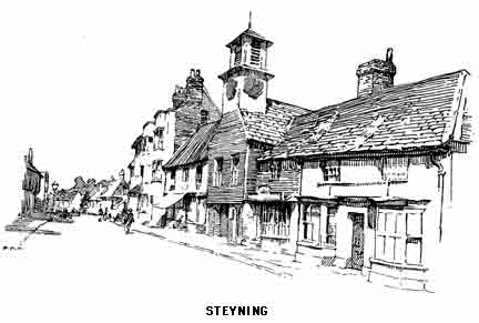
Steyning was once known as Portus Cuthmanni and to this point the tidal estuary of the Adur then reached. There are a number of fine old houses in the little town, some with details which show them to date from the fifteenth century. The gabled house in Church Street was built by William Holland of Chichester as a Grammar School in 1614; it is known as "Brotherhood Hall." The vicarage has many interesting details of the sixteenth century and in the garden are two crosses of very early date, probably Saxon.
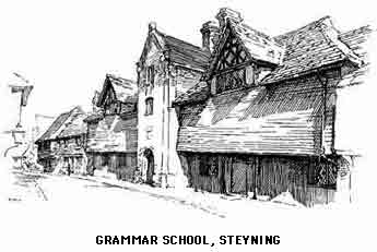
The bygone days of Steyning seem to have been almost as quiet as its modern history. A burning of heretics took place here in 1555; and the troops of the Parliament took quiet possession of the town when besieging near-by Bramber, but Steyning had not the doubtful privilege of a castle and so its days were comparatively uneventful.
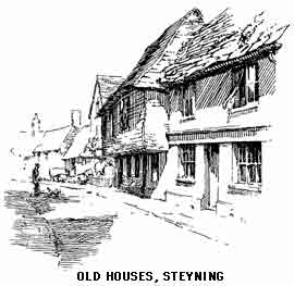
The main road may be left at the north end of Steyning by a turning on the left which rises in a mile and a half to Wiston ("Wisson") Park and church; this is the best route for the ascent of Chanctonbury. The park commands fine views and is in itself very beautiful; the house dates from 1576, though several alterations have spoilt the purity of its style. This manor was once in the hands of the de Braose family, from whom it passed by marriage to the Shirleys, another famous family. Sir Thomas Shirley built the present house about 1578. It was Sir Hugh Shirley to whom Shakespeare referred in King Henry IV.
"Hold up thy head, vile Scot, or thou art like
Never to hold it up again. The spirits
Of Shirley, Stafford, Blount, are in my arms."
His great-grandsons were the famous Shirley brothers, whose adventures were so wonderful that their deeds were acted in a contemporary play. One went to Persia to convert the Shah and bring him in on the side of the Christian nations against the Ottomans. On the way he discovered coffee! His younger brother, who accompanied him, remained in Persia and married a Circassian princess. The elder, after being taken prisoner by the Turks, was liberated by the efforts of James I and then imprisoned in the Tower by the same King for his interference in the Levant trade. Ruined in pocket and with a broken heart he sold Wiston and retired to the Isle of Wight. The estates soon afterwards passed to the Gorings, who still own them.
Wiston church, which stands in the park and close to the house, contains several monuments to the Shirleys and one of a child, possibly a son of Sir John de Braose; a splendid brass of the latter lies on the floor of the south chapel; it is covered with the words 'Jesu Mercy.' There are a number of dilapidated monuments and pieces of sculpture remaining in the church, which has been spoilt, and some of the details and monuments actually destroyed, by ignorant and careless "restoration."
To the north-west of Wiston Park is Buncton Chapel, a little old building in which services are occasionally held. The walls show unmistakable Roman tiles.
Chanctonbury (locally "Chinkerbury"), one of the most commanding and dignified of the Down summits, rises 783 feet on the west of Wiston; the climb may be made easier by taking the winding road opposite the church. The "ring" which is such a bold landmark for so many miles around makes a view from the actual top difficult to obtain. The whole of the Weald is in sight and also the far-off line of the North Downs broken by the summits of Holmbury and Leith Hill with Blackdown to the left. In the middle distance is St. Leonard's Forest, and away to the right Ashdown Forest with the unmistakable weird clump of firs at Wych Cross. But it is the immediate foreground of the view which will be most appreciated. The prehistoric entrenchment is filled with the beeches planted by Mr. Charles Goring of Wiston when a youth (about 1760). In his old age (1828) Mr. Goring wrote the following:—
"How oft around thy Ring, sweet Hill,
A Boy, I used to play,
And form my plans to plant thy top
On some auspicious day.
How oft among thy broken turf
With what delight I trod,
With what delight I placed those twigs
Beneath thy maiden sod.
And then an almost hopeless wish
Would creep within my breast,
Oh! could I live to see thy top
In all its beauty dress'd.
That time's arrived; I've had my wish,
And lived to eighty-five;
I'll thank my God who gave such grace
As long as e'er I live.
Still when the morning sun in Spring,
Whilst I enjoy my sight,
Shall gild thy new-clothed Beech and sides,
I'll view thee with delight."
Chanctonbury must have had an overpowering effect on our ancestors; the correspondent quoted below perhaps saw the hill through one of the mists which come in from the sea and render every object monstrous or mysterious.
"Chanckbury, the Wrekin or Cenis of the South Downs, is said to be 1,000 perpendicular yards above the level of the sea; on the summum jugum, or vertex, is a ring of trees planted by Mr. Goring of Whiston, and if they were arrived at maturity, would form no indifferent imitation of an ancient Druidical grove." (Gentleman's Magazine, 1819.)
The descent from the ring is made past a pond whose origin is unknown; judging by its appearance it may well have supplied the men who first occupied the fortifications on the hill top. The white path below eventually leads, by a narrow and steep gully, very slippery after rain, directly to the village of Washington on the Horsham-Worthing high road. The church stands above the village in a picturesque situation, but is of little interest. With the exception of the tower, it was rebuilt in 1866. Here is a sixteenth-century tomb of John Byne from the old building, and in the churchyard may be seen the grave of Charles Goring. Hillaire Belloc has immortalized the village inn thus:—
"They sell good beer at Haslemere
And under Guildford Hill;
At little Cowfold, as I've been told,
A beggar may drink his fill.
There is good brew at Amberley too.
And by the bridge also;
But the swipes they takes in at the Washington Inn
Is the very best beer I know."
A great find of silver coins of the time of the last Saxon Kings was made in 1866 on Chancton Farm; a ploughman turning up an urn containing over three thousand. This was an effective rebuke to those who laugh at "old wives' tales," for a local tradition of buried treasure must have been in existence for eight hundred years.
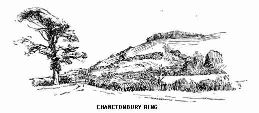
A motor-bus runs here from Worthing and then westwards as far as Storrington on the branch road to Pulborough. Storrington has almost the status of a small town and lays claim to fame as the birthplace of Tom Sayers, the prize-fighter, and of an equally famous prince of commerce in whose honour a metropolitan street has recently been renamed "Maple" (late "London") Street. The church has been almost spoilt by "restorers," but there are fine tombs by Westmacott and a brass of the sixteenth century. Near the church is a modern Roman Catholic Priory; the beautiful chapel is always open and should be seen. It is, however, for its fine situation opposite Kithurst Hill and its convenience as a centre from which to explore this beautiful section of the Down country that Storrington is important to the explorer of Downland. Within easy reach are the quiet stretches of the Arun at Pulborough and Amberley, and Parham (p. 191) is within three miles. The line of lofty hills on the south are seldom visited, most tourists being content with Chanctonbury. Near the Downs, about a mile south-east, lies the little church of Sullington under its two great yews, very primitive and at present unrestored; most of the work seems to be Early English. Here is an effigy of an unknown knight, also an old stone coffin. A footpath leads direct to Washington where we turn towards the sea, climbing by the Worthing road the narrow pass which cuts between the Downs and drops to Findon. This is another beautifully placed village with a Transitional and Early English church in an adjacent wood and, for strangers, rather difficult to find. In the chancel is a doorway in a curious position between two seats. A Norman arch, probably the relic of an older building, fills the opening of a transept on the south side. A former rector in 1276 must have broken all records in the matter of pluralities; besides Findon he held livings in Salisbury, Hereford, Rochester, Coventry, two in Lincolnshire, and seven in Norfolk, also holding a canonry of St. Paul's and being Master of St. Leonard's Hospital in York.
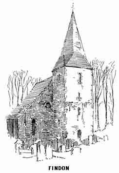
Findon is noted for its racing stables; the hills and combes on the east forming an ideal galloping ground. The walks over Black Patch and Harrow Hill are among the best in the central Downs. East of the village a path leads to Cissbury Ring (603 feet). "Cissa's Burgh" was the Saxon name for this prehistoric fortress which was adapted and used by the Romans, as certain discoveries have proved. Cissa was a son of Ella and has given his name to Chichester also. The foundations of a building may be seen in dry summers within the rampart; this is probably Roman. On the western slopes are some pits which may be the remains of a British village. But stone weapons, some of rude form and others highly finished, prove the greater antiquity of the camp. About sixty acres are enclosed within the trench, and approaches to it were made on the north, east and south. Cissbury is thus the largest entrenchment on the Downs and must have been one of the most important in the south. The views seawards are very fine and the stretch of coast is one of the longest visible from any part of the range Below the southern side of the fosse, on the slope that brings us down to Broadwater, is the reputed site of a Roman vineyard; the locality still goes by this name and certainly the situation, a slope facing south and protected from cold winds, is an ideal one for the culture of the grape.
Broadwater is now a suburb of Worthing. Here is a very interesting Transitional-Norman cruciform church, at one time magnificent in its appurtenances, no fewer than six chantry chapels being attached; the remains of these were done away with in the early nineteenth century. Note the old altar stone in the floor of the chancel, also on the exterior north wall a dedication cross in flints. In the chancel is a brass to John Mapleton, 1432, chancellor of Joan of Navarre, and there are two fine tombs, one of Thomas Lord de la Warre (1526) and the other of the ninth of that line (1554). John Bunnett, interred in 1734, aged 109, had six wives, three of whom he married and buried after he was 100! The church has a modern association which will be of interest to all lovers of wild nature; here in 1887 Richard Jeffries was buried. One cannot but think that the great naturalist would have been more fittingly laid to rest in one of the lonely little God's-acres which nestle in the Downs he loved so well.
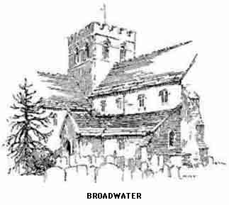
Worthing until the end of the eighteenth century was a mere suburb of Broadwater; its actual beginnings as a watering place were nearly contemporary with those of Brighton. When the Princess Amelia came here in 1799 the fortunes of the town were made, and ever since it has steadily, though perhaps slowly, increased in popular favour. The three miles of "front," which is all that fifty per cent, of its visitors know of Worthing, are unimposing and in places mean and rather depressing in architecture, but this is atoned for by the stretch of hard clean sands laid bare at half tide, a pleasant change after the discomfort of Brighton shingle. As a residential town, pure and simple, Worthing is rapidly overtaking its great rival, and successful business men make their money in the one and live in the other, as though the Queen of Watering-places were an industrial centre. Worthing has a great advantage in its fine old trees; as a matter of fact the place would be unbearably arid and glaring without them in the summer months, for it has undoubtedly proved its claim to be the sunniest south coast resort; a claim at one time or other put forth by all. The most convincing proof to the sceptical stranger will be the miles of glass houses for the culture of the tomato with which the town is surrounded. Its chief attraction lies in the number of interesting places which can easily be reached in a short time and with little trouble. The Downs here are farther off than those at Brighton, but are of much greater interest, and public motors take one easily and cheaply into their heart as we have already shown. The South Coast Railway runs east and west to Shoreham and Arundel, reaching those super-excellent towns in less than half an hour; and of the walks in the immediate neighbourhood, all have goals which well repay the effort expended in reaching them.
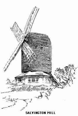
Sompting, which can be combined with Broadwater as an excursion, has already been described; we therefore turn westward again and passing the suburb of Heene, now called West Worthing, arrive, in two and a half miles from the Town Hall, at the village of Goring. Its rebuilt church is of no interest. Here Richard Jeffries died in the August of 1887. A mile farther is West Ferring with a plain Early English church; notice the later Perpendicular stoup at the north door and the piscina, which has a marble shelf. The Manor House is on the site of an ancient building in which St. Richard of Chichester lived after his banishment by Henry III, and here the saint is said to have miraculously fed three-thousand poor folk with bread only sufficient for a thirtieth of that number.
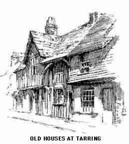
A pleasant ramble through the lanes north of the village leads to Highdown Hill, perhaps the most popular excursion from Worthing; the top has an earthwork probably dating from the stone age. Human remains of a later date were found here in 1892, also coins, weapons and personal ornaments belonging to the time of the Roman occupation. The "Miller's Tomb" is on the side nearest Worthing; it has representations of Time and Death with some verses composed by the miller, John Olliver. A cottage on the other side of the hill stands on the site of the mill. The view is particularly fine both Downwards and seawards, though the hill is not half the altitude of Cissbury. Northwards are the beautiful woods of Castle Goring, once the residence of the Shelleys, through which we may walk to Clapham and Patching, villages on southern spurs of the Downs; the latter has a restored Early English church with a very beautiful modern reredos. Clapham has a Transitional church containing memorials of the Shelley family. Notice the blocked-up Norman arch which proves the existence of an earlier building. On the south is a venerable farmhouse, ancient and picturesque.
The return journey to Worthing may be taken through Salvington, passing the ruins of Durrington chapel; at the south end of the village at the cottage named "Lacies" John Selden was born in 1584. On the door post is a Latin inscription said to have been composed by him when ten years old; it runs thus:—
Gratus, honeste, mihi, non claudar, initio sedebis,
Fur abeas non sum facta soluta tibi.
Translated by Johnson:—
Walk in and welcome; honest friends, repose;
Thief, get thee hence, to thee I'll not unclose.
Selden's father was a wandering minstrel and the birthplace of the great jurist was humble even for those days.
A short walk southwards brings us to West Tarring, which is practically a suburb of Worthing. Here is a very fine Early English and Perpendicular church with a lofty spire. Notice the beautiful modern mosaics depicting the Prophets and Apostles. Also the old miserere seats and an ancient muniment chest. The window under the tower is in memory of Robert Southey whose daughter married a onetime vicar of Tarring. Another incumbent here was Stripe the historian.
A peculiarity noticeable in many country churchyards may be remarked here—the reluctance to bury on the north side of the church (though strangely enough this has been reversed at near-by Ferring). In many churchyards, where the ground is as extensive on the north side as on the others, the grave digger's spade has left it either quite untouched or the graves are few in number and mostly of recent date.
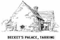
West Tarring was once a market town and several good specimens of medieval and Tudor domestic architecture still exist. It was once a "peculiar" of the Archbishops of Canterbury, and the remains of the archiepiscopal palace may be seen in the school house on the east of the church. In the rectory orchard close by is the "columbarium," or all that is left of it. Becket is said to have occupied the palace. The celebrated fig orchard is supposed to have been raised from slips planted by him, though another story has it that the original planter was St. Richard. The present orchard is of much interest and dates from the year of the "forty-five," though it can well be believed that some of the trees are older; the venerable patriarch in the centre is known as "St. Thomas," but this is of course impossible. A most remarkable occurrence takes place annually at the ripening of the fruit; a small bird similar to, if not identical with the Beccafico ("Figeater") of Italy visits the orchards here and at Sompting, stays a few weeks and then departs until the next season; it is seen in no other part of England.
There is a choice of roads between Worthing and Arundel: that which keeps to the low lands has been partly traversed in the journey to West Ferring.
About two miles east of this village, and close to Angmering station, are the twin villages of East and West Preston; the former has a Norman and Transitional church with one of the four stone spires in Sussex. At Rustington, a mile farther, is a more interesting Early English church with a Transitional tower. Note the ancient sculpture in the north transept, also the squint and rood-loft steps. This village is but a short distance from Littlehampton, which may be approached by the shore road.
The country about here seen from the flats appears to be thickly wooded, an effect that is produced by the screen of tall trees in every hedgerow, untouched until time levels them, in return for their protection of the growing crops from the searching sea winds which sweep across the level fields to the Downs. Vegetation here has a different aspect from that on the other side of the wall of hills. In May and early June one may come from the tender green of the Washington lanes over the pass through Findon and find the spring livery of the lowland hedgerows temporarily blackened and withered.
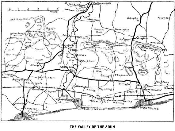
The direct way to Arundel, and also the most interesting and beautiful, is by Castle Goring, reached by the Broadwater road. A short distance past the Goring woods a side road on the left leads to Angmering. Here the rebuilt church retains its old chancel and tower with an inscribed stone over the doorway. Returning by a shorter lane northwards to the main road we pass New Place, once a mansion but now converted into a group of cottages; it is famous as the birthplace of the three sons of Sir Edward Palmer, who were born on three consecutive Sundays, a circumstance probably unique in natal annals. All three were afterwards knighted by Henry VIII.
The foothills of the Downs to the right are hereabouts very beautiful; one of the spurs is occupied by Angmering Park belonging to the Duke of Norfolk. At Poling, on a tributary of the Arun southwards, is a decoy for wild fowl. Here is a Perpendicular church containing a fourteenth-century brass to a former priest, one Walter Davey. A chapel belonging to a commandery of the Knights of St. John still stands near the church; it has been converted into a modern dwelling house.
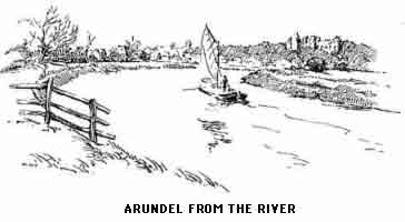
The first view of Arundel as it is approached from the Worthing road or from the railway station is almost unique in England. Bridgnorth, the northern Richmond, Rye, all cities set on a hill, come to the mind for comparison, but none have the "foreign" look of Arundel; this is to a large extent helped by the towering church of St. Philip Neri; the apsidal end and the great height of the building in proportion to its length, appear more in keeping with northern France than southern England. The town, when one comes to close quarters with it, has a feudal air, and indeed this is as much a matter of fact as of fancy. Arundel is a survival, and depends for its existence on the magnificent home of the Howards which dominates domestically and ecclesiastically the town at its feet. The castle has the same relation to the pass of the Arun that Bramber and Lewes have to the Adur and Ouse, but the fact that it is still the ancestral home of an ancient and historic family gives it a far greater interest than either of the others possesses. The castle is mentioned in Domesday Book, and prior to this in the will of Alfred the Great. The earldom was given by the Conqueror to Roger of Montgomery; in addition to the castle and its immediate neighbourhood it comprised wide and rich possessions in the surrounding country. By their treason to the Crown the Montgomerys soon forfeited the estates and the Earldom passed through the hands of Queen Adeliza, and her son de Albrin, and then to the Fitz-Alans, who held it for over three hundred years. The daughter of the last Earl married the fourth Duke of Norfolk and this family have held it ever since. They have made it their principal home and have built in recent years the magnificent temple of the older faith which dwarfs and overshadows the parish church. This itself has felt the might of the great family who, as we shall presently see, imposed their will on the representatives of the Establishment.
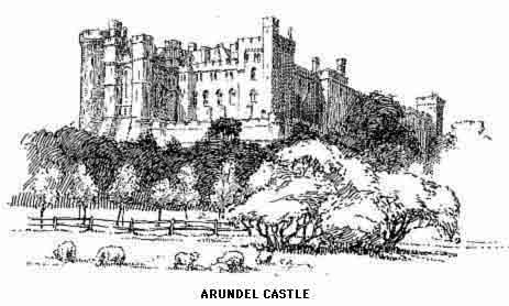
"What house has been so connected with our political and religious annals as that of Howard? The premiers in the roll-call of our nobility have been also among the most persecuted and ill-fated. Not to dwell on the high-spirited Isabelle, Countess Dowager of Arundel, and widow of Hugh, last earl of the Albini family, who upbraided Henry III to his face with 'vexing the church, oppressing the barons, and denying all his true born subjects their right'; or Richard, Earl of Arundel, who was executed for conspiring to seize Richard II—we must think with indignation of the sufferings inflicted by Elizabeth on Philip, Earl of Arundel, son of the 'great' Duke of Norfolk, beheaded by Elizabeth in 1572 for his dealings with Mary Queen of Scots. In the biography of Earl Philip, which, with that of Ann Dacres his wife, has been well edited by the fourteenth Duke, we find that he was caressed by Elizabeth in early life, and steeped in the pleasures and vices of her court by her encouragement, to the neglect of his constant young wife, whose virtues, as soon as they reclaimed him to his duty to her, rendered him hated and suspected by the Queen, so that she made him the subject of vindictive and incessant persecution, till death released him at the age of thirty-eight. To another Howard, Thomas, son of Earl Philip, the country is indebted for those treasures of the East, the Arundel marbles."
(Quarterly Review: Hare.)
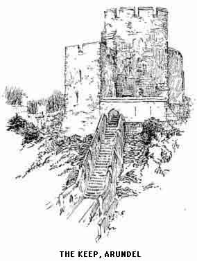
The castle, though not that portion at which we have been looking, has been besieged on three important occasions; in 1102 by Henry I, to whom it surrendered. By Stephen, on its giving hospitality to the Empress Maud; and by Waller, who captured it after seventeen days' siege with a thousand prisoners. Artillery mounted on the tower of the church played great havoc with the building and it remained in a ruinous condition until practically rebuilt by the tenth Duke in the latter part of the eighteenth century.
We commence the ascent of the keep, which is the only part shown to the public (usually on Mondays only) by way of the clock tower which once formed the entrance to the inner courts. We can now see the remnants of Richard Fitz-Alan's buildings (1290). A flight of steps leads to the Keep, the older portion of which was built by the same Earl; the walls are in places ten feet thick. In the centre a well descends to the storeroom of the garrison, which is cut out of the solid chalk. Over the entrance note the remains of St. Martin's chapel; from the window is a magnificent view towards Littlehampton. The openings in the floor suggest the use of boiling liquid for the heads of besiegers.
The Keep was once famous for its owls, the older members of the colony being known by appropriate names, such as that recorded in the story of the Ducal butler who convulsed the guests one evening by announcing, "Please, your Grace, Lord Thurlow has laid an egg."
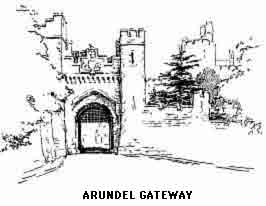
The views in every direction are very fine and the nearer prospect proves to the observer the unrivalled position which the fortress held as guardian of one of the most important of the routes between London and the Continent by way of the Port of Littlehampton. In the distant view "The Island" is conspicuous on clear days with Chichester Cathedral spire in the middle distance. Eastwards is Highdown Hill and the country round Worthing, North the beautiful valley of the Arun and the lovely tree-clad slopes of the Downs of which the nearer spurs form Arundel Park.
The "state" and residential portions of the castle are never shown to the general public. In the fine collection of pictures are a number of Van Dycks and Holbeins, mostly portraits of the Fitz-Alans and Howards.
The entrance to the chancel of Arundel Church, now the Fitz-Alan Chapel, is from the castle grounds. Permission to inspect the famous tombs is rarely given. A lawsuit in the last century attempted the recovery of the chancel for the parishioners of Arundel, but was ineffectual owing to the fact that the chapel was originally that of the college of Holy Trinity, founded in 1380 by Richard Fitz-Alan; this passed to its present possessors at the Dissolution. The Lady Chapel retains its old altar stone with consecration crosses, and above is a window with some fragments of stained glass. In the centre is the tomb of the sixteenth Earl (1421) and a modern tomb of Lord Henry Howard. A number of interesting brasses may also be seen. The main portion of the chapel contains the more famous tombs, the effigies being highly interesting studies of the state dress of various periods. Earl Thomas and his Countess, daughter of King John of Portugal, (1415) occupy the centre; the others are Earl John (1435) under the east arch. William, nineteenth Earl (1488), in a chantry on the south side. On the north are Thomas (1524) and William (1544). A tablet over Earl William's chantry is in memory of the last Fitz-Alan, Earl Henry (1580).
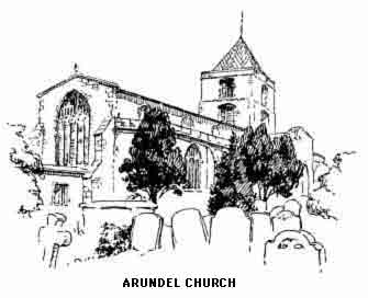
The fine parish church is separated from the chancel by a screen wall. It dates from 1380 and now consists of nave and transepts, the space under the tower being used as the choir. An ancient canopied pulpit is placed against the south-west pier. On the north side are frescoes of the Seven Deadly Sins and the Seven Works of Mercy. The modern ornate reredos shows with great effect against the curious arrangement of iron grill and bare brick which forms the screen wall. The church was once attached to the Monastery of Seez in Normandy.
The magnificent modern Roman Catholic church of St. Philip Neri is open to visitors between the services. It is built in the purest style of Decorated Gothic and has already cost over one hundred thousand pounds. Notice, before entering, the statues of the Twelve Apostles at the west end beneath the fine "rose" window. On entering, the imposing effect of the clustered columns and beautiful apse will be admired. Unlike most Roman churches there is but little colour displayed, the "Stations of the Cross" being bas-reliefs in the aisle walls. The subdued yet glowing tints in the stained glass help the general effect of restrained dignity.
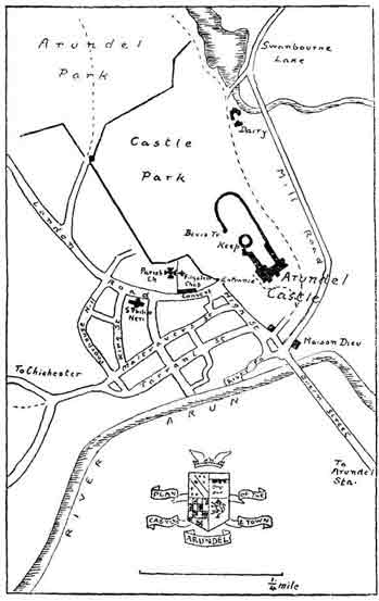
In the lower portion of the town, the scanty remains of Maison Dieu show the position of that retreat, founded by Earl Richard, who built the church; the house provided for twenty inmates. The piers of Arun bridge were built out of the ruins in 1742.
The park will probably prove the most satisfactory of the sights of Arundel to the ordinary visitor, who is here allowed to wander where he will. The road passing under the castle to the right should be taken as far as a small gate on the left, by the mill, entering which we immediately see the Swanbourne Lake in all its beauty.
"The mill is situated beneath the castle, on the east side, at the head of the stream by which the ancient Swanbourne Lake discharges itself into the river, and most probably occupies the site of the original building mentioned in Domesday. Perhaps, of all the beautiful spots in the neighbourhood of Arundel, none comprises more real beauty than this. The valley in front, shaded by the willows and the ash which adorn the little islands of the lake, and winding its way in the distance among the hills; the castle projecting boldly from the eminence on the left; the steep acclivities on each hand, clothed to their summit with luxuriant forest trees ... present a scene in whose presence the lapse of centuries will be easily forgotten." (Tierney.)
The charm of the spot is not in any way spoilt, obvious care being taken to keep the surroundings spotless; although picnickers are allowed where they will, here are no scraps of paper or broken bottles, the efficient service of "clearing up" is at work in the early hours of the morning, which is the right time to see the park. The visitor should continue round the left bank and up the hill to Hiorne's Tower, from which a magnificent view of the Arun valley and the surrounding Downs is to be had. Equally beautiful is that from the brow of the hill overlooking the Arun, from which point the castle makes an effective picture with the broad sweep of the sea and lowlands behind. The Downs are here at their best and the glorious woods of beech and oak are superb in October, and that month, with late May as an alternative, is the best time to see the western Downs. The Castle Dairy is open to the public, usually on the same days that the Keep may be seen. The Dairy dates from 1847 and has the appearance more of a monastic establishment than of farm buildings.
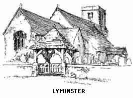
The exploration of the valley of the Arun must be commenced by turning down the stream to see that least interesting section which lies between Arundel and the sea. At the mouth of the river stands the old port of Littlehampton, the direct road to which leaves the Arun to the right and passing Lyminster (Lemster), sometimes spelt Leominster, which has a restored Transitional church, enters Littlehampton near the Railway station. The river road goes by way of Ford, where there is a little church interesting by reason of its many styles. According to Mr. P.M. Johnson they range from Norman (and perhaps Saxon) right through to Caroline. Nearly two miles west is another interesting church at Yapton, which has a black granite font, ornamented with crosses and probably pre-Norman. The interior of the church shows work of an archaic character usually described as early Norman. The inn here has a sign—"The Shoulder of Mutton and Cucumbers"—which must be as unique as it is mysterious.
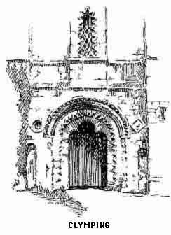
Continuing south we reach in another mile the very fine Early English church at Clymping. The tower is Transitional. The artist has sketched the beautiful doorway, one of the finest in Sussex. Notice also the old stone pulpit and ancient chest. The road running directly south leads to the coast at Atherington, where are the remains of a chapel attached to the "Bailiff's Court House," a moated mediaeval building with portions of a cloister. The Bailiff was the local representative of the Abbey of Seez already referred to. The Littlehampton road turns east half a mile beyond Clymping and after a dull stretch of over a mile crosses the Arun by Littlehampton (swing) Bridge.
The ancient seaport, never of more than local importance, has given way to a watering place almost entirely devoted to children. From the number of nursemaids seen on the beach on an average summer day and the scarcity of other adults one is forced to the conclusion that patrons of this resort use it as a dumping ground for their offspring while they enjoy themselves elsewhere. The firm clean sands are ideal for paddling and castle building, and many ephemeral Arundels arise between tides. The ebb and flow in the Arun interfere with what would otherwise be an enjoyable trip up stream, but with skill and care there is little danger. Littlehampton shows few traces of its antiquity, the church was rebuilt in the last century and is of no interest, but there are many good walks in the neighbourhood and the immediate country is beautifully wooded, with the distant Downs as an occasional background.
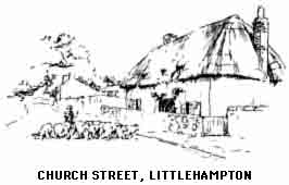
To explore the valley of the Arun to the north a return must be made to Arundel, and either the path through the park or the road to South Stoke may be taken. The latter runs between park and river and soon reaches the two villages of North and South Stoke, both charming little hamlets without any communication by road, though a footpath unites the two. The first village, South Stoke, has an Early English church with sedilia and other details. North Stoke has a fine Norman door worthy of inspection. Here a British canoe was discovered in the last century; it may be seen in the Lewes Museum. Across the river, and only to be approached by a detour past Amberley Station, is Houghton. From the bridge over the Arun is a very beautiful retrospect of the valley towards Arundel with the hills falling in graceful curves to the river. The church is Early English of a severe type; here is a fifteenth century brass but nothing more of much interest.
A mile from Houghton Bridge will bring us to Amberley. The village is built on a low hill or cliff immediately above the "wild brooks" or water meadows of the Arun, and is famous for the picturesque remains of the palace of the Bishops of Chichester, which still edge the sandy hill in front of the village. Amberley Castle, as the residence has always been called, was built in the reign of Richard II, about 1379, and then consisted of a crenellated building with square corner towers and two round gate towers; the present house, which stands within the walls, was erected in the early sixteenth century by Bishop Sherbourne. This has probably been the site of an episcopal residence since before the Conquest and is in as beautiful a situation as is to be found in Sussex, though judging by a local saying quoted by Lower, it would not appear to be as perfect in the winter. An Amberley man when asked from where he comes then answers "Amberley, God help us," but in the summer—"Amberley, where would you live?" "Amerley" is immortalized by Izaac Walton for its trout, and by Fuller, who speaks of them as "one of the four good things of Sussex."
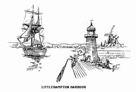
Amberley Church is a small Norman building with Early English additions; note the brass to John Wantle (1424) and the beautifully ornamented door in the south aisle. There is an hour-glass stand in the pulpit. Notice also the ancient font and the remains of frescoes at the east end of the nave.
The road now runs eastwards with the fine escarpment of Rackham Hill to the right and in about two miles reaches Parham Park, the seat of Lord Zouche. A short distance further east is Storrington, which we have seen on our way to Worthing. Delightful walks may be taken across the park, which is freely open to the pedestrian. This stretch of sandy and picturesque wild land is undoubtedly one of the most beautiful domains in the south. Its fir-trees are characteristic of the sandstone formation which here succeeds the chalk. Visitors should make their way to the lake where the scene, with the Downs as a background, is one of extreme beauty. The Heronry here is famous; the birds were originally brought from Wales to Penshurst, from which locality they migrated to Angmering and then to Parham.
Lady Dorothy Nevill, in her interesting "Leaves," refers to Parham as a favourite resort of smugglers. A former Lady de la Zouche, while a little girl, was made to open a gate for the passage of a long procession of pack-horses laden with kegs.
Parham House is a fine Elizabethan manor, although partly spoilt by some modern additions; built by Sir Thomas Palmer about 1520 it passed to the present family in 1597. The house is famous for the magnificent collection of works of art, early printed books and ancient illuminated MS.; permission to inspect these may be obtained by written application when the family are not in residence and for purposes of research this important collection is always available. Some time since the most valuable items were removed to the British Museum for safety. The house contains a priest's hole, the entrance to which is from a window seat in the long gallery; one of the Babington conspirators—Charles Paget—was hidden here. South of the house is Parham Church, possessing one of the three leaden fonts of Sussex.
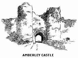
It is now proposed to visit Pulborough and the valley of the Rother. Though rather far afield from Seaward Sussex and the chalk lands, this district comes naturally within the Down country, but must have a chapter to itself. From Parham we may either go direct to Pulborough by the highroad or, more profitably, by Greatham to Coldwaltham on the Roman Stane Street, the great highway from Chichester to London; here we turn north east and in a mile (just past the railway) note the scanty ruins of Hardham Priory on the right; another mile and, crossing the old Arun bridge, we are in Pulborough.
Pulborough on Stane Street was once a Roman station. Relics of the occupation are constantly turning up in the neighbourhood. Near the church is a mound, on which stood the "castellum." A glance at the map will show the commanding position the station held over the meeting of the Arun and Rother. There are traces of a Roman villa at Borough Hill north-east of the village.
The fine church is mostly Perpendicular, though there are Early English portions. Note the archaic Norman font and several interesting brasses, especially that of Thomas Harlyng, Canon of Chichester and rector here in 1420; also the restored sedilia and beautiful modern reredos.
Not far from the church are the remains of the ancient "Old Place" once belonging to the Apsleys; the neighbouring barn is even older than the house; "New Place," a little farther north, is another picturesque house with a fine hall.
Pulborough is, with Amberley, a Mecca for weekend anglers; it has a famous inn, the "Swan," and is a good halting place before proceeding westwards, in which direction our road now runs. A mile out of the town we take final leave of the Arun at Stopham Bridge, a fine medieval structure of many arches. The Rother joins the larger river just below the bridge and between the two streams may be seen Stopham House, the home of the Bartelotts, seneschals of the Earls of Arundel; their monuments and brasses for several centuries are in the church, an ancient building among trees some distance from the bridge.
We now approach Fittleworth, another favourite place for anglers, whose rendezvous must be looked for nearly a mile away near the bridge and station. The Early English church, unrestored and interesting, has in the vestry a curious stone coffin lid with a Greek cross upon it. The famous "Swan" Inn is a well-known feature of the little town and a great resort for artists, who find endless subjects in the beautiful district we are now traversing.
Egdean has a church dating from the early seventeenth century. About fifty or more years ago it was "restored" in a way which even among restorers must be unique, "Early English" details being imposed upon the original work. Byworth is picturesque, as Miss Vigers sketch will show; but, apart from its situation, it calls for no other comment.
The scenery around Petworth is characteristic of the Lower Greensand country and the picturesque wooded outcrop north-east of Byworth is perhaps as beautiful as any other part of this distinctive belt. In no part of this miniature range, about three miles long, is the altitude over 450 feet, but the charm of the woodland dells and meandering tracks which cross and traverse the heights between the "Fox" on the north-west and the Arun at Hardswood Green, is quite as great as in localities of more strongly marked features and greater renown.
The road trends north-west by Egdean and Byworth to Petworth. Petworth town consists of a number of old-world streets extremely crooked, narrow, and picturesque. Seen from any near point the grouping of roofs is as artistically good as any in Sussex. Petworth Church has been practically rebuilt. The north chantry contains the tombs of some of the Percy family, including that of the ninth Earl, who was imprisoned in the Tower on suspicion of being concerned in the Gunpowder Plot. Here is also the monument to Lord Egremont (1840), a fine seated figure. Notice several interesting brasses and a sixteenth century tomb of the Dawtreys. Near the church is an old house belonging to this family. One of the rectors of Petworth was Francis Cheynell, the antagonist of Chillingworth. Just below the church is the Somerset Hospital, eighteenth century almshouses founded by a Duke of Somerset. In North Street is Thompson's Hospital, another picturesque group. In the centre of the town stands the Market House built by the Earl of Egremont. In its front is a bust of "William the Deliverer."
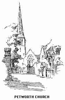
Petworth is another instance of feudal foundation. The manor, at present owned by Lord Leconfield, was for centuries in the possession of the Percy family. The house is said to have the finest private collection of pictures in the kingdom, most of which are due to the collecting zeal of the third Earl of Egremont; they are usually shown on Tuesdays and Thursdays, and visitors are handed a list of the paintings by the guides. The hurried round of the pictures takes about an hour. A wide range of schools are represented, but the most interesting is perhaps the splendid show of Turners.
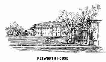
The present mansion is one of the ugliest in the county and replaced in 1730 a beautiful medieval pile; the latter had been the scene of some historic visits, notably that of Edward VI, and in 1703 Charles III of Spain, who was met by Prince Consort George of Denmark. The Prince Regent with the Allied Rulers visited the Earl of Egremont in 1814. Three interesting relics shown are a piece of needlework made by Lady Jane Grey, the sword of Hotspur used at the battle of Shrewsbury, and an illuminated Chaucer MS. The chapel is the only portion of the old building remaining.
Petworth Park is quite free and open to the pedestrian. The entrance is in the Tillington road. Although of an entirely different character from the scenery we have already passed through, partaking more of the nature of an East Midland demesne, especially in the lower, or south end, the magnificent stretches of sward interspersed with noble groups of native trees will amply repay the visit. For those who have time to extend the ramble to the Prospect Tower in the northern portion of the park there is a magnificent view in store, especially south and west. Herds of deer roam the glades and there are two fine sheets of water.
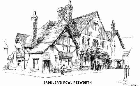
The author of Rural Rides thus describes Petworth: "The park is very fine and consists of a parcel of those hills and dells which nature formed here when she was in one of her most sportive moods. I have never seen the earth flung about in such a wild way as round about Hindhead and Blackdown, and this park forms a part of this ground. From an elevated part of it, and, indeed, from each of many parts of it, you see all around the country to the distance of many miles. From the south-east to the north-west the hills are so lofty and so near that they cut the view rather short; but for the rest of the circle you can see to a very great distance. It is, upon the whole, a most magnificent seat, and the Jews will not be able to get it from the present owner, though if he live many years they will give even him a twist."
The road now goes directly west and in a mile reaches Tillington, which has a Transitional church modernized and practically rebuilt by the Earl of Egremont; here are several interesting tombs and brasses. A divergence two miles further will take us downhill across the Rother to Selham (with a station close to the village). The Norman and Early English church has a chancel arch with finely carved and ornamented capitals. Proceeding westwards between high banks of red sandstone our road soon approaches Cowdray Park, across which it runs without hedge or fence.
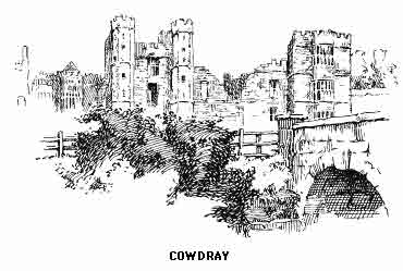
The park is a beautiful pleasaunce for the inhabitants of Midhurst; thickly carpeted with bracken and heather and broken by many picturesque knolls and hollows. The famous burned and ruined mansion lies on the west, close to the town and river. This beautiful old house was destroyed in 1793 through the carelessness of some workmen employed in repairing the woodwork of some of the upper rooms. Within a month of the calamity the last of the Montagues, a young man of 22, was drowned while shooting the falls of the Rhine at Schaffhausen. These tragic happenings were supposed to fulfil a curse of the last monk of Battle pronounced against Sir Anthony Browne when he took possession of the Abbey. "Thy line shall end by fire and water and utterly perish."
The following is a contemporary account of the tragedy: "Lord Montague was engaged to the eldest daughter of Mr. Coutts (the present Countess of Guildford) and, with a view to his marriage on his return to England, the mansion house had been for several months undergoing a complete repair and fitting up. The whole was completed on the day preceding the night on which it was consumed, and the steward had been employed during the afternoon in writing the noble owner an account of its completion. This letter reached his hands. On the following day the steward wrote another letter announcing its destruction: but in his hurry of spirits, he directed it to Lausanne instead of Lucerne, by which accident it was two days longer in its passage to his lordship's place of abode than it otherwise would have been. Had it not been for that fatal delay, in all human probability this noble family would not have had to deplore the double misfortune by which its name and honours have become extinguished; for the letter arrived at his lordship's lodging on the morning of his death, about an hour after he had left them, and, as nearly as can be computed at the very moment in which he was overwhelmed by the torrent of the Rhine."
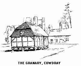
The turreted entrance gateway is less ruinous than the remainder of the buildings and, with the banqueting hall, is as fine a specimen of early sixteenth-century architecture as will be found in England. Notice the vaulted entrance to the Hall. On the north side, looking towards the Guard House is the State Bedchamber, wherein Queen Elizabeth slept in 1591. There are several contemporary accounts of the stately merrymakings which took place during the visit, including the "hunting" scene in which buck deer were guided past Gloriana's bower, from which she made dead shots at them, reminding one of the "bulls-eyes" with which a later Queen opened the national shooting competition for her worshipping subjects.
On St. Ann's Hill near the town may be traced the outlines of the stronghold erected by the de Bohuns; the town and surrounding country remained in their hands until Sir David Owen, uncle of Henry VII, married the last of the line. Sir David sold the estate to the Earl of Southampton, whose son left it to his half brother Sir Anthony Browne, Standard Bearer of England; his son became the first Viscount Montague.
The estate is now held by Lord Cowdray, who has a modern mansion, built in a flamboyant Elizabethan style, near-by.
Midhurst is a pleasant old place with some good ancient houses here and there. Those in the centre which form the subject of Miss Vigers' sketch, are being demolished as this is written; their disappearance will be appreciated by motorists in a hurry but by no one else. The Perpendicular church has been largely rebuilt during the last century and the Montague Chantry lacks its tomb, which has been removed to Easebourne. Richard Cobden was educated in the Grammar School (founded in 1572). During the last few years Midhurst has become to some extent a resort for Londoners who appreciate a quiet country town amid beautiful surroundings which may be explored easily. The walks, not only to the Downs on the south but northwards to the lovely and remote hills which culminate in Blackdown, are among the best in West Sussex. South, west, and east the town is well served by the Brighton and South-Western Railways, a single line in each direction.
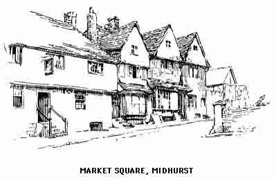
The road to Henley is one of the loneliest as it is one of the loveliest in south-west Sussex. The writer has tramped the long miles to Henley (uphill all the way) without meeting a single pedestrian. Even the advent of the great Sanatorium on the southern slopes of Bexley Hill does not seem to have made any difference. Possibly visitors use the public motor which runs between Midhurst and Haslemere. By so doing they miss one of the finest woodland walks in the south, indescribably beautiful in the scarlet and gold of late autumn.
The traveller in Downland is advised for once to turn his back on the hills and walk as far as the summit of the Haslemere road where the new route turns sharp round to the left and hugs the escarpment of Bexley Hill. In front will be seen an overgrown track, the old highway, plunging down the face of the hill. A few feet down this causeway, paved with large slabs of stone, brings us to a surprising hamlet clinging to the hillside and, with its "Duke of Cumberland" Inn, looking across the wide Fernhurst vale to where Blackdown lords it on the other side.
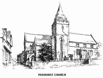
At Easebourne, about a mile north-east of Midhurst, is a Benedictine Priory used, until quite lately, as a farmhouse. It is close to the church, which, with the buildings of the nunnery, form three sides of a hollow square. The restoration has been carried out with taste and care and the whole is worth seeing. The nuns of Easebourne would seem to have been "difficult females," for a Bishop of Chichester in 1441 was obliged to call the Prioress to order for wearing sumptuous clothes with fur trimmings and for using too many horses when travelling, the penance being a restriction to four. The nuns were spoken of by a contemporary writer as "wild females of high family put at Easebourne to keep them quiet."
The church, besides the tomb of the first Viscount Montague, removed from Midhurst, contains a figure of Sir David Owen (1540); also a Transitional font.
We now leave the Rother, turn south by the Chichester road and passing over Cocking causeway reach, in three miles, that little village at the foot of the pass through the Downs to Singleton, or better still, by taking a rather longer route through West Lavington we may see the church in which Manning preached his last sermon as a member of the Anglican communion. The church and accompanying buildings date from 1850 and were designed by Butterfield; they are a good example of nineteenth-century Gothic and are placed in a fine situation. In the churchyard, which is particularly well arranged, lies Richard Cobden not far from the farmhouse in which he was born. Dunford House is not far away; this was presented to Cobden by the Anti-Corn-Law League, and here the last years of his life were spent.
Cocking once had a cell belonging to the Abbey of Seez in Normandy but of this nothing remains. This beautifully situated little place has a primitive Norman church with a fine canopied tomb and an old painting of Angel and shepherds. We are now at the foot of Charlton Forest covering the slopes of the Downs which stretch eastwards to Duncton Beacon; and along the edge of this escarpment it is proposed to travel. This is one of the loneliest and most beautiful sections of the range.
"A curious phenomenon is observable in this neighbourhood. From the leafy recesses of the layers of beech on the escarpment of the Downs, there rises in unsettled weather a mist which rolls among the trees like the smoke out of a chimney. This exhalation is called 'Foxes-brewings' whatever that may mean, and if it tends westwards towards Cocking, rain follows speedily." (Lower.)
The hamlet of Heyshott need not tempt us from the hill, though Graffham, one of the loveliest villages in Downland, might well be visited. Where at last it is necessary to drop toward the Petworth Chichester road a divergence may be made to East Lavington with its associations and memories of Samuel Wilberforce, who is buried here and in whose memory a memorial brass may be seen in the church; note also the Bishop's pastoral staff fixed to the wall near the altar. There are still "oldest inhabitants" of this peaceful place who remember the celebrated Victorian, whose rather unkind sobriquet was really but a tribute to his genial kindliness of disposition. Here he married in 1828 the local heiress, Miss Emily Sergent, and here Mrs. Wilberforce was buried in 1841. It is said that at Oxford, or wherever the Bishop was resident, there hung in his bedroom a picture of Lavington churchyard "that I may ever see my own resting place."
Directly south of Lavington rises the summit of the Downs—Duncton Beacon (837 feet), like many other "highest tops" a great disappointment after visiting some of the lesser heights, for the Beacon, which is named "Littleton Down" on the Ordnance map, is not on the edge of the range but stands back among encircling lesser heights and is itself partly covered with trees which to a great extent cut off the view. Barlavington Down, about half the height of Duncton, and Farm Hill face east and both command fine views in this direction. The latter is above Bignor, to which village we now descend. This is a place beloved of archaeologists, for here is the site of the famous Roman villa. Bignor church is remarkable for the chancel arch which most authorities admit to be a genuine Roman work. Note also the long lancet windows in the chancel and the magnificent yews in the churchyard. Enquiry must be made in the village for the farm at which the keys of the villa enclosure are kept. (Notice the beautiful old house, timbered and with a projecting upper story, near the lane leading to the villa.) Authorities are at variance as to the actual history of the remains which were discovered in 1811. The conjecture that this was the fortified station on Stane street (which may be seen descending the hills south-west), at the tenth milestone, "Ad Decimum," seems lately to be discredited, and the supposition gains ground that the villa was simply the country palace of a great Roman, or possibly a civilized British prince. However that may be, the discoveries revealed one of the most important and interesting remains of the Roman occupation in Britain, and cover an area of no less than 600 feet in length by 350 feet in breadth. The principal pavement may be that of the Banqueting hall, in the centre of which is a stone cistern, probably a fountain. The hypercaust below has caused the floor to give way in several places. The pavement of a smaller room is perfect and shows a finely executed design; another is decorated with cupids fighting. The details of the building, too numerous to be mentioned here, deserve careful attention even by the uninitiated and prove more forcibly than history-books the magnificence of the civilization which once was, before Sussex became an entity, and which the first Sussex men so wofully destroyed.
The old Roman way could be followed directly across the hills for four miles until the high road is joined near Halnaker Hill, where we shall presently arrive from Goodwood, but a longer route must be taken to explore the lovely and retired part of the Downs which lies between Bignor and Singleton. A path between Farm Hill and Barton Down leads to Up Waltham where is a little Early English church with the rare feature of a circular apse. Just south of the village an exquisite combe opens out to the south-west and is traversed by a rough and stony hill road leading to East Dean; this claims to be the real East Dean where Alfred met Asser, but its beautiful situation will be its chief recommendation to the traveller. Another mile brings us to the hamlet of Charlton from which the extensive forest to the north takes its name. A short distance further and the Midhurst-Chichester road is joined at Singleton, which village, very pleasantly situated, has a Perpendicular church with a Norman tower, so ancient that some authorities name it Saxon; it is at the latest very primitive Norman. Notice the quaint wooden gallery and the stairs to the rood loft, and also a stoup in good preservation. The village is in a most beautiful situation, surrounded by groups of low wooded hills. There is a station here on the Midhurst railway.
The high road now winds through West Dean to Mid-Lavant and Chichester. Both villages have "restored" churches. The first named contains a notable monument—the Lewknor. Near by is the beautiful West Dean Park. Mid-Lavant church is Early English but boasts a Norman window. The name of this village perpetuates a phenomenon which is becoming more rare each year. At one time erratic streams would make their appearance in the chalk combes in the head of the valley and combining, cause serious floods or "lavants." For some unknown reason the flow of water is gradually becoming smaller and of late years it has been quite insignificant.
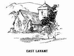
To resume the route a return must be made to Singleton and the path taken which leads over the Goodwood hills past the Race Course to Halnaker. The whole of this beautiful stretch of Downland is open to the stranger; the best views are undoubtedly from the Race Course, which dates from 1802. This is the most fashionable of all race-meetings and the course is in the most beautiful situation. To the west of the course, on an isolated eminence, sometimes called "Roche's Hill" and sometimes "The Beacon" is an ancient camp with double vallum and fosse enclosing over five acres. On the slope due south of Roche's Hill are some caves supposed to have been prehistoric dwelling-places. A mile to the south is Goodwood House (Duke of Richmond), on certain days and during certain seasons open to the public. The house, so far as its exterior is concerned, is exceedingly ugly, but contains a magnificent collection of paintings, chiefly portraits, the most famous of which are by Lawrence, Gainsborough, Romney and Vandyke, the last named being represented, among other works, by the well-known painting of Charles I with his queen and children.
The most striking view in the neighbourhood of the house is from "Carney's Seat" above the pheasantry, a magnificent prospect of the coast extending for many miles in each direction. There are grand groups of cedars here and throughout the park; these add materially to the foreground of the prospect. The timber generally is very fine, as is almost always the case in the enclosed parklands of West Sussex. In High Wood is a temple which contained until recently an inscribed slab discovered in Chichester when the foundations of the Council chamber, erected in 1731, were being excavated. This stone, of the greatest interest to antiquaries, has been returned to the town and will be noticed when we arrive there.
The ruins of Halnaker are on the south-east of the park. The house was built in the reign of Henry VIII by Sir Thomas West, Lord De la Warr. Before being allowed to fall into ruin the best of the fittings were removed to the "Chantry" in Chichester.
At the distance of a mile south of Halnaker, Stane Street is reached at a point about four miles from Chichester. There are, however, still some interesting places to be seen before, for almost the last time, we turn west. These include Boxgrove, which must on no account be missed.
Eartham is a beautifully situated village about two miles directly east of Halnaker. It is chiefly of interest for its associations with the poet Hayley, who lived at Eartham House, now the residence of Sir P. Milbanke. The house became for a time the rendezvous of many celebrities, including Cowper, Flaxman, Blake and Romney. A very fine Flaxman monument in memory of Hayley's son may be seen in the church; notice also the memorial of William Huskisson the statesman, who lived near here and who was afterwards killed at the opening of the Liverpool and Manchester Railway. The church has a Norman arch in the chancel, much admired for its graceful proportions and details.
Even more beautiful a village is Slindon, about two miles farther east and about three miles from Arundel. Its perfect situation is enhanced by the picturesque clumps of beech trees on the sides of the hills that encircle it. In the restored church, which was built at various periods, is the effigy of a knight in wood. Note the curious shorn pillars in the nave. Here is an old Elizabethan hall, and the park, with its magnificent beech woods, is very fine. Slindon is becoming a favourite resort for those who desire a quiet holiday in delightful rural surroundings.
Two miles south of Slindon lies Walberton. The church walls have Roman bricks worked into Saxon masonry. The upper part of the nave is of the usual heavy Norman type. Eastergate, the next village on the main road to Bognor, has an untouched Saxon chancel, with a good deal of Roman masonry mixed with later material built into the walls. These interesting little villages may be easily reached from Bognor.
The last years of the eighteenth century were prolific in the birth of south-coast watering places or in the transformation of decayed ports or remote seaside hamlets into fashionable bathing places. Bognor is a case in point and comes within the latter category. A successful hatter of Southwark named Hotham, having "made his pile" built himself a house near the little manor hamlet of Bognor, which boasted a single inn but no church. The example of Brighton and the nearer neighbour Worthing being constantly before the then member of Parliament and one-time business man, the possibilities of the land he had acquired, with its fine fringe of firm sand, soon made themselves apparent, and the Crescent, Hothampton Place and several other terraces in what is now the centre of modern Bognor quickly appeared. A determined attempt to change the name to Hothampton failed, and as soon as the speculator died, his gamble a personal failure, the town reverted to the original Saxon Bognor (Bucganora).
The young town had the usual royal send-off; the Princess Charlotte stayed here for a short time and was followed in due course by the little princess who was one day to become so famous a Sovereign.
It will be seen that Bognor has nothing to interest the visitor who requires something besides a rather homely home from home with good air, bright sunshine and almost the nearest stretch of good sand to London, which delights the shoals of juveniles who give to the front its air of busy animation. The famous Bognor rocks provide an additional attraction; the sea at low tide retires for a considerable distance and exposes a line of rocks which indicate the general trend of the ancient coast. Here treasures of the sea may be found in profusion and variety. During spring and leap tides the waves, backed by a strong wind, may cause great excitement by dashing across the front and invading the back streets; until the present wall was built this was of frequent occurrence. Bognor has a very mild winter temperature and runs Worthing very close for sunshine.
The old parish church is at South Bersted. It is of Norman origin with some remains of this period and possibly of Saxon times; the main portion is, however, Early English. Note the stone slabs outside the porch; these were brought from Bosham by a former incumbent. There is a sixteenth-century fresco on one of the nave pillars depicting St. Thomas Aquidas disputing with the doctors. In the churchyard are several interesting graves and a very ancient yew reputed to be over 800 years old.
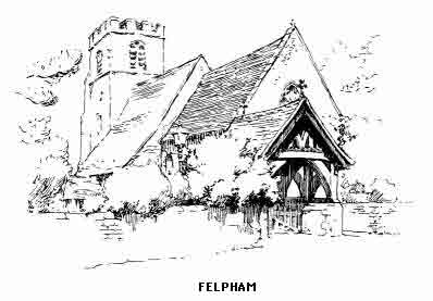
Felpham is now the eastern suburb of Bognor, and is linked to the town by a small bungalow colony. Here Hayley came after selling Eartham, but the place is now more famous for its associations with the poet's friend Blake, who lived for three years in the small thatched cottage which still stands at the seaward end of the village. Hayley was buried in the churchyard, which also contains the tomb of Dean Jackson, once tutor to George IV. The church is a mixture of styles, one row of pillars being Early English the other Transitional. The much quoted epitaph on a blacksmith written by Hayley runs as follows:—
"My sledge and hammer lie reclin'd;
My bellows, too, have lost their wind;
My fire's extinct, my forge decay'd,
And in the dust my vice is laid;
My coal is spent, my iron gone,
The nails are driven, my work is done."
Blake's associations with the village came to a sudden end in consequence of a stupid and unwarranted prosecution for treason, the outcome of a struggle with a drunken soldier. The mystic poet-artist gained some of his most characteristic inspirations while staying here, and it was in the garden of his cottage that he saw a "fairy's funeral," the description of which has been often quoted; it is difficult to judge how much of his visions were, to himself, poetic fancy or actual fact.
We now resume our journey towards Chichester at Walberton, north of which the high road runs west, with little of interest until a turning on the right brings us to the finest ecclesiastical building in the county excepting the Cathedral.
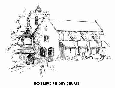
The Priory Church of St. Mary and St. Blaise Bosgrave was founded in the reign of Henry I by Robert de Haia of Halnaker. Being a Benedictine church, the nave, now in ruins, formed the parochial section. The choir, transepts and tower, which remain, belonged to the monks, and this portion, with the exception of the Norman tower, forms one of the most beautiful examples of Early English in the kingdom and dates from about 1200. The fine Purbeck marble columns are much admired, as are also the graceful clerestory and vaulting. The galleries of the transepts have ornamented oak fronts, and were used by the lay portion of the ancient congregation. There is a frescoed ceiling belonging to the sixteenth century. Notice the Renaissance tomb of Lord De la Warr (1532) on the south side of the chancel with its curious carvings and in the south transept those of Countess Phillippa of Arundel (1428) and her second husband, Adam de Poynings; also several others, some of which are without inscriptions, but possibly including those of the daughters of that Countess of Arundel who was once the first Henry's queen. The ruins of the priory may be traced and several of the beautiful Norman arches belonging to the cloisters still remain.
Tangmere has a Norman and Early English church with a wooden tower. The village is on the south side of the main road but need not detain us. West Hampnett, nearer Chichester, is of more interest; here Saxon work in Roman materials may be seen; notice the fine tomb of Richard Sackville and the representation of the Trinity between the kneeling figures of Richard and his wife. On the left of the road will be seen an old Tudor house which has been converted into a workhouse. The road now enters the suburbs of Chichester.
The Brito-Roman city of Regnum has left its mark on modern Chichester in the regularity of the streets, which follow the lines of the ancient thoroughfares. The actual beginnings of the town may antedate the Romans, but of this we know nothing. It was to the British chief Cogi, whose name was Romanized into Cogidubnus, that the foundation of Chichester was probably due; this Briton was a chief of the native tribe of the Regni who inhabited the Down country and the adjacent seaboard. Instead of opposing the conquerors this astute statesman welcomed and allied himself to them and in return received the unique honour, for a native, of the title "Legate of the Emperor."
It is probable that the city was built on the fork of two important existing roads, Stane Street—the new stone causeway from London to the harbours on the coast between modern Bosham and Portsmouth—and the adapted and straightened ancient trackway running parallel to the sea and serving the settlements and ports east and west of the junction. At that time small ships were able to approach within a short distance of the meeting place and here the new town would naturally arise.
Many remains of the Roman period have from time to time been excavated; a pavement was found in 1866 below the retro-choir of the cathedral and some ancient graves in St. Andrew's churchyard were found to have the coffins resting on a tessellated pavement. Old buildings in various parts of the town, notably St. Olave's church, have much Roman brickwork, and the usual treasure of denarii and broken pottery is found whenever an exceptional turning over of the foundations of the town takes place.
But the most remarkable of all these earlier relics is the so called "Pudens Stone" to which reference has been made in speaking of Goodwood Park. This slab was discovered while digging the foundations of the Council Chamber and after being kept at Goodwood for many years has been returned to the Council House in North Street, where it may now be seen. The stone is Purbeck marble and bears the following inscription:—
(N)eptuni et Minervae templum
(pr)o salute d(omus) divinae
(Ex) auctoritat(e Tib) Claud.
(Co)gidubni r. leg. aug. in Brit.
(Colle)gium fabror. et qui in eo
(A sacris) sunt d.s.d. donati aream
(Pud)enti Pudentini fil.
(The conjectural restorations are given in parentheses.)
(Translation.) "The temple of Neptune and Minerva, erected for the health and preservation of the Imperial family by the authority of the Emperor Tiberias Claudius and of Cogidubnus, the great king of the Britons. The company of Artificers, with others, who were ambitious of supplying materials, defrayed the expense. Pudens, son of Pudentinus, gave the ground." (Hare.)
The great interest of the inscription is in that part which refers to Pudens; a controversy raged for a long time during the middle of the last century around the question of the identity of this individual, the results of which seem to favour the connexion between Chichester and the Pudens of St. Paul's second Epistle to Timothy.
The town seems to have been of little importance in South Saxon times, although the modern name dates from that period—"Cissa's Ceaster." Cissa was one of the sons of Ella who landed on the Selsey peninsula. During the Conqueror's reign Chichester regained some of its former dignity when the seat of the Sussex see was removed hither from Selsey. At the same time the town was presented to Roger Montgomery, Earl of Alencon, together with most of South-west Sussex. The Earl built a castle, but nothing of this remains, though the mound in the Priory Park is said to be the site.
The troops of the Parliament—led by Sir William Waller, besieged Chichester in 1642; after ten days the city fell and much ill work, especially in the cathedral, followed. Since then its history has been uneventful.
Some days may be spent in this pleasant town without exhausting its interest and charm and the cathedral cannot be seen in one visit without fatigue. As a centre for the exploration of West Sussex Chichester is much better than one of the smaller towns. (I am not now advising that adventurous traveller who, fearing nothing, will trust himself to a remote village hostelry among the Downs.) The South Coast Railway runs in three directions and all high roads converge on the city.
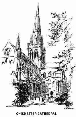
Chichester Cathedral is the second on the site, and much of this building has been added to and altered at various dates. The original cathedral is supposed to have been for a time the adapted church of St. Peter's monastery which stood on or near the south-west corner of the city cross-roads. Bishop Ralph's building, erected in 1107, was destroyed by fire in 1114. The same bishop started to build the older portions of the church which we now see.
The most striking object in the exterior view is the modern spire, built by Scott to replace the tower which fell in 1861 while repairs to the piers were in progress. The summit is exactly equidistant from the west porch and the end of the Lady Chapel. The most effective, if not the most picturesque view, is from the north, where the sturdy campanile makes a good foil to the graceful spire. Until the enormous bulk of the new Liverpool Cathedral rose above the great city in the north, Chichester was the only English cathedral visible from the sea.
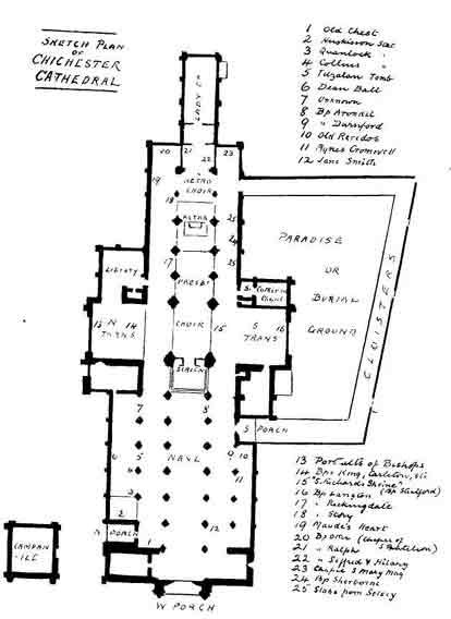
The nave should be entered from the west porch, a much admired specimen of Early English. We are at once aware of the fine effects of light and shade produced by the four aisles. The Cathedral is one of the widest in England (though those usually quoted as excelling it—York Minster and St. Paul's, are actually excelled themselves by Manchester, which also has four aisles). The nave and the inner aisles are Norman, the outer being Geometrical; these were added to make room for the various chapels and shrines which were found necessary as the development of the church progressed. The base of the south-west tower is possibly of an earlier date than the remainder of the nave and the suggestion has been put forward that it forms part of the original monastery church of St. Peter; the style of it is very rude and archaic.
Proceeding by the left-hand or north aisle we see first, close to the north door, the chapel of the Baptist, which contains an unknown tomb and an ancient chest reputed to be over a thousand years old and to have been brought from Selsey. Following come the Collins tomb and the Arundel chantry containing the altar-tomb of Richard Fitz-Alan and his countess. At the end of this aisle is an unknown female effigy conjectured to be Maud of Arundel (1270). Some good modern stained glass will have been noticed in the nave. The pulpit, a memorial to Dean Hook, was designed by Sir Gilbert Scott. The south aisle of the nave has the tomb of Bishop Arundel (1478), Bishop Durnford, and Agnes Cromwell and a brass to William Bradbridge three times mayor of Chichester (1592).
In a spirit of ruthless improvement the beautiful old stone screen between nave and choir was removed in 1859, and replaced by the present rood-screen in memory of Archdeacon Walker. The finely carved throne and stalls in the choir are also modern but are in excellent taste and keeping with the solemn Norman stone which surrounds them. The east window was placed in 1844, and it is no worse than other examples of this period.
The north transept was for many years used as the parish church of St. Peter. Note the pictures by Bernhardi of the English Bishops; those after Elizabeth were destroyed when the tower fell. On the west are the tombs of three bishops, Grove (1695), King (1669) and Carleton (1705). King was the defender of Chichester during Waller's attack and the latter described him as a "pragmatical malignant." The cathedral library is in this transept, entered from the north choir aisle. It contains several treasures, notably the service book of Hermann, Archbishop of Cologne, once the property of Cranmer and bearing his autograph. From this book the Reformer adapted many phrases for the Book of Common Prayer. There are several interesting relics from the stone coffins discovered under the choir in 1829, including a papal absolution cross, an abraxas ring and a twelfth-century silver chalice and paten. These are displayed in a case by the wall. In the north choir aisle is a beautiful altar cloth in a glass case. We now pass the fine canopied tomb of Bishop Moleynes (1449). In the Early English chapel at the end, dedicated to St. Panthelon, is the modern tomb of Bishop Otter (1840). Before entering this chapel note the stone built into the wall and known as "Maudes Heart." The screens separating the aisles from the presbytery are made of native Sussex iron.
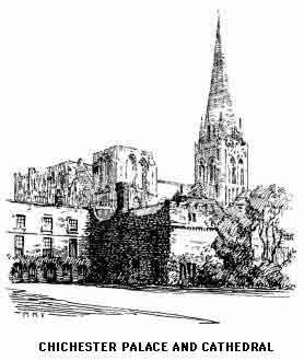
We now return and cross to the south transept, on the north side of which is the tomb once supposed to be the shrine of St. Richard de la Wych, Bishop (1253) but now definitely accepted as that of Bishop Stratford (1362). This tomb, with several others, was barbarously "restored" in the last century; near it may be seen the modern brass in memory of Dean Burgon (1888). The pictures on the west wall are by Bernhardi and represent Ceadwalla giving Selsey to St. Wilfrid and the confirmation made by Henry VIII to Bishop Sherborne. Part of the transept is used as a consistory court. The sacristy is on the west side and on the east is St. Catherine's Chapel. In the wall of the aisle, proceeding east, note two slabs which are said to have been brought from Selsey Cathedral. The subjects are the Raising of Lazarus and the Saviour meeting Martha and Mary. Note between them the tomb of Bishop Sherborne (1536); near by is a memorial of Dean Hook (1875) also the coffin slabs of Bishop Neville (1224) and Bersted (1262).
We now enter the Transitional Retro-choir; here is the altar tomb of Bishop Story (1503) who built Chichester Market Cross, and of Bishop Day (1556). The columns of Purbeck marble which grace this part of the cathedral are of great beauty. The screens of native iron have already been noticed, they are of simple but effective design.
We pass the terminal chapel of the south aisle, dedicated to St. Mary Magdalene and restored in memory of Dean Cross, and enter the Chapel of Our Lady, noting (left) the tombs of Bishops Hilary and Ralph, and (right) Bishop Seffrid II, the builder of the Early English portions of the Cathedial. This beautiful chapel was finished in the early fourteenth century and in the eighteenth was considered unworthy of repair and handed over to the Duke of Richmond, whose private property it for a long time became. The floor was raised to allow of a burial vault being constructed below, and the upper portion became the library.
The restoration was resolved upon in 1870 as a memorial to Bishop Gilbert, and the then Duke being in sympathy with the revived canons of good taste no opposition was encountered. It may be of interest to quote an anonymous correspondent in the Gentleman's Magazine (1829, part II) which shows how the leaven was at work even then.
"Some ten years since a Goth, by some untoward chain of circumstances, possessed sufficient influence with his brethren in the Chapter to induce that body to whitewash the church, and by way of ornament, and with a view to compensate for the loss of the original paintings on the groining of the choir destroyed by the whitewash, the said gentleman had the archivolt mouldings and all the lines of the building which were in relief, tastefully coloured in yellow ochre. The name of the perpetrator of this outrage on good taste and good feeling it is unnecessary to add, as he will never plan or design any further embellishment to the cathedral, but if any of his coadjutors in the daubing and smearing line have survived him, and still possess influence, I tremble for the effects of the present repair.
"The curious chantry of St. Richard, an object of veneration among Catholics even to our own days, and the elegant stone screen of the roodloft, have been literally plastered with whitewash, the rich sculptured bosses being converted into apparently unshapely lumps of chalk, and the flat spaces within the heads of the Norman arches of the nave, which are sculptured with scales and flowers, are almost reduced to a plane surface.... The removal of this rubbish would be a work of time; it should be gradually and effectually performed arch by arch, or its removal may carry away with it many of the sculptures it may conceal. This will certainly be the case if any London architect, with a contractor at his heels, sets about a thorough repair to be completed in a given time....
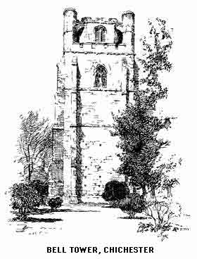
"The more ancient injuries which the appearance of the cathedral had sustained were, in the first instance, occasioned by the erection of a breastwork in front of the triforium, which concealed the bases and half the shafts of the columns; this might now be easily removed as the object of its erection, to protect from accident the spectators of the ancient processions, has ceased to exist. Since the Reformation a great portion of the nave has been fitted up with pews, the congregation adjourning from the choir to the nave to hear the sermon. I need not point out the injury the nave sustains in appearance from this cause and many points of perspective, highly picturesque, which would arise from the singular duplication of the aisles of this church are entirely lost through the existence of the sermon place."
On the south side of the nave is the entrance to the irregularly built cloisters; here are several monuments and a good view of the interesting details of the exterior of the cathedral. The Bishop's Palace is at the west end; it has an Early English chapel in which is an interesting fresco of the Virgin and Child. At the south-east angle of the cloister is the Chantry of St. Faith dating from the early fourteenth century.
The Bell Tower, which is an unique feature of the Cathedral, dates from the late fifteenth century; it was built to relieve the central tower of the main building from the weight of the eight bells, most of them ancient, with quaintly worded and spelt inscriptions. The Arundel screen has been placed within the tower, but special permission must be obtained to see this.
The old documents in the Cathedral muniment room are quaint reading, especially in these post-war days; here are a few items taken at random from an old book of accounts:—
| Payd Thomas the broderer for his labors in amendyng of dyverse cooppes vestments and other ornaments of the church workynge thereabouts by the space of IIII wyks after Chrystmas | VI s |
| For hys comones so longe | IIII s |
| Payd unto Wolsey the masson for amendynge of the tumbe in our Lady Chapell that was broken uppe when the Commissionars were here from the Councell to serch the same | XV d |
| (This was possibly the shrine of St. Richard.) | |
| Payd to Mother Lee for apparellinge of XV mens albes | XIIII d |
| unto hyr for a dosen of childrens albes | IIII d |
| unto hyr for the makinge of a towell | I d |
| Payd unto Thomas Nowye for pollynge and shavinge of the chorusters crounes for VI quarters ending at our Ladye in Lente | VIII s |
In 1553 Lambart Barnard the painter received an annual payment of £3 6s. 8d. for his works in the church "in arte suae facultate sua pictoria" (sic).
This Barnard was probably a relative of Bernhardi.
The surroundings of the Cathedral on the south side are very pleasant and the second visit should be made by way of the Canon Lane Gate in South Street. On the right is the Vicar's Close and, farther on, the Deanery (1725). The passage called St. Richard's Walk gives a particularly beautiful view of the Cathedral.
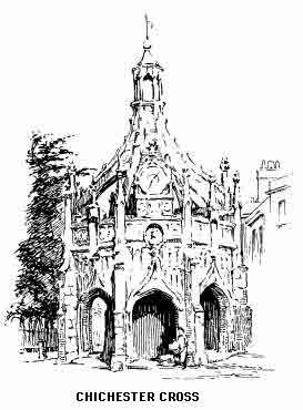
Chichester Cross is the next object of general interest. It was built by Bishop Story in 1500 and received rough treatment from Waller's men. On the east side is a bronze bust of Charles I. The clock was presented by Dame Elizabeth Farringdon in 1724 as "an hourly memento of her goodwill to the city"; it has not, however, added to the beauty of the cross. The central column is surrounded by a stone seat which bears witness to the generations who have used it as a resting place. The stone lantern which crowns the whole dates from the eighteenth century.
We may now proceed up North Street, passing on the right St. Olave's Church. A quantity of Roman materials have been found in the walls, and some authorities declare the south door to be actual Roman work; it is undoubtedly the oldest building in the town. The Council House is at the corner of Lion Street; here may be seen the Pudens Stone already described.
At the end of Lion Street stands St. Mary's Hospital. This was originally a convent founded in 1158; for some unknown reason the nuns were evicted in the following century, since then it has been an almshouse, probably the oldest foundation of its kind in the county. It supports eight poor persons who live in tiny two-roomed dwellings round the sides of the great hall. At the end of this is the Decorated chapel separated from the remainder of the building by an open screen. The main portion of the building is Early English and a great deal of timber has been used in the construction. Visitors should enter without waiting for permission, and one of the courteous ladies will, if required, show the chapel. The whole makes a quaint and pleasing picture, quite unique in its way.
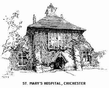
We may continue along St. Martin's Lane northwards to the Guildhall, no longer used as such. This was originally the chapel of the Grey Friars. It has a very fine Early English window; the sedilia should also be seen. The building was for many years used as a court of justice; its future is still uncertain.
The city walls are not far distant; though not continuous, considerable portions have been laid out as public promenades. They are for the most part constructed of flints and undoubtedly have a Roman base. Some lines of fortifications about a mile north of the walls, locally called the "Broyles," are supposed to be Roman works, possibly in connexion with the military station or garrison.
Returning to the city's centre at the Cross, St. Andrew's Church in East Street may be visited; this has a Roman pavement at a depth of about five feet. The poet Collins is buried within the church. Note the slab on the outside wall which up to the present has kept its secret from archaeologists.
A very interesting museum in South Street contains a quantity of local finds. Particular note should be made of the pottery removed from a British tomb at Walberton; also of the curious old lantern called the "moon," formerly carried in municipal processions after dark.
The "Pallant," a corruption of Palatinate, was once an ecclesiastical peculiar; it consists of four streets between South and East Streets. In West Street is the Prebendal school at which Selden commenced his education. This street has a very fine specimen of seventeenth-century architecture, built by Wren and dated 1696. There are several good old residences of about this date in South Street.
Chichester Harbour ends just west of the town and close to the Portsmouth high road at New Fishbourne, a pleasant little place with a restored Early English church. This may be said to be the north-western limit of the Selsey Peninsula, one of the most primitive corners of southern England. The few visitors who make use of the light railway to Selsey have little or no knowledge of the lonely hamlets scattered over the wind-swept flats, in which many old customs linger and where the Saxon dialect may be heard in all its purity.
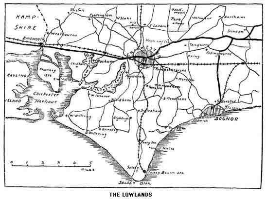
Selsey—"Seals' Island"[2]—was the scene of the first conversions to Christianity in Sussex and, for this reason, a semi-sacred land to the early mediaeval church in the south.
St. Wilfrid's first visit was unpremeditated; he was shipwrecked while returning from a visit to France, where his consecration had taken place in A.D. 665. His reception was so hostile that after getting safely away he decided to return at some future date and convert the Barbarians to more gentle ways. Not for fifteen years did his opportunity come. Then, despoiled of his northern bishopric, for Wilfrid was a turbulent Churchman, he came prepared, we must suppose, for the reception usually meted out to the saints in those days. The heathen Saxons, however, were now in a different mood, for "no rain had fallen in that province for three years before his arrival, wherefore a dreadful famine ensued which cruelly destroyed the people.... It is reported that very often, forty or fifty men, being spent with want, would go together to some precipice, or to the sea-shore, and there hand in hand perish by the fall, or be swallowed-up by the waves." (Ven. Bede.)
The efforts of the missionary saint met with success. The unprecedented sufferings of the people had been ignored by their tribal deities and the offer of a new faith was eagerly accepted. The King had been converted, possibly in secret, before this. The baptism of the leading chieftain was followed by the breaking of the terrible drought. The fruits of the woods came to feed the bodies of those who had accepted the food of the spirit, and "the King being made pious and gentle by God, granted him (Wilfrid) his own town in which he lived, for a bishop's see, with lands of 87 houses in Selesie afterwards added thereto, to the holy new evangelist and baptist who opened to him and all his people the way of everlasting life, and there he founded a monastery for a resting-place for his assembled brothers, which even to this day belongs to his servants." (Eddi's Life of Bishop Wilfrid.)
The monastery site was probably the same as that of the cathedral, now beneath the waves, about a mile east of the present Selsey church.
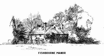
To explore the peninsula a start should be made at Appledram, a small village close to Chichester Channel and about two miles south-east of the city; here is a fine Early English church, on the south of which is an ancient farm-house, originally a tower built by one Renan in the reign of Edward II. The King would not grant permission for its crenellation, Renan thereupon disposed of most of the materials and they were used to build the campanile at Chichester. Footpaths lead across the meadows to Donnington where is another Early English church of but little interest. A mile away on the banks of the disused Chichester and Arundel canal is the strangely named "Manhood End." This is a corruption of Mainwood, and refers to the great forest which once stretched from the Downs to the sea. A rather dull walk westwards past Birdham to West Itchenor, a remote little place on the shores of the creek, is amply repaid by the fine views northwards up the Bosham channel, with the far-flung line of the Downs beyond. (A ferry can be taken from here which would make a short cut to Bosham or Fishbourne practicable.) Returning past the church with its interesting font, a footpath is taken to West Wittering and its very fine Transitional church, the most interesting ecclesiastical building in the Selsey Peninsula; note the two rude sculptures of the Annunciation and Resurrection at the ends of a canopied altar tomb; and a coffin lid with pastoral staff possibly of a "boy-bishop." We are now on that portion of the coast which approximates most nearly to the original spot, now beneath the waves, where the first colonists of Sussex landed.
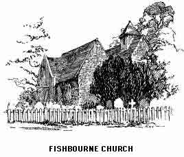
At East Wittering a short distance away is an Early English church with a Norman door. This is not far from Bracklesham Bay, an adventurous excursion for Selsey Beach visitors who come here treasure hunting for fossils, of which large numbers repay careful search. To reach Selsey "town" devious ways must be taken past Earnley, which is surely the quietest and most remote hamlet in the kingdom, on the road from nowhere to nowhere; or we may, if impervious to fatigue, follow the beach all the way to Selsey Bill. The settlement is easily approached from Chichester and the South Coast line by the Selsey Tramway (8 miles). The charm of the place, which consists in a great measure in its air of remoteness, is likely to be soon destroyed. Pleasant bungalows, of a more solid type than usual, are springing up everywhere between the railway and the Bill, though here we may still stand on the blunt-nosed end of Sussex and watch the sun rise or set in the sea.
It would be interesting to know if the quality of the buildings erected will enable them to last until the sea eventually disposes of Selsey. The encroachment of the waves, especially on the eastern side of the Bill, has been more rapid than on any other part of the coast, except perhaps certain parts of Norfolk. The sea immediately east of Selsey is called the "Park"; this was actually a deer-park no longer ago than Tudor times and in Camden's day the foundations of Selsey Cathedral could be seen at low water.
The Transitional church was rebuilt in 1867 from the materials of the older church, two miles away at Church Norton, where the chancel still remains among its old mossy tombs. Each stone and beam was placed in the same position on the new site. The old chancel at Church Norton contains a battered tomb to John Lewes and his wife (1537). Near-by is a mediaeval rectory, once a priory, dating from the fourteenth century, very quaint and picturesque.
We now follow the line of the light railway. At Sidlesham, the first halt, is a restored Early English church containing a fine old chest. Note the curious epitaphs within and also on the gravestones in the churchyard, and, not least, the queer names that accompany them:—"Glue," "Gravy," "Earwicker" etc.
From the station a footpath may be taken to Pagham and what is left of the harbour of that name. Here there was until late years a curious phenomenon known as the "Hushing Well." A rush of air would burst through the water in the harbour at the time of the incoming tide. The "well" was destroyed by draining operations which also caused the disappearance of large numbers of rare water fowl and aquatic insects, though the naturalist will still be repaid by a visit to this lonely coast and its immediate surroundings. A short time ago the sea made an entrance, but without reconstructing the old conditions. It is no longer practicable to walk along the coast to Bognor.
Pagham Church is an interesting Early English building dedicated to St. Thomas of Canterbury and erected by a successor to St. Augustine's Chair. Note a slab in the chancel with Lombardic lettering and the old glass in the east window. The scanty remains of the episcopal palace may be seen southeast of the church.
From Hunston Halt a walk of about a mile westwards leads to another remote and straggling village, North Mundham. In the restored church is a Saxon font and certain curious sculptures may be seen outside the door. From here it is only two miles to Chichester, passing Rumboldswyke church, which has interesting features, including Roman brickwork in the chancel arch.
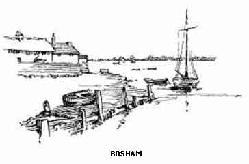
The Portsmouth road, in three miles from Chichester, reaches Walton, where a turning to the left leads in another mile to Bosham, certainly the most interesting relic of the past in West Sussex. Bosham (pron. Bozam) to-day seems existent solely in the interest of artists; it is certainly the most besketched place on the South Coast and is rarely, in fine weather, without one or more easels on its quiet quay. The best loved hours of the day for the painting or sketching fraternity—those of low tide, when every boat lies at a different angle—will be the most unpopular for the ordinary visitor, who will be eager for the friendly smoke-scented parlour of the inn as a refuge from the flavour of the malodorous flats; at low tide Bosham is certainly picturesque, at the full she is comely and clean.
The harbour, from British, through Roman, Saxon and Norman times to the later middle ages, was one of the principal entrances to and exits from this county. It was on several occasions harried by the Danes and, as depicted on the Bayeux Tapestry, Harold left here on that visit which was to have such dire consequences for himself and his line, and such untold results on the history of the nation-to-be. The great Emperor of the North—Knut—was a frequent visitor to the creek in his dragon-prowed barque. His palace, also the home of Earl Godwin and Harold, is supposed to have been on the northeast of the church, where a moat is still in existence. It is here that the incident recorded in every school reader, the historic rebuke to sycophantic courtiers, is said to have taken place.
The church is of venerable antiquity. The tower has certain indications which point to its being Saxon work. The chancel arch may be still older in its base, and some authorities suggest that the lower portions are actually the remains of the basilica erected in the time of Constantine, on the site of which the church now stands. The east portions of the chancel are Early English and once formed the chapel of a college founded by William Warlewaste, Bishop of Exeter (1120). Note the figure in the north wall, said to be that of the daughter of Knut who died here while on a visit to Earl Godwin. The effigy is, however, of much later date. The fine arcaded font is placed upon high steps against a column. At the east end of the south aisle the floor is raised over an Early English crypt or charnel-house, the entrance to which is close to a canopied tomb. This tomb is that of Herbert of Bosham, secretary to Becket, who wrote the Book of Becket's Martyrdom.
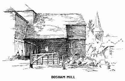
The church was restored in 1865 and during this work the most interesting discovery was made of the traditional burial place of Knut's daughter. How often has a local tradition, accepted as fact by the peasant, but looked upon as an idle tale by his educated superior, proved to have more than a grain of truth in it and sometimes to be a very circumstantial record of actualities, and fully supported by antiquarian research. The exact position of the grave is shown by the figure of a Danish raven painted upon a tile, and a stone slab with an inscription upon it placed by the children of Bosham in 1906.
One of the ancient bells was stolen by Danish pirates; the story goes that when half way to the open sea a storm arose which swamped the boat in consequence of the great weight of the metal on board. On high festivals of the Church, a Bosham man will tell you, its sound can be heard from the waves mingling with the chimes of the modern bells of the tower. As a matter of fact the echo of the peal, thrown back by the woods of West Itchenor, is, in certain favourable conditions of the atmosphere, distinctly like a second chime, and might deceive a stranger into thinking that another church lay across the water.
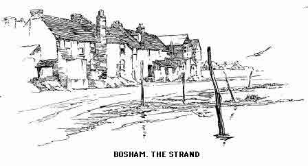
A most interesting fact recorded by the Venerable Bede is that when Wilfrid of York came here in 681 he found a religious house ruled by a monk named Dicul. It was this monk who had converted King Ethelwalch before Wilfrid arrived. The existence of this tiny community in the midst of hostile tribes, over two hundred years after the extinction of Christianity in the south, is a matter of high romance in the history of the faith in Britain.
There are two other isolated bits of Sussex on the south of the high road to Emsworth, the first containing the small hamlet of Chidham with a beautiful little Early English church; the next is occupied by West Thorney. Here is another church of the same period with a Transitional tower and a Norman font. This peninsula was until quite recently an island and the home of innumerable sea fowl.
Emsworth is almost entirely in Hampshire and therefore outside our limits, but we can well make it the starting place for the last corner of seaward Sussex unexplored.
Westbourne, one mile north of Emsworth, has a fine Transitional church with a large number of monuments and an imposing avenue of yews. At Racton to the north-east is the well-known seamark tower used by mariners in the navigation of the channels of Chichester Harbour. The church has a monument to an ancestor of that Colonel Gunter who took part in the escape of Charles II. Near by is Lordington House, erected by the father of Cardinal Pole and said to be haunted by the ghost of that Countess of Salisbury who, when an old woman upwards of seventy, was beheaded by the order of Henry VIII, and caused the headman much trouble by refusing to place her head upon the block; an illustration by Cruickshank depicts the executioner chasing the Countess round the platform.
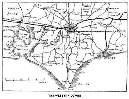
Several roads lead north through beautiful country, covered by lonely and unfrequented woodlands, to the Mardens. West Marden is about five miles from Emsworth and close to the Hampshire border; all the four villages which bear this name are among the most primitive in southern England. At North Marden is a plain unrestored Norman church, the only one in the immediate vicinity which is worth a visit for its own sake. Compton, a mile beyond West Marden, has a Transitional Norman church partly rebuilt; this is close to Lady Holt Park, a favourite retreat of Pope; and Up Park, a fine expanse of woodland, where the Carylls once lived; their estates were forfeited for their championship of the Stuarts. The northern end of the park rises to the edge of the Downs close to Torberry Hill, the last summit in Sussex, though the traveller who is so inclined may, with much advantage to himself, penetrate into the lonely recesses of the Hampshire hills, sacred to the shade of Gilbert White, and, still within the probable limits of the ancient kingdom of Sussex, finish his travels at Butser Hill and Petersfield.
Butser Hill is 889 feet above the sea, and therefore higher than any point of the range within Sussex. This well-known summit is familiar to all travellers on the Portsmouth road, from which it rises with imposing effect on the west of the pass beyond Petersfield. Here the South Downs, so called, may be said to end. The chalk hills are continued right across Hampshire, slowly diminishing in height until they are lost in the great plateau of Salisbury Plain in Wiltshire.
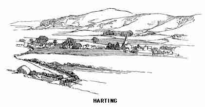
Between a fold of the hills lies picturesque Harting in a most delightful situation; an ideal spot for a restful time away from twentieth-century conditions. The tourist, if amenable to the simple life, might well make a stay of a few days to explore the lovely country of which this village forms the centre. The finely placed Early English cruciform church has several interesting monuments to members of former local families, including sixteenth century memorials of the Cowper-Coles. Here is buried Lord Grey, who was connected with the Rye House Plot. Notice the embroidery in the reredos, an unusual style; also the fine wooden roof and shorn pillars; the latter detract from the general effect of the interior and have been noticed in other Downland churches on our route. Quite close to the church are the old village stocks, undoubtedly placed in this position for the sake of convenience, the "court" in more remote districts having been held, in former times, in the church itself. Harting was for a time the home of Anthony Trollope, and Cardinal Pole was rector here.
There are few districts in England and certainly none south of the Trent where old customs and queer legends persist with so much vitality as in these lonely combes and hollows. The effect of being out of the world is perhaps enhanced in these western Downs by the ring fence of dark woods through which we have to pass to reach the bare, wind-swept solitudes and lonely hamlets within them. The northern escarpment and southern flanks of the hills are clothed in vast forests of beech which add that grandeur to the great ramparts of chalk which the eastern ranges lack. Seen through the ever-shifting sea mists which creep up from the channel these heights take on an appearance of greater altitude and an added glamour of mystery.
South-east of Harting is the isolated Beacon Hill, once a semaphore station between Portsmouth and London; but instead of taking at once to the heights, the pedestrian should first visit Elsted up on its own little hill, and Treyford a mile farther; both churches are ruined and deserted. A new church with a spire that forms a landmark for many miles, stands midway between the two and serves both. Elsted has an inn from the doorway of which the traveller has a superb view of the Downs. From Treyford a bridle-path leads directly south to the summit of Treyford Hill, where are five barrows called "The Devil's Jumps." From here the track running along the top of the Down will bring us in two miles to the bold spurs of Linch Down (818 feet), the finest view-point on the western Downs, the views over the Weald being magnificent in all directions. A track will have been noticed on the west side of the summit, and a return should be made to this, and then by striking southwards through the Westdean woods we eventually reach Chilgrove. We might then climb the opposite spur and keep southwards until the ridge rises to the escarpment of Bow Hill, but the finest walk of all and the most fitting termination to our tour will be to keep to the rough road which runs down the valley south-east to Welldown Farm. Here a road turns right and in a little over a mile drops to the romantically beautiful Kingley Vale.
This vale is a cup-shaped hollow in the south side of Bow Hill; its steep sides are clothed in a sombre garb of yews and at the farther end of the combe is a solemn grove of these venerable trees amid which broad noon becomes a mystic twilight filled with the spirit of awe; a fitting place for the burial of warrior kings with wild, barbaric rite. Tradition has it that many Danish chieftains were here defeated and slain and that here beneath the yews they rest. But who shall say what other strange scenes these lonely deeps in the bosom of the hills have witnessed before Saxon or Dane replaced the Celt; who in turn, for all his fierce and arrogant ways, went, by night, in fear and trembling of those spiteful little men he himself displaced, and whose vengeance or pitiful gratitude is perpetuated in the first romances of our childhood. Though their living homes were in the primeval forests of the Britain that was, their last long resting places were under the open skies on the summits of the wind-swept Downs. Many of the smooth green barrows that enclosed their remains have been ruthlessly rifled and desecrated by greed or curiosity. It is to be hoped that the votaries of this form of archaeological research have now discovered all that they desired to know, and that our far-off ancestors will be left to the peace we do not grudge our more immediate forefathers.
Footnotes
[1] These measurements are confusing, unless the pillars were of an unusual shape. A round column 18 feet thick would be 54 feet in circumference.
[2] Two seals were seen on the west of the Selsea Peninsula in December, 1919, and one of them was shot for preservation in a local museum.
THE SUSSEX DOWNS FROM END TO END
The following summary will suggest to the stranger how his time, if limited, could be so disposed as to take in the whole range with those villages which are essentially Downland settlements and those which lie immediately at the foot of the escarpment. For this purpose the order of the book is reversed and the tourist should start at the western or Hampshire end and finish his walk at Beachy Head. The enjoyment of this tour will of course be greatly enhanced if half the distance is traversed each day, thus doubling the time.
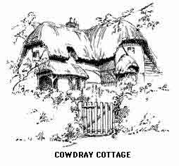
1ST DAY.— Midhurst (Angel Inn) or Cocking Station via Lynch Down, Beacon Hill, to Harting, 9 miles (Ship Inn).
2ND DAY.— Harting to Bow Hill and Kingley Bottom via North and East Marden, 8 miles; on to West Dean, Singleton and Cocking (Inn), 17 miles; or Midhurst, 20 miles.
3RD DAY.— Cocking by Heyshott Down and Duncton Beacon to East Dean, 7 miles (Inn); on by Burton Down and Bignor Hill (Stane Street) to Bignor, 13 miles (Inn); on to Amberley, 19 miles (Inn).
4TH DAY.— Amberley to Rackham and Kithurst Hills; down to Storrington (White Horse Inn), 5 miles. By the main road to Washington (Inn) and Wiston. Ascend Chanctonbury Ring, 10 miles; on to Cissbury Ring and over Downs at Steyning, 16 miles (White Horse).
5TH DAY.— Steyning via Bramber and Upper Beeding to Trueleigh Hill and Devil's Dyke, 6 miles (Inn); down to Poynings, round Newtimber Hill to Pyecombe and Wolstonbury, thence by hill road to Ditchling Beacon, 12 miles; on by edge of Downs to Mount Harry and down to Lewes, 18 miles (White Hart, Crown, etc.)
6TH DAY.— Lewes over Cliffe Hill and Mount Caburn to Glynde and West Firle, 4 miles (Inn); over Firle Beacon and along edge of Downs to Alfriston, 9 miles (Star Inn); by Lullington to Windover Hill ("Long Man of Wilmington") down to Jevington, 12 miles (Inn); up to Willingdon Hill and thence by eastern edge of Downs all the way to Beachy Head, 17 miles. Eastbourne, 20 miles.
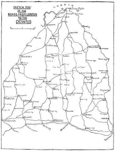
LONDON TO THE SOUTH DOWNS—THE WEALD
The writer of the preceding chapters has often been tempted to trespass outside the limits imposed upon him, and penetrate the woody fastnesses of the Weald. In this separate section a short description will be given of some of the most characteristic scenes and interesting towns and villages between London and the coast.
A certain proportion of the pleasure of a holiday is, or should be, obtained on the journey toward the goal. This is, of course, much more the case where road rather than rail is taken, and most of the routes to the south run through a lovely and varied countryside which will repay a leisurely mode of progression. To the writer there is no way of seeing England equal to doing that on foot; however, it would be unreasonable to expect every one to adopt this mode of travelling even if they were able, and these notes can easily be followed by motorist or cyclist without undue loss of time.
LONDON TO LEWES BY WESTERHAM AND MARESFIELD
This road keeps within Kent until the boundary of Sussex is reached, and runs via Catford Bromley and Keston, climbing gradually to Westerham Hill, after which there is a steep and dangerous descent to the small town of Westerham (23 miles) pleasantly situated between the North Downs and the sandy hills of the Surrey Weald. It is famous as the birthplace of Wolfe, whose statue adorns the green, around which is grouped the quietly dignified assemblage of inns, shops and houses that are typical of this part of Kent. The large and finely situated church also has a memorial to the local hero, who was born in the vicarage here and buried at Greenwich.
The road continues through pleasant country over Crockham Hill to Edenbridge (28 m.) on the small river Eden. Although the immediate surroundings are dull and featureless this is a good centre from which to explore the district eastwards to Hever, Penshurst, and Tonbridge. One mile out of the town we bear left and, in another three, cross the Kent Water into Sussex. In 7½ miles the road passes over the Medway to Hartfield (33½ m.) on the edge of Ashdown Forest. The Early English church has a lych-gate dating from 1520. Inside may be seen three piscinas, one in an uncommon position near the south door.
[A long mile east is Withyam, with a Perpendicular church famous for its monuments of the Dorset family. Only a gateway remains of the ancient Buckhurst mansion, the greater part of the materials going to the erection of Sackville college at East Grinstead.]
From Hartfield we climb steadily towards the centre of the Forest with occasional wide views between the close woods which line the northern slopes.
[Before reaching Camp Hill and near the summit, a path leads left to Crowborough, which of late years has become suburban and a second Haslemere. The Beacon commands wide views, but the immediate surroundings have been spoilt.]
We now drop towards Maresfield with grand forward views over the Weald to the South Downs.
Maresfield (41 m.) has a small Decorated church with a Norman window in the nave. Note the ancient woodwork and restored oak porch, also two stoups, one within and the other outside the church. This was once an important "Black Country" centre. Local names, such as "The Forge" perpetuate the memory of this strange period in the history of Sussex, which was at its busiest about 1680, the last furnace being quenched in 1828.
"It is a strange thing to remember, when one is standing on the cold desolate hills about Crowborough Beacon, or in the glens of the Tilgate Forest—now the very picture of quiet, and rest, and loneliness—that this same Sussex was once the iron mart of England. Once, spotted over these hills and through these forests, there were forges that roared from morning till night, chimneys that sent up their smoke and their poisonous vapour from one year's end to another; cannon were cast ... where now there is no harsher voice than the tap of the woodpecker.... One cannot fancy the forests of St. Leonards and Ashdown, the Wolverhampton of their age. But so it was; and not the least remarkable thing ... is the absence of traditions about the life and customs of the manufacturers so employed." (Lower.)
[From Maresfield a round of about thirty miles could be made through the beautiful East Sussex Weald, rejoining the main road at Uckfield. In two miles is Buxted, which has an interesting Early English church standing high amidst woods. In the Decorated chancel is the brass of Britellus Avenel (1408) and J. de Lewes (1330), by whom the church was founded. Note the old muniment chest in the north aisle and the mortuary chapel of the Earls of Liverpool south of the chancel. Not far from the church is "Hog House," note the hog carved over the door and dated 1581. The Hogge family, ironmasters, once lived here. In 1543 was cast the first iron cannon made in this country.
"Master Huggett and his man John,
They did cast the first cannon."
Not far away is the one time cell of a hermit, carved out of the rock, and named "The Vineyard." The road now winds through a remote country, which once resounded with the clangour of the forge, to Hadlow Down and Butcher's Cross and in seven miles reaches Mayfield. The village street is according to Coventry Patmore the "sweetest in Sussex." The half-timbered "Middle House" nearly opposite the church is the best example of this style of architecture in the south, it is dated 1575. Lower House was built about 1625. The fine Perpendicular church is on the site of the traditional building erected by St. Dunstan. This was made of wood, and the Saint, finding that the orientation was not quite true, set his shoulder to the wall and pushed it straight! The visitor will note the fine effect of the raised chancel, the roof of which is composed of a one time gallery. Note, among other objects, the old screen and choir stalls; a squint; font dated 1666; iron slabs in the nave to the Sands (1668 and 1708); monument to T. Aynscombe (1620); chandeliers; and curious east window; and, not least, the glorious view from the churchyard. The Palace of the Archbishops is now a convent: it was restored by Pugin after being in a state of ruin for many years. Certain portions may be seen at uncertain times. In the ancient dining-room are preserved the hammer, tongs and anvil of St. Dunstan. The Saint's well is in the garden. It was hereabouts that St. Dunstan had his great tussle with the Devil, holding the fiend by the nose with his tongs; eventually the Evil One wrenched himself free; making an eight mile leap he cooled his nose in a pool of water, giving it for ever "a flavour of warm flat irons" and making the fortune of the future Tunbridge Wells. Mayfield has another claim to a niche in history, not a quaint old tale like the above but a sombre fact:—
"Next followed four, which suffered at Mayfield, in Sussex, the twenty-fourth of September 1556, of whose names we find two recorded, and the other two we yet know not, and therefore, according to our register, hereunder they be specified, as we find them: John Hart, Thomas Ravendale, a shoemaker and a carrier, which said four being at the place where they should suffer, after they had made their prayers, and were at the stake ready to abide the force of the fire, they constantly and joyfully yielded their lives for the testimony of the glorious Gospel of Jesus Christ." (Foxe.)
The scenery hereabouts is distinctly of Devonian character. Rich and varied views reward the leisurely traveller who will make a side excursion to Rotherfield, passing, halfway the conical Argos Hill crowned with a windmill. The village, though not so interesting as Mayfield, is well placed and has a fine Perpendicular church, the spire being a landmark for many miles. Here is an east window by Burne Jones and several other good examples of modern stained glass which make fine splashes of colour in the old building. A quaint saying in reference to the handsome presence of the Rotherfield women is that they have an "extra pair of ribs."
The beautiful district between here and Tunbridge Wells deserves a chapter to itself. Frant Wadhurst and Ticehurst belong more naturally to West Kent than East Sussex. These three beautiful villages and the glorious Eridge Park could be combined in this excursion by the traveller who has unlimited time.
We may now follow the valley of the Rother through scenery of much quiet beauty to Burwash, 6½ miles from Mayfield. Here is an old church with a (possibly) Saxon tower and an interesting iron slab inscribed "Orate p Annima Johne Colins," probably the oldest piece of local ironwork in existence. The outline of the village is eminently satisfying to the artist, especially the house called "Rampyndens." Burwash is connected with the Rev. J. Cocker Egerton, to whom reference has already been made. From the natives of this particular district was gleaned that record of rustic humour which makes the Sussex peasant depicted in his writings so real to those who know him. The village has lately become the home of Rudyard Kipling, who lives at "Batemans," a beautiful old house in an adjacent valley surrounded by wooded hills. "Puck of Pooks Hill" is said to have been inspired by the locality. Brightling Beacon, three miles farther, commands the finest prospect of the western Weald, the immediate foreground being of great beauty. Brightling church should also be seen.
A return could now be made by way of Heathfield, from Brightling, passing Cade Street. Here a monument commemorates the death of Jack Cade, who was shot by an arrow discharged by Alexander Iden, Sheriff of Kent, in 1450. Cade had been hiding at Newick Farm; gaining confidence he came out for a game of bowls and met his end while playing. Heathfield old village and church are off the main road to the left; our route passes the railway station and runs westwards to Cross-in-Hand and Blackboys; this road is a succession of lovely views throughout the seven miles to Framfield, where there is a Tudor church. A short two miles more brings us to our main route at Uckfield.]
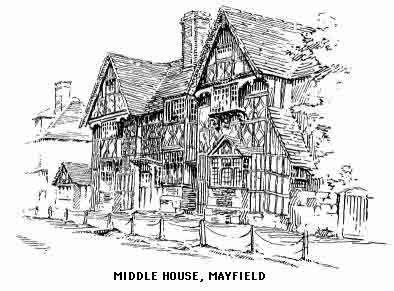
Uckfield (43½ m.) old church was pulled down in the early nineteenth century, and its successor is of no interest. An old stone house in front of the "King's Head" was once the village lock-up. A picturesque outcrop of the Hastings sandstone around a small lake forms a beauty spot of local fame: it is within the demesne of "The Rocks" on the west of the town.
[An alternative route to Lewes could be taken from Uckfield through the best part of the Ouse valley; nearly half-way and on the right is Isfield ("Eyefield"), the church is interesting.]
The road now bears south-east to High Cross and then by Halland to East Hoathly (48¼ m.). The church here has the Pelham buckle as a dripstone. Note the Norman piscina. In five miles the little hamlet of Horsebridge is reached. We are now in the Cuckmere valley.
[One mile short of this a round of four miles could be made via The Dicker to Mickleham Priory and Hailsham. The Priory is now a farmhouse; the position of the chapel is shown by some arches built into the wall. The interior has a fine cowled fireplace and Early English crypt. The gatehouse is the only complete portion of the Priory buildings. Permission must be obtained to view the interior.]
The Eastbourne road crosses the Cuckmere and turns sharp to the right before reaching the railway.
Hailsham (55½ m.). The fine pinnacled tower of the church shows up well above the roofs of the old market town, which, however, has little to show the visitor and is not particularly picturesque. The immediate surroundings of the road are tame until we enter the woodlands, which surround the route almost to Polegate (58½ m.). We now have fine views of the Downs on our right front though Willingdon to Eastbourne (63 m.).
LONDON TO SEAFORD BY EAST GRINSTEAD AND LEWES
This route follows the Brighton road through Croydon to Purley (12½ m.). Here we bear south-east and follow the Eastbourne road through suburban but pleasant Kenley and Whyteleafe to Caterham (17½ m.). The North Downs are crossed between Gravelly hill (Water Tower) and Marden Castle, followed by a long descent to Godstone (20 m.), built around a charming green with a fine old inn ("Clayton Arms") on the left. A lane at the side of the inn leads to the interesting church and almshouses. The direct road onwards, runs over Tilburstow Hill (500 feet), but the better route bears left and passes Godstone station, rejoining the old road at Springfield (23 m.).
[At Blindley Heath a road bears left to Lingfield, a pretty village with an interesting church, once collegiate. Note misererie seats and choir screen (fifteenth century). Tombs of the 1st, 2nd and 3rd Lord Cobhams and other interesting tombs and brasses.]
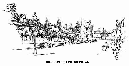
At Fellbridge, just past the Horley road, we enter Sussex and, after a short rise and fall, arrive at East Grinstead (30 m.). This is one of the pleasantest towns of the Weald, with many old houses here and there in the High Street. The church, though of imposing appearance from a distance, is, on closer acquaintance, disappointing; the fabric dating from 1790. Note an iron tomb slab (1570). Not far from the church is the Jacobean Sackville College. Here the celebrated Father Neale was warden for twenty-five years. (In barely two miles from the centre of the town a lane leads over the railway to the right in 1/3 mile to the picturesque ruins of Brambletye.)
Forest Row (33 m.), on the river Medway. The road now climbs steadily between woods to Wych Cross (35 m.). Grand views south and west. This is one of the finest passes over the Forest Ridge and the peculiar characteristics of the Hastings sands are here seen to the best advantage. These high sandy moors, covered with glorious stretches of bracken and heather, here and there clothed in dense growths of oak and beech, with occasional distinctive clumps of Scots fir and beneath all a thick tangle of bramble, a perfect sanctuary of wild life, are more reminiscent of Radnor or Galloway than of the south country.
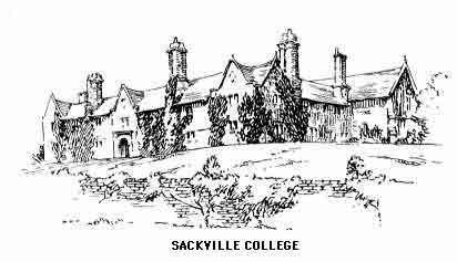
The right-hand road is taken at the fork and there follows a long coast down to Danehill, where the Lewes road bears left to Sheffield Green (40 m.).
[A road to the left would bring us in 2 miles to Fletching, where the forces of Simon de Montfort started on their march to Mount Harry and subsequent victory of Lewes. The village is the centre of a delightful neighbourhood and is delightful in itself, not only for the charm of its surroundings, but for its quaint and attractive architecture of the humbler sort. The Early English church has been well restored and beautified by the Earl of Sheffield, whose estate lies to the west. Gibbon the historian lies in the Sheffield mausoleum. Note the old glass in the small lancet windows; this was buried in the churchyard during some forgotten trouble and discovered and replaced during the restoration. Several old helmets and gauntlets with the crest of the Nevill's are hung in the north transept. A small brass should be noticed; the inscription refers to a local worthy, P. Devot, who took part in the Cade rebellion.]
Sheffield Park on the left is full of fine timber; at the end we cross the Ouse and the railway and keep straight forward to Chailey (43½ m.) with occasional views ahead of the Lewes Downs. Passing Chailey potteries on the left the road calls for no comment until we pass Cooksbridge station and draw near the Downs.
Offham (48 m.). Lewes (50 m.). There is a choice of routes to Seaford; that passing Southease (54 m.) enters Newhaven and crosses the Ouse there. The alternative road crosses the river in Lewes, runs under Mount Caburn and going through Beddingham (51¼ m.) bears right.
South Heighton (55½ m.).
Seaford (59 m.).
THE BRIGHTON ROAD
This classic fifty-two miles, the scene of many records in coaching, running, cycling and walking, is the shortest way from London to the sea, but not by any means the most interesting either for the lover of nature or the tourist of an antiquarian turn. Distances are reckoned from Westminster Bridge ("Big Ben"). After Kennington comes a two-mile ascent from Brixton to Streatham and then a fairly level stretch to Croydon (10 m.), Whitgift Hospital (1596), Archbishop's Palace, fine rebuilt church. We now enter the chalk country and pass through suburban Purley to Merstham (18 m.).
[Reigate (2 m. right). Large Perpendicular church. The town is pleasant and picturesque but rapidly becoming suburban.]
The road drops between spurs of the North Downs to Redhill (20 m.); a busy railway junction. Thence over Earlswood Common.
Horley (24¾ m.). Interesting church; note yews in churchyard. Lowfield Heath. Three miles from Horley we pass into Sussex and shortly reach Crawley (29¼ m.). Decorated church. Note the quaint lines on one of the roof beams. Mark Lemon lived at Vine Cottage in the village.
[The tiny village of Worth, south of the East Grinstead road and nearly 3 miles from Crawley, should be visited for the sake of its unique Saxon church, the only one remaining which is complete in its ground plan. Notice the typical band of stones supported by pillars which runs round the building; also the curious double font; pulpit dated 1577 and ancient lych-gate. On the north side of the church is a "Devil's Door." The exorcized spirit passed out this way at the sacrament of Baptism.]
We now enter the forest zone. Note the fine retrospect when approaching Pease Pottage (31¼ m.).
[On the left is Tilgate Forest, which is continued by Worth Forest, whence many lovely and lonely paths lead to Horstead Keynes and West Hoathly, whose church has a land-mark spire visible for many miles. Underneath the tower will be seen two iron grave slabs. Within the church notice the Geometrical windows and the triple sedilia. The village is picturesque and well placed, and the local "lion"—"Great upon little," an effect of denudation, is well known. The village is much nearer the Seaford road at Wych Cross, but from the present route we have the advantage of seven miles of woodland otherwise unexplored.
On the right from Pease Pottage, in the recesses of St. Leonard's Forest, and two miles from the main route, is Holmbush Beacon Tower. This should be visited for the sake of the magnificent woodland views; in the distance are the south Downs visible from Butser Hill behind Portsmouth to the hills surrounding Lewes. Hindhead, Blackdown, Leith Hill, the North Downs and the Hampshire Heights are all visible on a clear day.
We are here in a remote district, the haunt of legend and folk-lore almost unequalled in the south. Here St. Leonard put an end to the career of a fierce and fiery dragon, but not before the saint was grievously wounded, and where his blood fell now grow the lilies of the valley, common here but nowhere else in the neighbourhood. Headless horsemen, who have an unpleasant habit of sharing the benighted traveller's steed; witches and warlocks; white-ladies and were-wolves are in great plenty, and the normal inhabitants of the forest must have a fervent appreciation of the high noon and the hours of daylight.]
The two miles south of Pease Pottage are the highest on the road culminating at Handcross, 504 feet (33½ m.). The road now descends the steep and dangerous Handcross Hill.
[At the foot of the hill, half mile right, is Slaugham ("Slaffam") with a Decorated church, old font and brasses.]
Bolney Common (37½ m.) in lovely surroundings. The church has early Norman, or as some authorities declare, Saxon features. The Norman south door, covered by a wooden porch dating from the eighteenth century, should be noticed.
[Cuckfield ("Cookfield") 3 miles left, amidst beautiful scenery, with a fine Early English church commanding a glorious view. Note monuments and handsome reredos. Cuckfield Place is the original of "Rookwood," but has been "improved" out of its ancient character. The Jacobean gate house still stands unrestored at the end of the avenue. Close by is Leigh Pond, a fine sheet of water.]
Albourne Green (42 m.), for Hurstpierpoint (1 m.), beautiful views of the South Downs which we now ascend to Pyecombe (45½ m.).
Preston (49½ m.).
Brighton (front 51½ m.).
THE HORSHAM ROAD
At Kennington Church we leave the Brighton Way and pass Clapham Common, Tooting and Merton to Cheam (11¼ m.) Ewell and Epsom (14½ m.) The Downs and Race-course are up to the left.
Ashtead.
Leatherhead (18½ m.). This little town has some picturesque streets, but is rapidly becoming suburban. The Perpendicular church contains interesting windows. The scenery now greatly improves and becomes beautiful after passing Mickleham, a pretty village with a Transitional church.
Norbury Park, on the right, is one of the most charming places in Surrey. Box Hill (590 feet), which may easily be ascended from the well-placed Burford Bridge Hotel, is on the left. The road, river and rail run through a deep cleft in the North Downs forming the Mole valley and facing the sandstone hills of the Weald. In the shallow depression between the two ranges lies Dorking (23¼ m.). The town is pleasant but has nothing of much interest for the visitor. It is for its fine situation from a scenic point of view and as a convenient headquarters from which to explore the best of Surrey that it will be appreciated. The rebuilt parish church is imposing and stands on the site of the ancient Roman Stane Street. We leave the town by South Street and proceed to Holmwood, from which Leith Hill may be visited, though there are more direct and much finer routes from Dorking.
Capel (28¾ m.). We are now in quiet wealden scenery and there is nothing of special interest until we cross the Sussex boundary, about half a mile beyond the railway bridge. Kingsfold (31½ m.). We now bear left and again 1½ miles farther by Warnham Pond, with memories of Shelley.
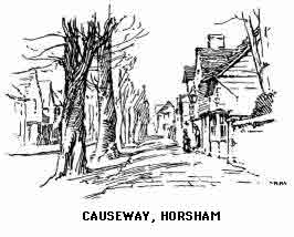
Horsham (36 m.). This prosperous and pleasant county centre makes a good halting place. The Early English and Perpendicular church is worth a visit, although practically rebuilt in the middle of the last century. The fine proportions and spacious and lofty interior will at once strike the visitor. Notice the altar tomb of Thomas de Braose (1396), Lord Hoo (1455), Eliz. Delves (1645), and a brass of Thomas Clerke (1411). Also the ancient font. The old "Causeway," which leads to the church from Carfax, as the centre of the town is called, should be more popular with artists than it is. The wonderful colour of some of the Horsham roofs will be noticed; this is due to the local stone with which the older roofs are covered. It seems a pity from an aesthetic point of view that the quarries are no longer used. The great weight of the covering had another advantage, it made for sturdy building and honest workmanship. Horsham no longer has the artificial importance of returning members to Parliament (at one time, two; and as lately as 1885 one), but is now merged in the western division of Sussex, of which district it shares with Midhurst the position of chief agricultural and commercial centre. The town is also becoming residential as East Grinstead, on the other side of the county, has already done.
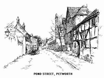
THE SHOREHAM ROAD
The high road from Horsham skirts Dene Park, which is quite open and commands fine views of the town and the surrounding Weald. To the right may be discerned the buildings of Christ's Hospital and Southwater Station (38½ m.).
Burrell Arms (41½ m.). A halt must be made to view the scanty remains of Knepp Castle, a one time stronghold of the de Braose family. Close by is a beautiful lake, the largest sheet of water in the south of England. The road now bears south-east. To the right and close to the Adur is West Grinstead. The church, partly Norman, should be seen. Note the two naves. The old oak seats bear the names of the farms to whose occupants they have from time immemorial belonged. Behind the altar of the north nave is an aumbry, and in the roof above is a cover once used for suspending the canopy over the Host. There are several interesting monuments including two altar tombs in the Burrell chantry with fine fifteenth century brasses. Note the font, an old stone coffin, foliated lancets, fragments of old stained glass and some remains of ancient frescoes. The rectory is a good specimen of Elizabethan building. West Grinstead House, once the home of the Carylls, friends of Pope, "This verse to Caryl, Muse, is due," Rape of the Lock. The poem is said to have been written under the shade of "Pope's Oak" in the park.
[Cowfold, 3 miles east, is chiefly remarkable for the Carthusian Monastery dedicated to St. Hugh. Its spire is a landmark for many miles. This has been the home of exiled French monks since 1877. Visitors are very courteously shown over the greater part of the building, which is of much interest and contains several venerated relics brought from the monastery of the Grand Chartreuse. The magnificent brass to Nelond, Prior of Lewes, in the parish church should also be seen.]
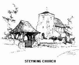
We now continue south-east and cross the railway to Shoreham. The tall spire seen on the left is St. Hugh's Monastery (above). Partridge Green station (44¼ m.), Ashurst (46¼ m.), with an Early English church. At the top of every rise we are rewarded with glorious views of the Downs crowned by Chanctonbury Ring.
Steyning (49¼ m.).
Bramber (50¼ m.).
New Shoreham (54¼ m.).
THE WORTHING ROAD
As above to the Burrell Arms. The route runs south and then south-west to Dial Post (43¼ m.), and so with striking views ahead through Ashington (46¼ m.) to Washington (48¼ m.).
Findon (51 m.).
Broadwater (54¼ m.).
Worthing (55½ m.).
THE ARUNDEL—CHICHESTER ROAD
This route leaves the Horsham road nearly two miles south of the village of Kingsfold.
Warnham (33¼ m.). The district is the scene of Shelley's childhood and youth. The poet was born at Field Place, about 1½ miles south on the right of the road.
Broadbridge Heath (35¼ m.).
Five Oaks (39 m.). We now join the Roman "Stane Street" from London Bridge to Chichester.
Billingshurst (40¾ m.). Norman and Perpendicular church. Note fine oak panelled ceiling.
[Across the Adur valley, 2½ miles west is the interesting church at Wisborough Green. The situation is delightful and the antiquarian interest more than ordinary. Kemble identifies the mound on which the church is built as being the site of a temple dedicated to Woden (Wisc or "Wish"). Restoration brought to light early Norman (perhaps Saxon) remains in this late Norman church. The chancel is Early English. Notice the tower walls inside. There are some ancient frescoes, a stoup, and other interesting details.]
Adversane (42¾ m.).
Pulborough (46 m.).
Bury (50¾ m.).
Arundel (55¼ m.).
To Chichester at 1¾ m. past Bury turn S.W.
Balls Hut Inn (56½ m.).
Chichester (62 m.).
THE CHICHESTER ROAD VIA GUILDFORD AND MIDHURST
This route follows the Portsmouth Road from Westminster through Wandsworth and over Putney Heath to Kingston (12 m.). Here we bear left past the King's stone and then by way of the river bank through Thames Ditton to Esher (16 m.), then by the famous "Ripley Road" over Fairmile Common and through Street Cobham (19½ m.).
Ripley (23¾ m.).
Guildford (29¾ m.). A prosperous and good-looking old town in danger of becoming smug and suburban; the steep and picturesque High Street, however, keeps its old time amenities. The ruins of the castle keep may be seen south of the High Street. Abbott's Hospital (1619), the Guildhall with projecting clock (1683); St. Mary's church, Norman and Early English. Note paintings in north chapel. St. Nicholas' Church has been mostly rebuilt. Our road turns left just beyond the Wey bridge and passes under the ruins of St. Catherine's Chapel on the left. At Shalford (30¾ m.), bear right to Godalming (34¼ m.) in the centre of a lovely country. Here is a large cruciform church, Norman and Early English, with interesting brasses and pulpit.
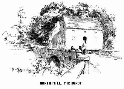
Milford (35 m.). A long rise follows to Brookstreet (39¼ m.) and a dangerous drop just beyond. Haslemere (43 m.). Although the scenery is very beautiful on all sides of this once remote hamlet, the late nineteenth century saw a colonization of the slopes of Hindhead, with the attendant outbreak of red brick, which has almost completely spoilt the neighbourhood. Branch excursions may be made towards the Hampshire border and to Chiddingfold country. We cross the Sussex boundary one mile south of the town and are immediately in the lonely and very lovely Blackdown country. A climb follows to Kingsley Marsh and a steep descent to Fernhurst (46¼ m.).
[Blackdown, the highest point in Sussex (918 feet) can be easily reached from here, the distance is about two miles in each direction with woodland most of the way. The view from the summit is magnificent in every direction. Aldworth, where Tennyson died, is on a spur of the hill slightly east of north.]
Henley (48½ m.). A picturesque hamlet below the road commanding magnificent views of Blackdown. A steep descent, then a road through lovely woodlands brings us to Midhurst (51 m.).
Cocking (54 m.). Steep hills.
West Dean (57½ m.).
Chichester (63 m.).
LONDON TO EASTBOURNE BY OXTED AND HEATHFIELD
Only slow trains, with possible change of carriage, by this route; the Eastbourne expresses run by Three Bridges and Lewes. After Croydon the long ascent between the northern slopes of the Surrey Downs extends to Woldingham Tunnel. Wide views and retrospect of the Downs. Oxted (20 m.) (church and village right).
Edenbridge (25 m.).
Hever.
Cowden. The line crosses the Kent water and enters Sussex. Ashurst (Infant Medway right). Eridge (35½ m.) (a good centre from which to explore north-east Sussex). Rotherfield. Mayfield (scenery reminiscent of Devon). Hailsham (49¾ m.) for Hurstmonceux. Polegate. Eastbourne (57 m.).
LONDON TO SEAFORD BY EAST GRINSTEAD AND LEWES
(To Oxted above.) Lingfield (picturesque village and well-known racing headquarters.) West Hoathly (34 m.). (Ashdown Forest left). Horsted Keynes. Newick. Lewes (50¼ m.). Newhaven (56½ m.). Seaford (59 m.).
LONDON TO BRIGHTON BY REDHILL AND THREE BRIDGES
This is the line of the fast expresses, and in the summer one of the busiest 50 miles of railway in the kingdom. Croydon. Purley. Merstham. Redhill (20½ m.). Express Trains pass to the left of this station (fine views). Horley. Gatwick (race-course, right). A long climb over the Forest Ridge followed by a drop to the Ouse viaduct (St. Saviour's College, Ardingley, left). Hayward's Heath (37¾ m.) (a suburban growth). Wivelsfield. Burgess Hill (Ditchling Beacon, left front). Hassocks (43½ m.) (Clayton Tunnel). Preston Park. Brighton (50½ m.).
LONDON TO SHOREHAM AND WORTHING
Sutton (15 m.) (an outlier of villadom). Ewell. Epsom (18½ m.). Ashtead. Leatherhead (22¾ m.). The scenery rapidly improves and before reaching Box Hill Station attains much beauty. Dorking (26¾ m.). Holmwood (31¾ m.) (Leith Hill, right, conspicuous by its tower). Capel. Horsham (40¼ m.). Christ's Hospital (left). Southwater. West Grinstead (Chanctonbury Ring, right). Henfield (52¾ m.). The Adur valley is followed to Steyning and Bramber. New Shoreham (60¼ m.). Worthing (64¾ m.).
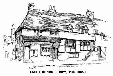
LONDON TO ARUNDEL AND CHICHESTER
(To Horsham above.) Billingshurst (46 m.). Pulborough (junction for an alternative route to Chichester via Midhurst). Views (left) of the long escarpment of the Downs. Villages on the Arun (right). Amberley Castle (left) and (exceedingly fine) Arundel Castle (right). Arundel (59¼ m.). Ford. Barnham. Chichester (70½ m.).